Why The Freedom Trail matters.
The Freedom Trail is a historic walking corridor where Downtown's revolutionary heritage meets the political upheaval of colonial America, the architectural foundations of the early republic and the extraordinary events that transformed thirteen British colonies into the United States.
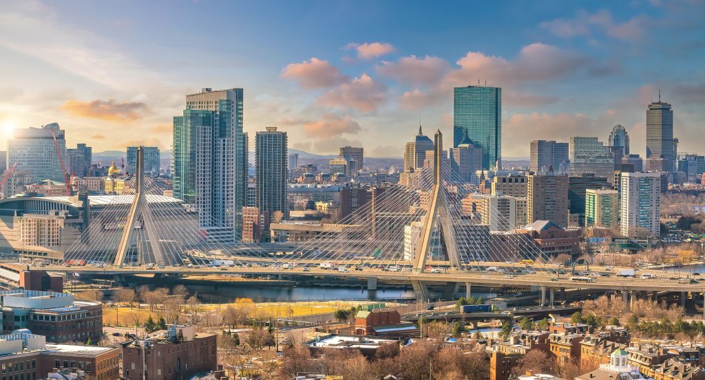
Running through Downtown between Beacon Hill and the North End, the historic corridor follows a red-brick route from Boston Common through Tremont Street, School Street and Washington Street, continuing across the North End and Charlestown Bridge toward the waterfront heights of Charlestown. Brick sidewalks, granite paving and painted street markings guide pedestrians through successive layers of colonial streets, nineteenth-century commercial architecture and preserved public buildings. Narrow passages alternate with broad civic spaces, revealing the compact geography of Boston's original settlement. Church steeples, burial grounds and historic masonry facades punctuate the route, establishing a continuous connection between the modern city and its colonial foundations. The result is an exceptionally concentrated historical landscape whose surviving buildings and public spaces illuminate the political, religious and military events that shaped the American Revolution.
What defines The Freedom Trail.
The Freedom Trail is best known for connecting sixteen historically significant sites along a 2.5-mile walking route through the neighborhoods central to Boston's colonial and Revolutionary history. Journalist William Schofield proposed the creation of a marked historical walking route in 1951, seeking to make the city's scattered Revolutionary sites accessible through a coherent pedestrian itinerary. Boston officials adopted the concept, introducing a route that linked major public buildings, churches, burial grounds and military sites associated with the struggle for American independence. The trail subsequently developed into one of the country's most influential urban heritage attractions, establishing a model for interpreting historical events through preserved city landscapes. Boston's revolutionary importance emerged during the eighteenth century as British imperial taxation policies and colonial political resistance intensified across Massachusetts. The Stamp Act of 1765 and Townshend Acts of 1767 generated substantial opposition among merchants, artisans and political organizers who challenged Parliament's authority over colonial taxation. Samuel Adams became a central figure in the resistance movement, helping organize public meetings and political campaigns that strengthened opposition to British administration. The Boston Massacre of March 5, 1770, intensified tensions after British soldiers fired into a crowd, killing five colonists. Paul Revere's engraving of the confrontation became an influential instrument of colonial political communication, shaping public understanding of the event throughout British North America. The Boston Tea Party of December 16, 1773, escalated the dispute when protesters destroyed East India Company tea in opposition to British commercial policies. Parliament responded through the Coercive Acts of 1774, imposing punitive measures that deepened resistance and contributed to the formation of the First Continental Congress. Armed conflict began at Lexington and Concord on April 19, 1775, transforming the political crisis into the American Revolutionary War. Boston subsequently became a principal military objective as British forces confronted colonial militias and the emerging Continental Army. The Freedom Trail preserves the urban settings associated with these developments, connecting political organization, public protest and military conflict through a continuous historical route.
Boston Common marks the southern beginning of the trail, occupying public land established in 1634 and recognized as the oldest public park in the United States. Its early functions included communal grazing, military musters and civic gatherings, establishing a substantial public landscape within the developing colonial settlement. Massachusetts State House rises above the Common on Beacon Hill, its Federal-style architecture designed by Charles Bulfinch and completed in 1798. The building's gilded dome became one of Boston's most recognizable architectural features, establishing a prominent symbol of state government. Park Street Church occupies a historic position near the Common, with its tall steeple completed in 1810 and associated with influential nineteenth-century religious and reform movements. Granary Burying Ground contains the graves of Samuel Adams, John Hancock and Paul Revere, preserving the burial places of several leading figures in Revolutionary Boston. King's Chapel developed as an Anglican congregation during the colonial period, with its present stone building completed in 1754. The adjoining King's Chapel Burying Ground preserves connections with some of the city's earliest English settlers. Boston Latin School, founded in 1635, contributes another important institutional connection through the trail's historic schoolhouse site. Old South Meeting House served as a major gathering place for colonial political debate, accommodating large public meetings during the escalating dispute with British authorities. Old State House, completed in 1713, functioned as the seat of colonial government and subsequently became associated with the public reading of the Declaration of Independence in Boston. Faneuil Hall developed into a center of public assembly and commercial exchange, establishing an enduring association with political speech and civic participation. The trail's historical importance emerges through the concentration of these surviving institutions within the original urban geography of colonial Boston.
How The Freedom Trail fits.
The Freedom Trail works as the historical anchor for a Boston outing connecting the city's maritime economy, the preservation of colonial domestic architecture and the military history of the Revolutionary waterfront.
Begin at Paul Revere House, the historic North End residence constructed 1680 and associated with the celebrated patriot and silversmith. Revere purchased the property in 1770, establishing his household within one of Boston's most densely settled colonial neighborhoods. The building preserves a substantial timber-frame structure whose interior rooms introduce the domestic environment of a prosperous eighteenth-century artisan family. Its museum interpretation examines Revere's professional work, political activities and participation in the communication networks that supported colonial resistance. The property's preservation became an important achievement of Boston's early historic conservation movement. Continue to Old North Church, the historic Episcopal church completed in 1723 and distinguished by its commanding steeple above the North End. Its most celebrated association is the signal displayed on April 18, 1775, when two lanterns warned that British troops were advancing toward the colonial countryside by water. The signal became an enduring element of American Revolutionary memory through Henry Wadsworth Longfellow's poem “Paul Revere's Ride.” The church's preserved box pews, galleries and interior furnishings introduce the religious and social organization of colonial Boston. Its surrounding grounds preserve additional connections with the neighborhood's maritime and immigrant history. Conclude at Bunker Hill Monument, the granite obelisk erected on Breed's Hill to commemorate the Battle of Bunker Hill on June 17, 1775. The battle became one of the earliest major engagements of the American Revolution, demonstrating the determination of colonial forces despite a British tactical victory. Construction of the monument began in 1825, with the completed structure dedicated in 1843. Rising 221 feet above the surrounding neighborhood, the obelisk provides a commanding architectural memorial to the conflict. Its summit offers expansive views across Boston Harbor and the surrounding city, establishing a dramatic conclusion to the historical route. The progression moves from Paul Revere House's colonial domestic history through Old North Church's Revolutionary signaling traditions and culminates at Bunker Hill Monument's military commemoration, connecting three consequential chapters of Boston's struggle for American independence.
Where your story begins.
Foresyte Travel reveals places that feel extraordinary long before you arrive.
Enjoy editorial crafted for luxury travelers.
Foresyte may earn a commission when you book.