
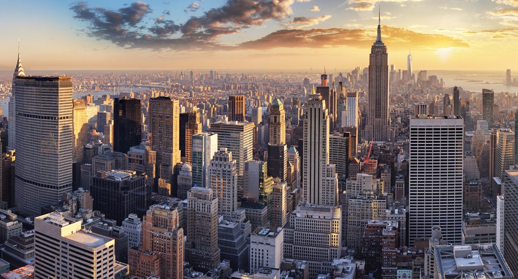
Why East River matters.
East River is a powerful tidal strait where Lower Manhattan's historic waterfront meets swift tidal water, island geography and a succession of bridges connecting Manhattan with Brooklyn and Queens.
Running from Upper New York Bay past the Seaport near the Brooklyn Bridge and north toward Long Island Sound, the waterway separates Manhattan and the Bronx from the western end of Long Island across a corridor 16 miles long and generally 600 to 4,000 feet wide. Roosevelt Island divides its midtown reaches into separate channels, followed farther north by Mill Rock, Randalls and Wards Islands as the strait contracts around Hell Gate. Four great suspension crossings punctuate the lower and middle reaches, placing stone towers, steel cables and immense spans above a water surface traversed by ferries, tugs, barges and commercial vessels. Manhattan's shoreline shifts repeatedly between bulkheads, piers and parkland as Brooklyn and Queens present their own industrial remnants, residential waterfronts and public esplanades across the channel. The result is a metropolitan waterway whose islands, tidal movement, bridge spans and contrasting shorelines reveal New York as a city physically organized around navigable water.
What defines East River.
East River is best known for forming the tidal connection between New York Harbor and Long Island Sound, a geographic role that placed the waterway at the center of New York's commercial expansion long before bridges crossed it. NOAA defines the East River as a tidal strait, with Upper New York Bay at its southern entrance and Long Island Sound at its northern end, rather than a freshwater river flowing from a terrestrial source. Manhattan's original eastern shoreline ran near present-day Pearl Street, but commercial growth pushed Lower Manhattan outward through successive landfill campaigns beginning in the late seventeenth century; the edge had reached Water Street by 1730 and Front Street by 1780. Water transport became fundamental to movement across the channel, and Dutch settlers operated ferries between Manhattan and Brooklyn as early as 1642. Fulton Ferry later developed into a major Brooklyn crossing, with the surrounding settlement growing into a commercial district before fixed spans altered the transportation pattern. John A. Roebling designed the Brooklyn Bridge, begun in 1869 and completed in 1883 with a 1,595.5-foot main span that made it the world's longest suspension bridge at completion. The Williamsburg Bridge followed in 1903 with a 1,600-foot main span, taking the world suspension-span distinction and carrying rail lines, trolleys, carriages and pedestrians between Manhattan and Brooklyn. Leon Moisseiff's Manhattan Bridge arrived in 1909 with a 1,470-foot main span and eventually carried four subway tracks alongside roadways, pedestrian circulation and cycling infrastructure. These crossings converted the East River from a barrier negotiated primarily by vessels into a corridor crossed continuously by rail, road and foot.
Hell Gate gives the East River a separate engineering history shaped by some of the strongest and most hazardous conditions encountered along the channel. Nineteenth-century mariners confronted submerged reefs, narrow passages and powerful tidal flows at the constriction between Manhattan, Queens and the islands to the north; during the 1850s, 1,000 ships ran aground there annually, producing more than $2 million in shipping damage. The U.S. Army Corps of Engineers began clearing the passage in 1851 under John Newton, combining subterranean excavation, steam drilling and underwater demolition to attack the obstructing rock. Flood Rock was honeycombed with four miles of tunnels and thousands of drilled holes before Newton's daughter Mary triggered the October 10, 1885 detonation. 300,000 pounds of explosives demolished the reef in what the Corps characterizes as the largest controlled explosion of its era, throwing water and debris hundreds of feet into the air and materially improving navigation through the passage. Modern oceanographic work continues to distinguish the East River through its intense tidal circulation: suspended silt remains in motion under strong currents, and NOAA research characterizes the strait as a high-nutrient, low-chlorophyll coastal system linking New York Harbor with western Long Island Sound. Passenger transportation returned to the water on a substantial scale in the twenty-first century when the city launched an East River Ferry pilot in 2011 and replaced it with NYC Ferry in 2017; current East River service links Wall Street/Pier 11 with DUMBO, Williamsburg, Greenpoint, Hunters Point South and East 34th Street. The East River remains both an engineered navigation channel and an active transportation artery more than a century after fixed crossings reshaped movement between its shores.
How East River fits.
East River works as the anchor for an outing following the waterway from Queens industrial infrastructure through Roosevelt Island memorial architecture to the sailing commerce preserved along Lower Manhattan.
Begin at Gantry Plaza State Park, where two restored transfer gantries preserve the Long Island City waterfront's former relationship with rail freight and river transport. The structures once loaded and unloaded railcar floats and barges, allowing freight cars to move across New York Harbor before modern highway freight systems displaced much of that traffic. New York State and the Port Authority joined through Queens West Development Corporation to remediate former industrial waterfront property, eventually creating a 12-acre park whose four piers retain direct contact with the East River beside the surviving machinery. Continue to Franklin D. Roosevelt Four Freedoms State Park, Louis I. Kahn's memorial occupying the triangular southern tip of Roosevelt Island. Kahn developed the commission during the early 1970s, but his death in 1974 left the project unrealized for decades; construction following his original design began in 2010 and reached completion in September 2012. A tapered lawn, allées of littleleaf lindens and an open-air granite room focus the composition toward Jo Davidson's sculpted head of Roosevelt, with the memorial drawing its title from the president's January 6, 1941 address defining freedom of speech, worship, freedom from want and freedom from fear. Conclude at Wavertree, the The Seaport Museum's 1885 iron-hulled, three-masted full-rigged cargo ship. Oswald, Mordaunt and Company built the vessel at Southampton, and R. W. Leyland & Company renamed her two years later before deploying her through the jute trade and global tramp commerce carrying grain, nitrate, lumber and other bulk cargo. A 1910 Cape Horn storm ended her sailing career; preservationist Karl Kortum rediscovered the surviving hull decades later, the Seaport Museum purchased it in 1968, and Wavertree reached New York in 1970 before a $13 million city-funded restoration returned the ship to Pier 16 in 2016. The progression moves from Long Island City's surviving freight-transfer infrastructure through Kahn's presidential memorial on an island within the channel and culminates aboard a cargo ship whose global trade routes embody the maritime commerce that made the East River waterfront central to New York's growth.
Where your story begins.
Foresyte Travel reveals places that feel extraordinary long before you arrive.
Enjoy editorial crafted for luxury travelers.
Foresyte may earn a commission when you book.







































































































