
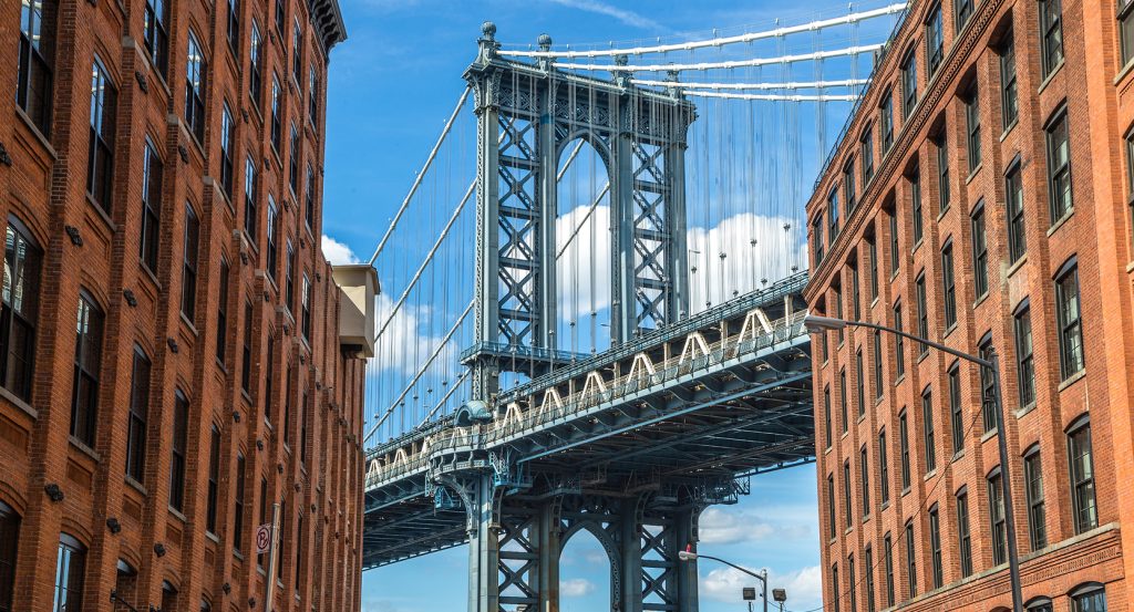
Why Brooklyn Bridge Park matters.
Brooklyn Bridge Park is an expansive waterfront park where Brooklyn Heights' elevated nineteenth-century streetscape meets rehabilitated shipping piers, constructed topography and 1.3 miles of East River shoreline facing Lower Manhattan.
Set along the East River between Atlantic Avenue and Jay Street near Furman Street and just below the Brooklyn Heights Promenade, the park occupies 85 acres of uplands, former cargo piers and water stretching beneath the Brooklyn and Manhattan bridges. Michael Van Valkenburgh Associates organized the post-industrial shoreline through lawns, meadows, planted slopes, beaches, promenades and six piers whose differing dimensions support distinct portions of the landscape. Twenty-to-thirty-foot hills between Piers 2 and 5 rise beside the Brooklyn-Queens Expressway, using constructed landform to reduce traffic sound from 75 to 68 decibels before the terrain falls toward the river. Pier 1 creates another pronounced topographic sequence on landfill, climbing to the park's 20-foot high point and descending through lawns toward a salt marsh, water gardens and Granite Prospect, whose steps reuse more than 300 pieces of stone salvaged from the Roosevelt Island Bridge reconstruction. The result is a long waterfront landscape whose repurposed piers, substantial planted landforms, reclaimed stone and changing shoreline conditions convert a former freight corridor into a continuous public edge between Brooklyn and the East River.
What defines Brooklyn Bridge Park.
Brooklyn Bridge Park is best known for reclaiming an industrial waterfront through a civic campaign that unfolded across more than two decades before the first completed park sections opened in 2010. Robert Fulton's steam-powered Fulton Ferry Company had begun service across the East River in 1814, accelerating movement between Brooklyn and Manhattan before railroad tracks reached Fulton Ferry Landing during the 1850s and massive warehouses rose beside the shoreline. The Brooklyn Bridge opened in 1883 and the Manhattan Bridge followed in 1909, weakening the ferry economy that had supported the waterfront. Cargo activity revived during the 1950s after narrow finger piers gave way to wider shipping structures and the Port Authority of New York and New Jersey acquired the piers from the New York Dock Company in 1955, yet changes in freight transportation left much of the shoreline abandoned by the 1970s. The Port Authority announced plans to sell the piers for commercial development in 1984, prompting residents and the Brooklyn Bridge Park Coalition to campaign for public waterfront use. The Downtown Brooklyn Waterfront Local Development Corporation formed in 1998 and produced an Illustrative Master Plan in September 2000. Governor George Pataki and Mayor Michael Bloomberg signed a 2002 memorandum committing state and city funding and creating the Brooklyn Bridge Park Development Corporation, with the agreement requiring long-term maintenance to be supported through revenue-producing development. Michael Van Valkenburgh Associates joined the undertaking in 2004, the master plan followed in 2005 and construction began in February 2008. Pier 1 became the first major completed section in March 2010, followed across the next eleven years by Pier 6 playgrounds, Pier 4 Beach, Pier 2, Main Street, John Street, Pier 5 Uplands, Pier 3, Pier 2 Uplands and Emily Warren Roebling Plaza. The 2021 opening of Emily Warren Roebling Plaza joined previously separated portions beneath the Brooklyn Bridge and marked completion of the 13-year construction campaign.
Ecological infrastructure forms a separate chapter in the park's conversion of hardened industrial shoreline into habitat. Stormwater passes through freshwater gardens for natural treatment before underground storage and reuse for irrigation, with Pier 1 alone holding more than 100,000 gallons and additional tanks installed at Pier 2 Uplands, Pier 3 Uplands, Pier 6 and Empire Fulton Ferry. Native salt marshes and meadows reconstruct shoreline conditions displaced during Brooklyn's industrial development, creating habitat for birds, marine species, butterflies and other wildlife beside heavily used public areas. Park horticulturists manage lawns, trees and planting beds organically through compost, compost tea, retained plant matter and pest-management practices that eliminate chemical herbicides and synthetic fertilizers. Salvage became another design strategy: clean fill excavated during the MTA's East Side Access project supplied substantial volumes beneath park landscapes, reclaimed granite arrived from the Willis Avenue and Roosevelt Island bridge projects, and surviving structural frames from former pier sheds were retained for shelter, lighting, recreation and sports infrastructure. The shoreline also participates in Billion Oyster Project's Community Reefs program, returning oysters to an estuary where they once covered more than 220,000 acres and using the restored reefs for filtration and marine habitat. Brooklyn Bridge Park operates as a large-scale experiment in post-industrial landscape construction, joining water recovery, habitat reconstruction, organic horticulture, structural reuse and marine restoration across a waterfront once engineered almost entirely around freight.
How Brooklyn Bridge Park fits.
Brooklyn Bridge Park works as the anchor for a Brooklyn outing connecting abolitionist organizing, nineteenth-century waterfront commerce and the engineering history of New York mass transportation.
Begin at Plymouth Church, founded in Brooklyn Heights in 1847 by 21 New England Congregationalists who selected Henry Ward Beecher as their first pastor. Beecher turned the congregation into a nationally consequential center of antislavery activism, staging public events that raised money to purchase enslaved people's freedom and forging connections with the Underground Railroad. During a service on February 5, 1860, the congregation raised $900 to secure freedom for a young enslaved girl known as Pinky, who returned for the church's eightieth anniversary in 1927 and gave back the gold ring Beecher had presented to her. The present sanctuary dates to 1849, and an E. and G.G. Hook organ installed in 1866 was then the largest pipe organ built in the United States; surviving casework and pipes remain incorporated into the instrument. Continue to Empire Stores, seven connected warehouses constructed between 1868 and 1885 when Brooklyn's shoreline operated as a major receiving and storage zone for international cargo. Thick brick exteriors and schist interior walls kept the warehouses cool enough for sugar, molasses, wool, rubber and coffee, and the Arbuckle Brothers later incorporated the complex into their extensive coffee operation for Ariosa and Yuban. New York Dock Company acquired Empire Stores during a vast 1901 foreclosure purchase extending across two and a half miles of industrial waterfront, and the Arbuckles acquired the complex in 1920. Abandonment followed during the 1960s, leaving the warehouses vacant for decades before Brooklyn Bridge Park selected Midtown Equities, Rockwood Capital and HK Organization in 2013 for their rehabilitation. Conclude at New York Transit Museum, occupying Court Street Station beneath Downtown Brooklyn, where the Independent Subway System opened the terminal on April 9, 1936 for the short HH Shuttle to Hoyt-Schermerhorn. Low ridership closed the station in 1946, and the underground complex spent three decades largely dormant before transit employees proposed using it for a United States Bicentennial exhibition. The New York City Transit Exhibition opened there on July 4, 1976 as a temporary presentation intended to last only months, yet its popularity sustained the institution that became the New York Transit Museum. The platform now spans a full city block and holds a rotating group of twenty historic subway and elevated cars, some dating to 1904, preserving transportation history inside an authentic former station. The progression moves from Beecher's abolitionist congregation through Empire Stores' global freight economy and culminates inside a preserved IND station, connecting the religious reform, maritime commerce and mass transportation systems that shaped Brooklyn's growth.
Where your story begins.
Foresyte Travel reveals places that feel extraordinary long before you arrive.
Enjoy editorial crafted for luxury travelers.
Foresyte may earn a commission when you book.







































































































