
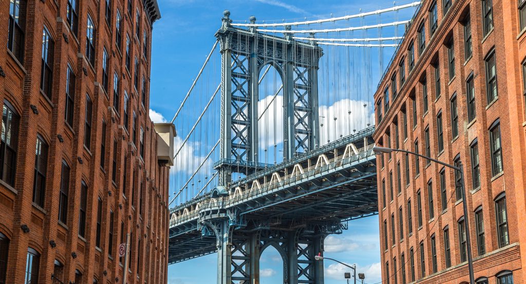
Why Brooklyn Heights Promenade matters.
Brooklyn Heights Promenade is an elevated waterfront walk where Brooklyn Heights' nineteenth-century residential character meets sweeping harbor panoramas, a linear garden edge and an extraordinary perch above the East River shoreline.
Set along the western edge of Brooklyn Heights near Montague Street and just steps from the Center for Brooklyn History, the promenade occupies the crest of the neighborhood's steep bluff with Lower Manhattan, Governors Island and New York Harbor spread across the horizon. A broad paved path runs beside planted beds, mature trees and long rows of benches, creating an unusually open foreground between the historic residential blocks and the water below. The western railing maintains an uninterrupted visual field across Brooklyn Bridge Park toward the harbor, with the Brooklyn Bridge entering the panorama near the northern end and the Statue of Liberty visible toward the southwest. Brownstone and brick houses rise immediately behind the path along Columbia Heights, giving the waterfront outlook a close architectural edge distinct from the expansive geography beyond the railing. The result is a long public balcony where garden planting, historic residential fabric and an exceptional harbor elevation compress Brooklyn Heights and New York's maritime geography into a single continuous walk.
What defines Brooklyn Heights Promenade.
Brooklyn Heights Promenade is best known for emerging from the fierce 1940s dispute over routing the Brooklyn-Queens Expressway through one of Brooklyn's oldest residential districts. Regional planners had proposed a Brooklyn-Queens Connecting Highway by 1936, and Robert Moses pressed the highway program forward as New York expanded its arterial network before and after World War II. A 1942 proposal threatened to bisect Brooklyn Heights, provoking organized opposition from the Brooklyn Heights Association and a front-page Brooklyn Eagle headline declaring the highway plan shocking. The association's Roy M. D. Richardson and Ferdinand W. Nitardy became important figures in the campaign for an alternative route along the bluff near Furman Street. A 1943 citizen proposal placed a three-level structure along the waterfront edge with private gardens above, and Moses accepted the general approach on the condition that the upper park become public. Engineering firm Andrews & Clark subsequently developed the unusual triple-cantilever solution, with Ernest J. Clark serving as chief engineer and S. Starr Walbridge and Phillips H. Lovering contributing to the structural work. The arrangement stacked two highway decks beneath the pedestrian level, using the sharp topographic drop between Columbia Heights and Furman Street to carry transportation infrastructure against the bluff. Demolition along Furman Street began in 1946, followed by several years of construction on the cantilevered structure. The southern portion of the Promenade opened on October 7, 1950, the northern portion followed on December 7, 1951, and highway traffic began using the completed structure in 1954.
Preservation battles soon extended from the neighborhood behind the Promenade to the panorama in front of it. The Port Authority sought in 1953 to retain the ability to replace waterfront warehouses with buildings rising as high as 70 feet, prompting concern that future construction would obstruct the newly opened public outlook. Brooklyn Heights subsequently became New York City's first historic district on November 23, 1965, following a sustained neighborhood preservation campaign that had developed alongside resistance to large-scale redevelopment. A further protection arrived in 1974 through a Special Scenic District created to preserve the visual corridor extending from the Promenade toward a line in the East River. The walk acquired another social history after its opening, becoming a prominent gathering place for gay men from the 1950s through the 1980s and a focus of police scrutiny during the 1960s; Charlotte Charlaque, an early American figure associated with gender affirmation surgery, became such a familiar presence that contemporaries called her the “Queen of the Promenade.”  Infrastructure now places the site within another major chapter: New York City owns the BQE Central section beneath it, and NYC DOT is advancing rehabilitation of the aging corridor between Atlantic Avenue and Sands Street. The Promenade carries several layers of twentieth-century New York history at once, joining neighborhood resistance, highway engineering, preservation law, social history and the continuing problem of maintaining major infrastructure within an established urban district.
How Brooklyn Heights Promenade fits.
Brooklyn Heights Promenade works as the anchor for a Brooklyn Heights and Downtown Brooklyn outing connecting abolitionism, nineteenth-century historical scholarship and the civic architecture of the former independent City of Brooklyn.
Begin at Plymouth Church, founded in 1847 by 21 New England Congregationalists who selected Henry Ward Beecher as their first minister and quickly made the church a nationally important center of antislavery activism. Beecher and members of the congregation aided freedom seekers moving north through the Underground Railroad, giving Plymouth the local nickname “Grand Central Depot”; Beecher also staged public events that raised money to purchase enslaved people's freedom. During a February 1860 service, the congregation raised $900 to secure freedom for a young girl called Pinky, who returned in 1927 and gave back the gold ring presented to her on the day of her liberation. Abraham Lincoln worshipped at Plymouth in 1860, and the church received National Historic Landmark designation in 1961. Continue to Center for Brooklyn History, housed in George B. Post's 1881 building for the Long Island Historical Society on Pierrepont Street. Post, later responsible for the New York World Building and New York Stock Exchange, experimented with structural techniques that produced large interior volumes during the formative decades of American tall-building engineering. The institution evolved into the Brooklyn Historical Society before joining Brooklyn Public Library in 2020, combining 157 years of collecting with the library's Brooklyn Collection. The merger created an extensive repository devoted to the borough's history inside the same purpose-built nineteenth-century headquarters that had served the earlier society for 140 years. Conclude at Brooklyn Borough Hall, conceived after Brooklyn became a city in 1834 and initially awarded through an architectural competition to Calvin Pollard. Financial problems halted the first undertaking after the cornerstone was laid in 1836; construction resumed in 1845 under Gamaliel King, whose reduced Greek Revival scheme opened as Brooklyn City Hall in 1848. A fire in 1895 destroyed the original clock and bell tower, and Vincent Griffith with Stoughton & Stoughton designed the replacement cast-iron cupola. Consolidation in 1898 converted City Hall into Borough Hall, closing the building's half-century chapter as the governmental center of an independent Brooklyn. The progression moves from Beecher's abolitionist congregation through Post's institution for preserving Brooklyn history and culminates at King's former City Hall, connecting reform, historical scholarship and municipal power across the neighborhood that fought to preserve its built fabric.
Where your story begins.
Foresyte Travel reveals places that feel extraordinary long before you arrive.
Enjoy editorial crafted for luxury travelers.
Foresyte may earn a commission when you book.







































































































