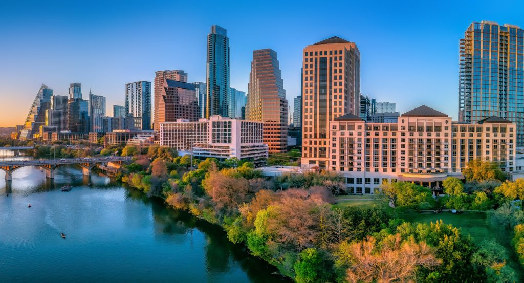
Why you should experience Bee Cave Road in Austin, Texas.
Bee Cave Road is a scenic corridor where Westlake's Hill Country landscapes, architectural refinement, environmental stewardship, and enduring West Austin character create one of the region's most celebrated drives.
Running through Westlake between Rollingwood and West Lake Hills, the corridor follows rugged limestone ridges, wooded canyons, and elevated terrain that reveals the dramatic transition between urban Austin and the eastern edge of the Texas Hill Country. Mature live oaks, limestone bluffs, expansive canyon views, and carefully integrated residential development create a landscape where natural beauty remains the defining experience. Decades of thoughtful growth have preserved the corridor's ecological character while accommodating some of Austin's most distinguished neighborhoods. The result is an experience defined by panoramic scenery, geological richness, and one of Westlake's signature corridors.
What you should know about Bee Cave Road.
Bee Cave Road is best known for following the historic route connecting Austin with the settlement of Bee Cave, a wagon road established during the mid-nineteenth century that became an important western transportation corridor for ranchers, farmers, merchants, and travelers crossing the rugged Hill Country long before the arrival of modern highways. The corridor traverses the eastern margin of the Edwards Plateau, where uplifted Cretaceous limestone, karst formations, steep canyon walls, and thin calcareous soils created one of Central Texas' most distinctive geological landscapes while supporting extensive stands of plateau live oak, Ashe juniper, Texas madrone, Mexican buckeye, and evergreen sumac. Much of the surrounding landscape lies within the Balcones Canyonlands ecological region, providing habitat for federally protected species including the golden-cheeked warbler and black-capped vireo, while nearby preserves conserve native oak-juniper woodland representative of the eastern Texas Hill Country. The corridor also reflects West Austin's transformation during the second half of the twentieth century as West Lake Hills, incorporated in 1953, and neighboring communities adopted nationally recognized approaches emphasizing hillside preservation, low-density development, scenic protection, and environmental conservation. Collectively, the corridor's frontier transportation history, geological evolution, ecological significance, municipal heritage, and enduring scenic character establish Bee Cave Road as one of Austin's defining Hill Country corridors.
The nearby Colorado River carved the deeply incised valleys that now distinguish West Austin, while long-term erosion exposed limestone escarpments, spring-fed ravines, and elevated overlooks that continue defining the surrounding landscape. Extensive recharge features associated with the Edwards Aquifer beneath the corridor contribute to one of Texas' most significant groundwater systems through fractured limestone, sinkholes, and natural infiltration zones supporting regional water resources. Archaeological investigations throughout the western Austin hills have documented prehistoric Indigenous campsites, stone tools, burned rock middens, and other cultural resources spanning thousands of years of human occupation before European settlement. Together, these hydrological systems, geological processes, and archaeological discoveries demonstrate how Bee Cave Road reflects a corridor where natural history, environmental stewardship, and human settlement have remained inseparably connected for millennia.
How to fold Bee Cave Road into your trip.
Bee Cave Road works as an exploration of West Austin's Hill Country landscapes, preserved natural areas, and panoramic scenery.
Begin at Wild Basin Wilderness Preserve, where protected canyons, native woodland, interpretive trails, and abundant wildlife introduce the ecological richness that has long distinguished the eastern Hill Country. Continue to Red Bud Isle, where shaded riverside trails, broad views across Lady Bird Lake, and mature riparian forest reveal another dimension of the Colorado River landscape shaping West Austin. Conclude at Mount Bonnell, where one of Austin's highest public overlooks provides the historical payoff through sweeping views across Lake Austin, the Colorado River valley, and the rugged limestone hills that have defined the region since the earliest frontier settlements. The progression moves naturally from protected wilderness to riverside habitat before culminating at one of Central Texas' most celebrated scenic overlooks.
Where your story begins.
Foresyte Travel reveals places that feel extraordinary long before you arrive.
Experience premium editorial crafted for luxury travelers.