Why High Road Leyton matters.
High Road Leyton is a vigorous corridor where Leyton's East End character meets an ancient route toward Waltham Abbey, Victorian civic architecture and the close-grained shopfronts of a town center built through rapid suburban expansion.
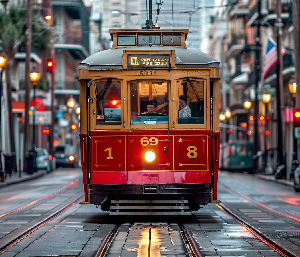
Running through Leyton between Stratford, and Walthamstow, the north-south corridor occupies the neighborhood's principal spine, passing through long commercial stretches before reaching the broader junction geometry around Bakers Arms. Two-storey terraces and shop-house parades establish its dominant physical grain, punctuated by larger corner buildings, recessed forecourts and surviving timber-framed structures that expose the road's much longer architectural chronology. Continuous storefronts create the primary encounter, with narrow plots producing a rapid sequence of independent premises and upper-storey façades directly against the pavement. Cross streets provide a secondary mechanism by revealing dense residential terraces behind the commercial frontage, making the High Road the organizing seam between shopping activity and the neighborhoods built outward from it. The result is a corridor where Leyton's growth remains exceptionally readable, carrying inherited route geometry, compact retail frontage and successive generations of suburban architecture along a street that still functions as the neighborhood's central line.
What defines High Road Leyton.
High Road Leyton is best known for following the historic road north toward Waltham Abbey, a route whose importance long preceded Leyton's transformation from an Essex settlement into a densely built London suburb. Harold II refounded and substantially endowed Waltham Abbey in 1060, and the High Road subsequently carried traffic and pilgrims toward one of medieval England's major religious houses. Permanent settlement initially concentrated farther south near the parish church, yet buildings gradually followed the road, including a surviving timber-framed house dating from the fifteenth century. Seventeenth and eighteenth-century merchants and businessmen then established substantial houses and pleasure grounds across a landscape still dominated by farms, fields, marshland and cottages between the River Lea and forest land to the east. John Rocque's 1745 map captured that rural condition through large open fields and scattered estates, with smaller holdings clustered along the road toward its junction with Hoe Street. Railway expansion and speculative building overturned that landscape during the nineteenth century, and development accelerated during the 1870s as housing spread east of the Lea Valley and industry occupied lower ground closer to the railway sidings. By the turn of the twentieth century, two-storey terraces covered much of the former countryside and the High Road had become the commercial spine of a fully urbanized district, preserving the ancient route within an entirely new metropolitan fabric.
Leyton's municipal expansion created a separate architectural mechanism when rapid population growth overwhelmed the first purpose-built town hall opened for the Local Board in 1882. That Italianate building, designed by John M. Knight, soon proved insufficient for an administration elevated to urban district status in 1894, prompting a competition for a larger civic complex combining municipal offices with technical education. John Johnson won the commission, F. J. Coxhead constructed his scheme during 1895 and 1896, and the completed building combined red brick with white stone in an eclectic composition mixing Italianate, Baroque and Gothic elements. An Ionic entrance porch, enriched frieze, decorative gable, octagonal corner towers and timber-and-lead flèche gave the High Road frontage architectural prominence, with the council chamber occupying the principal corner block and a technical institute extending behind it. The superseded municipal building entered library use, creating an adjoining civic group whose functions registered Leyton's transition from suburban growth into organized local government and public education. A further wing completed in 1910 enlarged the complex again, giving the High Road a civic center whose successive construction phases physically track the expanding administrative demands generated by Leyton's extraordinary late Victorian growth.
How High Road Leyton fits.
High Road Leyton works as the anchor for an afternoon tracing the neighborhood through medieval parish continuity, Edwardian investment in public recreation and a cricket ground that became central to the early history of Essex county competition.
Begin at St. Mary the Virgin, whose institutional history reaches the medieval parish of Leyton and whose surviving architecture contains the results of repeated rebuilding across several centuries. The church and manor passed to Stratford Langthorne Abbey 1200, and medieval foundations later discovered beneath the building established a compact nave and chancel within the footprint of the present church. A dangerous tower was replaced in red brick in 1658, the chancel followed in 1693 and John Strype served the parish for decades after becoming curate in 1669. Population pressure drove a major enlargement during the 1820s after an anonymous benefactor known as the Old Parishioner supplied £1,000, enabling John Shaw to design a new south aisle and alterations using slender cast-iron columns beneath timber-framed construction. The church subsequently accumulated monuments associated with John Flaxman and John Pasco, preserving a parish institution whose fabric spans Leyton's passage from rural Essex into metropolitan London. Continue to Coronation Gardens, developed from land acquired by Leyton Council in 1897 for public recreation. Landscape gardener W. J. Stuckey prepared an ornamental scheme, and government approval of a £1,000 loan in 1903 financed gravel walks, grass plots, shrubberies and formal bedding modeled on East Ham's Central Park. Between fifty and sixty unemployed local men carried out much of the winter construction before H. V. Chew opened the gardens on 23 May 1903. A cast-iron bandstand followed in 1904 and survives as the borough's sole example, with a war memorial fountain added in 1922 and a remembrance garden established after the Second World War. Conclude at Leyton Cricket Ground, where Essex County Cricket Club found the metropolitan base that helped move county cricket away from its earlier Brentwood headquarters. Essex first played there against Surrey in June 1885, then purchased the ground from Lord Lyttelton in 1886 after captain Charles Ernest Green pressed for a site with stronger connections to London. Richard Creed designed the substantial timber pavilion, and the ground remained Essex headquarters until 1933, with county matches returning between 1957 and 1977. The venue also staged Essex's 1899 defeat of Australia by 126 runs and a 555-run partnership in 1932 that remains the English record for any wicket. Municipal ownership carried the site into community sport, and investment with the England and Wales Cricket Board produced an Urban Cricket Hub in 2019 as restoration planning continued for the listed pavilion. The progression moves from a medieval parish institution repeatedly enlarged for a growing population through municipal creation of ornamental public space into a county cricket ground whose competitive history and surviving pavilion turned Leyton into a consequential center of English sport.
Where your story begins.
Foresyte Travel reveals places that feel extraordinary long before you arrive.
Enjoy editorial crafted for luxury travelers.
Foresyte may earn a commission when you book.