
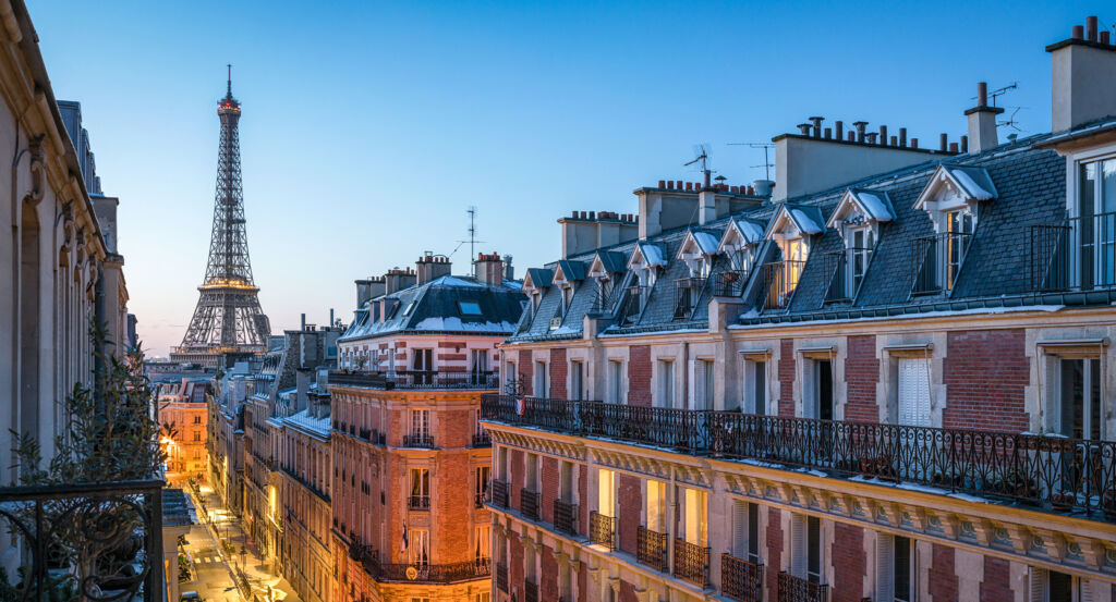
Why 18th Arrondissement matters.
18th Arrondissement is a many-layered enclave where the heights of Montmartre meet northern Paris through steep village streets, dense working-class districts, railway corridors and successive urban worlds gathered across one of the capital's most topographically varied territories.
Positioned between the 17th Arrondissement, Saint-Ouen-sur-Seine, and the 19th Arrondissement, the neighborhood occupies Paris's northern edge across the Butte Montmartre and lower ground extending east through Clignancourt, Goutte d'Or and La Chapelle. Sharp changes in elevation distinguish the hill from the flatter districts below, with staircases, winding lanes and irregular plots giving way to long commercial streets, railway infrastructure and broad nineteenth-century avenues across the Arrondissement's eastern half. Montmartre establishes the primary encounter through streets climbing around the butte, where surviving gardens, walls, passages and older houses preserve the physical imprint of territory that developed beyond Paris for centuries. Boulevard Barbès, Rue Ordener and Rue de la Chapelle introduce a distinct urban scale through dense apartment blocks and commercial corridors created as population growth and industrial expansion absorbed former fields and suburban settlements. Railway lines approaching Gare du Nord cut another powerful geometry through the eastern territory, separating blocks and recalling the infrastructure that drew workers and manufacturing activity northward during the nineteenth century. The result is an Arrondissement where a former hilltop village, industrial suburbs and intensely urban districts remain physically distinct yet historically connected, preparing an account shaped by the 1860 incorporation of territories that had developed outside Paris on markedly different paths.
What you should know 18th Arrondissement.
18th Arrondissement is best known for joining substantial portions of the former communes of Montmartre and La Chapelle when Paris expanded its boundaries on January 1, 1860. Both territories had become independent communes in 1790, yet their earlier histories followed different geographic conditions: Montmartre developed across a gypsum-rich hill long associated with vineyards, quarries and religious property, and La Chapelle grew around the medieval village centered on Saint-Denys de la Chapelle beside the historic road north from Paris. The 1859 annexation law dismantled those municipal boundaries as the capital expanded to the Thiers fortifications, bringing both communities into the newly created Arrondissement. Their incorporation arrived during an era of dramatic population movement toward northern Paris, where cheaper peripheral ground accommodated housing and employment beyond the increasingly reconstructed center. The Arrondissement's administrative center initially occupied the former Montmartre mairie before the present building on Place Jules Joffrin opened on July 8, 1892, physically shifting civic administration into the enlarged northern territory. Montmartre retained traces of its elevated village structure even as construction spread across its slopes, and the lower districts developed through denser apartment blocks and major circulation corridors. The former communes entered Paris as geographically adjoining territories with contrasting histories, establishing the internal diversity that still distinguishes the 18th from Arrondissements formed around more uniform urban fabrics.
Industrialization and migration created a separate historical mechanism across the Arrondissement's eastern districts. Construction of the Chemin de fer du Nord between 1843 and 1846 drove tracks through La Chapelle and removed part of the existing Goutte d'Or settlement, connecting territory still outside Paris directly with the expanding national railway system. Antoine Pauwels had already established a steam-engine factory in the Goutte d'Or in 1836, and metalworking, mechanical production and railway employment subsequently attracted workers into modest housing constructed across former agricultural ground. Migration broadened that population across successive generations: arrivals from northern France and Alsace were joined by Belgians, Italians, Poles and Spaniards, followed by Kabyle settlement beginning before the end of the nineteenth century and larger Maghrebi migration during the twentieth. Goutte d'Or became one of the capital's enduring migration districts through a process rooted first in industrial employment and inexpensive housing. La Chapelle experienced its own conversion as railways divided the former village and industrial uses spread beside the tracks. The decommissioning of the Thiers fortifications after 1919 opened another belt for construction, including habitations à bon marché across former military ground, extending dense residential Paris toward the Arrondissement's northern edge. These successive phases carried the 18th from peripheral villages and agricultural land into a populous northern district whose social geography developed through railways, industry, housing and international migration.
How 18th Arrondissement fits.
18th Arrondissement works as the anchor for an afternoon tracing Montmartre from a surviving seventeenth-century mill through an artists' residence turned museum into the vast Romano-Byzantine basilica that permanently altered the summit's silhouette.
Begin at Moulin de la Galette, whose surviving Blute-Fin mill dates to 1622 and passed through several names before the Debray family turned the surrounding property toward entertainment during the nineteenth century. Charles-Nicolas Debray moved the Radet mill beside Blute-Fin in 1834 and attached a bal and guinguette, creating the Moulin de la Galette name from the cakes served there; the dancing ground subsequently entered the artistic history of Montmartre through painters including Pierre-Auguste Renoir, and Paul Signac painted the two mills in 1884 before Blute-Fin assumed the Moulin de la Galette name in 1895. Continue to Musée de Montmartre, established in 1960 inside the seventeenth-century Maison du Bel Air at 12 Rue Cortot, a property whose earlier residents made the address part of the hill's artistic history before its museum conversion. Auguste Renoir maintained a studio there, followed across different periods by Émile Bernard, Raoul Dufy, Charles Camoin, Suzanne Valadon and Maurice Utrillo; the surviving Valadon and Utrillo studio and collections of paintings, drawings and posters connect the house directly with the ateliers and cabarets that drew artists to Montmartre. Conclude at Basilique du Sacré-Coeur, where Alexandre Legentil and Hubert Rohault de Fleury formulated the Voeu National in 1871 before the National Assembly declared construction a public utility in 1873. Paul Abadie defeated 77 competing proposals in the 1874 architectural competition with a Romano-Byzantine design organized as a Greek cross, and the first stone followed in 1875; unstable quarry ground demanded 83 foundation shafts descending 33 meters, turning the project into an immense engineering undertaking before the basilica rose over the summit. The progression moves from the Debray family converting Montmartre's milling inheritance into nineteenth-century entertainment through Rue Cortot becoming a working address for successive generations of artists into Abadie placing a new religious and architectural presence above Paris, tracing the forces that transformed the butte from productive village terrain into one of the capital's major cultural centers.
Where your story begins.
Foresyte Travel reveals places that feel extraordinary long before you arrive.
Enjoy editorial crafted for luxury travelers.
Foresyte may earn a commission when you book.














































































































