Why ʻĀhihi-Kīnaʻu Natural Area Reserve matters.
ʻĀhihi-Kīnaʻu Natural Area Reserve is a protected volcanic wilderness where South Maui's ancient Hawaiian settlement heritage meets Haleakalā's youngest lava landscapes, exceptionally preserved coral reef ecosystems and the conservation of one of Hawaiʻi's most ecologically significant coastal environments.
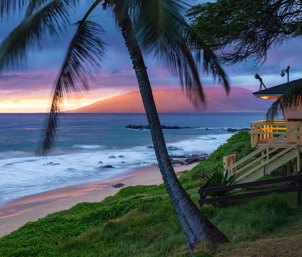
Extending along Maui's southwestern coast beyond Mākena State Park, where Mākena Road approaches ʻĀhihi Bay and continues toward Keoneʻōʻio at La Pérouse Bay, the reserve encompasses Cape Kīnaʻu's volcanic shoreline between Haleakalā's southwestern slopes and the ʻAlalākeiki Channel facing Kahoʻolawe. Vast expanses of black ʻaʻā lava cover the coastal plain, interrupted by smoother pāhoehoe formations, scattered native vegetation and irregular volcanic ridges. The rugged shoreline alternates between exposed rocky points and small coves, with submerged lava formations extending into clear Pacific waters. Inland, low cinder cones rise above the lava fields, creating a stark volcanic landscape beneath the mountain's descending southwestern flank. Small pockets of dryland vegetation occupy sheltered depressions, and isolated brackish pools occur where underground freshwater interacts with seawater. The result is an extensive coastal sanctuary whose young volcanic terrain, specialized native habitats and protected marine environments preserve an exceptional section of Maui's natural and cultural heritage.
What defines ʻĀhihi-Kīnaʻu Natural Area Reserve.
ʻĀhihi-Kīnaʻu Natural Area Reserve is best known for becoming Hawaiʻi's first designated Natural Area Reserve in 1973, establishing a precedent for protecting exceptional ecosystems through the state's developing conservation structure. Its designation under Executive Order 2668 protected 1,238 acres of terrestrial landscape and 807 acres of submerged marine habitat along the southwestern coast of Maui. The reserve's boundaries were developed around the volcanic formations associated with Cape Kīnaʻu and the adjoining shoreline of ʻĀhihi Bay, preserving a substantial portion of Haleakalā's southwestern rift zone. Geological investigations established that the Kālua o Lapa eruption produced extensive lava flows between 1419 and 1621, placing the volcanic event among the youngest episodes in East Maui's geological history. The eruption originated from a cinder cone 520 feet above sea level, sending molten basalt across the descending coastal plain toward the Pacific. Its ʻaʻā flows created an extensive landscape of fractured, jagged rock, and smoother pāhoehoe formations developed where lava moved under different physical conditions. The advancing flows formed Cape Kīnaʻu and extended onto the surrounding seabed, creating new coastal terrain over older volcanic formations. An earlier eruptive sequence, associated with the Kanahena flows, developed between 1024 and 1183, establishing another geological layer beneath the reserve's younger volcanic landscape. Radiocarbon dating overturned the longstanding attribution of the most recent eruption to 1790, demonstrating the importance of distinguishing the area's volcanic history from accounts repeated in older geographical descriptions. Hawaiian communities had occupied the surrounding Honuaʻula district for centuries before European contact, establishing settlements whose surviving features include residential foundations, ceremonial structures, trails, burial areas and traditional fishponds. The reserve encompasses portions of the ʻŌnau, Kanahena, Kualapa and Kalihi ahupuaʻa, traditional land divisions connecting upland resources with the coastal environment. Archaeological investigations identified nine historical site complexes entered in the Hawaiʻi Register of Historic Places, including the Maonakala Village Complex and the Kualapa Cluster. These settlements preserve evidence of a coastal economy supported by fishing, agriculture and exchange with communities occupying Haleakalā's higher slopes. During the eighteenth century, the region formed part of a broader inhabited landscape extending toward Keoneʻōʻio, where French explorer Jean-François de Galaup, comte de La Pérouse, encountered Hawaiian communities in 1786. Subsequent changes in land tenure and ranching altered portions of the surrounding district, and military activity introduced another period of disturbance during the twentieth century. The United States Navy used Cape Kīnaʻu for bombing practice during 1945 and 1946, leaving unexploded ordnance within sections of the volcanic landscape. The reserve's establishment subsequently brought these geological, archaeological and ecological resources under a unified conservation designation. Increased recreational activity during the late twentieth and early twenty-first centuries created substantial pressure on sensitive habitats, particularly through informal trails, shoreline access and disturbance of archaeological features. Hawaiʻi restricted public access to most of the reserve beginning August 1, 2008, protecting fragile areas from continued damage. The Department of Land and Natural Resources subsequently partnered with The Nature Conservancy of Hawaiʻi to develop a comprehensive management strategy through a twenty-member working group. Between 2008 and 2010, the group conducted more than fifteen meetings addressing conservation priorities, public access and the protection of cultural resources. A draft management plan followed in May 2012, establishing a structure for habitat restoration, visitor management and long-term stewardship. Subsequent improvements introduced designated access routes, interpretive signage and a managed parking system, concentrating recreational activity within approved portions of the reserve. ʻĀhihi-Kīnaʻu's historical significance extends from ancient Hawaiian settlement and Haleakalā's late volcanic activity through military disturbance and the establishment of a pioneering statewide conservation system.
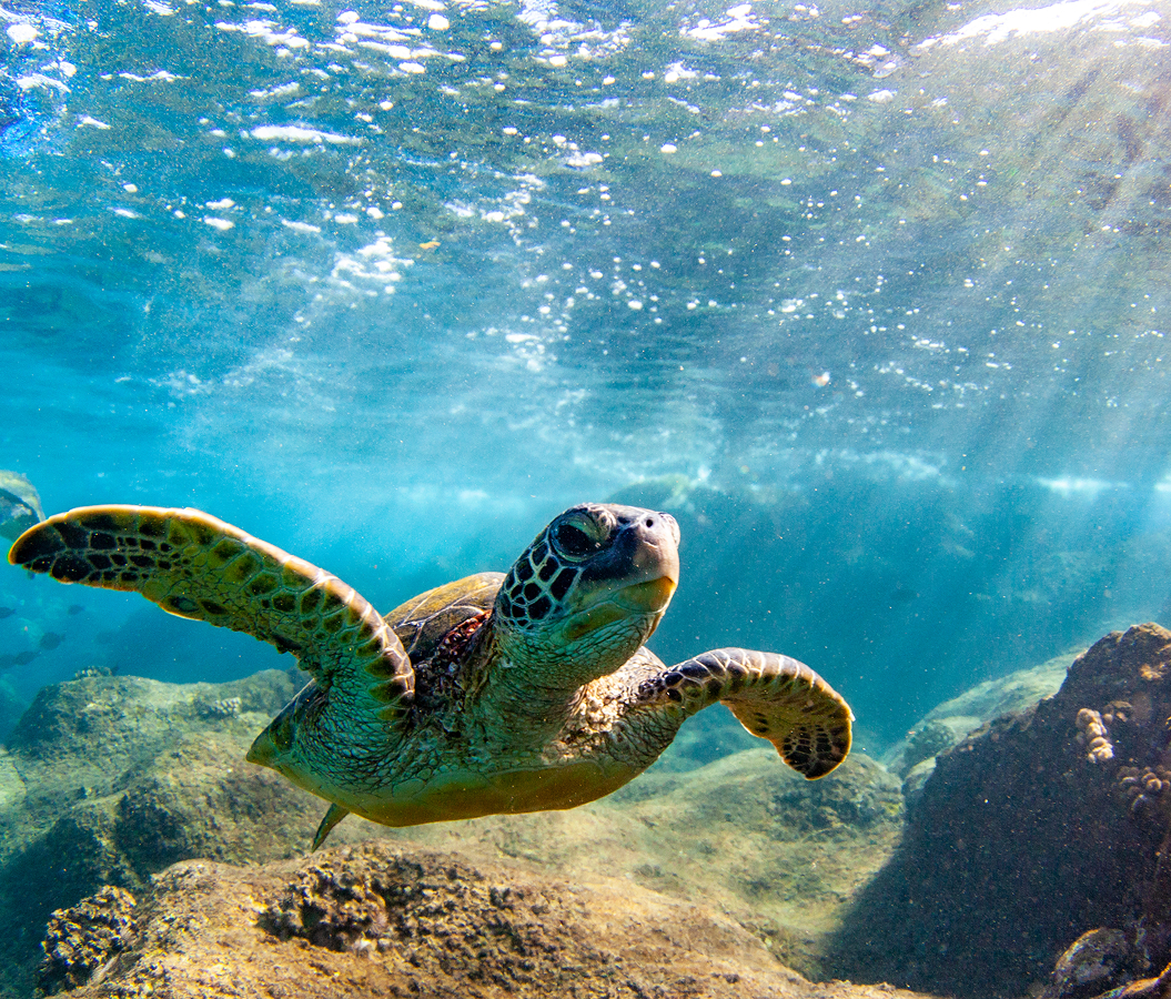
Hawaiʻi's Natural Area Reserves System protects an unusual combination of terrestrial and marine habitats at ʻĀhihi-Kīnaʻu, where the physical conditions of a young lava landscape have produced specialized ecological communities. The reserve's exposed volcanic terrain absorbs substantial solar radiation, creating hot, dry conditions that place severe limitations on plant growth across the coastal plain. Approximately 83 percent of its terrestrial area consists of unvegetated lava, making the surviving pockets of native vegetation particularly important for understanding ecological succession. These isolated habitats, known as kīpuka, contain plants that established themselves in protected areas surrounded by younger volcanic rock. Wiliwili, naio and native Hawaiian cotton survive within portions of this dryland environment, supporting insects and other organisms adapted to the island's seasonal rainfall. Feral goats threaten these communities through grazing and trampling, and invasive plants compete with native species for limited moisture and growing space. The landscape also contains anchialine pools, enclosed coastal wetlands supplied by underground connections to freshwater and seawater. Their water levels respond to tidal movement through the surrounding porous lava, creating distinctive brackish environments physically separated from the open ocean. Native Hawaiian shrimp occupy these pools, including species adapted to specialized combinations of salinity, temperature and limited food resources. Their isolation makes the pools especially vulnerable to introduced fish, invasive prawns and changes in water chemistry, and public access to these habitats is prohibited. The surrounding marine environment develops another dimension of the reserve's ecological importance through extensive coral reef formations occupying submerged lava surfaces. Coral colonies attach to stable volcanic rock, creating complex structures that support reef fish, invertebrates and other marine organisms. A 2007 assessment by Hawaiʻi's Division of Aquatic Resources distinguished the reserve's reef as the only surveyed reef community among its comparison sites that had avoided an overall decline. Earlier monitoring also measured an increase in coral cover within portions of the Kanahena reef between 1999 and 2006, demonstrating the ecological importance of this protected coastal environment. Reef fish occupy different habitats across the submerged volcanic terrain, with herbivorous species feeding on algae and predatory fish moving among coral formations and deeper water. Hawaiian green sea turtles use the surrounding coastal waters for feeding and movement between reef habitats, connecting the reserve to the wider marine environment of South Maui. Hawaiian monk seals and hawksbill turtles are among the protected marine species associated with the region, and humpback whales migrate through the offshore channels during their winter breeding season. Marine regulations prohibit fishing, the removal of organisms and the operation or anchoring of motorized vessels within designated reserve waters. These restrictions protect the ecological relationships among coral, reef fish and larger marine animals, preserving habitat conditions that are particularly vulnerable to concentrated human activity. The northern accessible shoreline provides designated opportunities to observe volcanic formations and marine life, with interpretive panels explaining the reserve's geology, native species and cultural heritage. Snorkeling within permitted areas reveals the relationship between submerged basalt, coral colonies and the clear water surrounding the rocky coastline. Rocky entries, changing currents and shallow reef formations require careful attention to ocean conditions, and the designated access system protects sensitive areas from trampling. The reserve's distinctive importance emerges through this combination of young volcanic geology, rare anchialine wetlands, surviving native dryland vegetation and protected coral reefs, preserving ecological relationships that developed across centuries of natural change.
How ʻĀhihi-Kīnaʻu Natural Area Reserve fits.
ʻĀhihi-Kīnaʻu Natural Area Reserve works as the centerpiece of an exploration connecting South Maui's volcanic coastal formations, the religious history of its Hawaiian communities and the maritime landscape encountered during the earliest European voyages to the island.
Begin at Mākena State Park, the protected coastal landscape encompassing Oneloa, commonly called Big Beach, and the volcanic headland of Puʻu Olaʻi. Its principal sandy shoreline extends beneath the dry southwestern slopes of Haleakalā, creating one of Maui's largest undeveloped beach environments. Puʻu Olaʻi rises between Oneloa and Oneʻuli Beach, preserving a substantial cinder cone formed during an earlier phase of East Maui's volcanic activity. Geological mapping places the formation within the Hāna Volcanics, connecting its origin to the eruptions that shaped the island's southern coastal terrain. The park's pale sand contrasts with the dark volcanic formations of the surrounding headlands, and its exposed western shoreline experiences powerful shorebreak during periods of increased surf. Continue to Keawalaʻi Congregational Church, the historic Hawaiian Christian congregation established in 1832 as the Church of Honuaʻula. Its original place of worship was constructed from pili grass, and the congregation subsequently developed a substantial stone church using locally gathered lava rock and coral-based mortar. The surviving building dates to the nineteenth century and incorporates thick masonry walls, a shingled gable roof and a bell tower above its principal entrance. In 1856, the congregation's Sunday school raised $70 to purchase a church bell from the United States, which arrived in January 1860 and was installed in February 1862. The church preserves a continuing relationship with Hawaiian-language worship, traditional music and the religious heritage of South Maui's coastal communities. Conclude at La Pérouse Bay, the volcanic embayment known in Hawaiian as Keoneʻōʻio, occupying the southern end of the coastal road beyond Mākena. The bay acquired its European name after French naval commander Jean-François de Galaup, comte de La Pérouse, approached Maui during his Pacific expedition in 1786. His voyage aboard the frigates Boussole and Astrolabe formed part of a French scientific and geographical expedition undertaken during the reign of Louis XVI. The surrounding shoreline preserves evidence of Hawaiian habitation, including stone walls and former residential areas associated with the coastal settlement of Keoneʻōʻio. The historic Hoapili Trail begins near the bay, following a section of the traditional coastal route across rugged lava terrain toward the southern shores of Maui. The route connects the area's maritime history with the overland transportation networks that served Hawaiian communities before the development of modern roads. The progression moves from Mākena State Park's volcanic coastal formations through Keawalaʻi Congregational Church's Hawaiian religious heritage and culminates in La Pérouse Bay's maritime and settlement history, connecting the geological, cultural and navigational significance of southwestern Maui.
Where your story begins.
Foresyte Travel reveals places that feel extraordinary long before you arrive.
Enjoy editorial crafted for luxury travelers.
Foresyte may earn a commission when you book.