
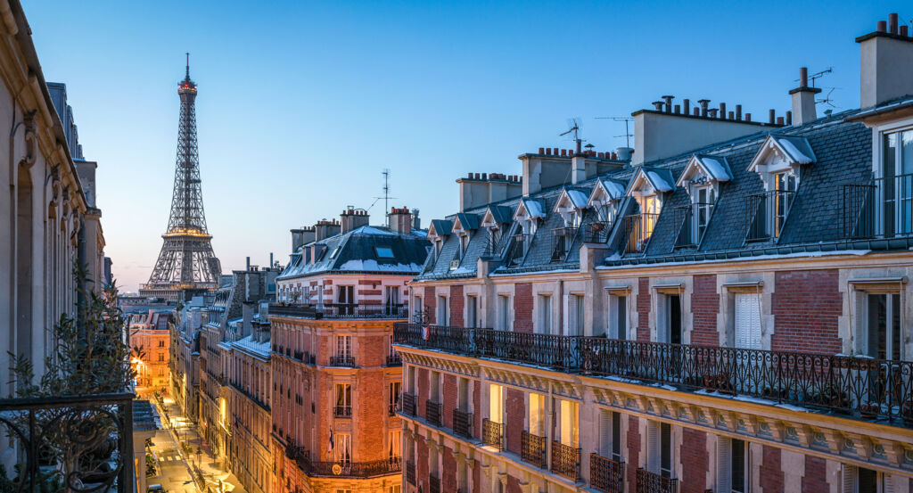
Why Charonne matters.
Charonne is a village-like enclave where the southern slope of Belleville meets eastern Paris through cobbled streets, former vineyard ground and an inherited street pattern that survived the absorption of an independent commune into the capital.
Positioned between Père-Lachaise, Saint-Fargeau, and Porte de Montreuil, the neighborhood occupies an eastern pocket where Rue de Bagnolet, Rue Saint-Blaise and Rue des Pyrénées cross the rising ground that once supported the village of Charonne beyond Paris. Rue Saint-Blaise preserves an unusually intimate physical setting through small houses, irregular building lines and a gentle climb toward the old village center, with larger twentieth-century residential blocks appearing behind a street whose dimensions still belong to an earlier settlement. Rue de Bagnolet establishes the primary encounter along the former Grande Rue de Charonne, carrying the neighborhood across the hillside on the axis that historically connected the settlement with Bagnolet and the eastern countryside. Side streets around Rue des Prairies and Rue de la Réunion deepen that encounter through changes in elevation, enclosed gardens and surviving low-rise buildings that expose the older scale beneath later urbanization. The southern exposure of the Belleville hillside adds another layer to the terrain, recalling the springs, cultivated plots and vines that once covered the slopes around the settlement before dense construction reached eastern Paris. The result is a neighborhood where topography and inherited village structure remain unusually powerful, preparing a history that begins centuries before Charonne entered the municipal boundaries of Paris.
What defines Charonne.
Charonne is best known for evolving from an agricultural settlement and medieval seigneurie into an eastern Paris district whose surviving street structure still traces the independent village absorbed by the capital in 1860. Written references to the locality extend to the end of the tenth century, and Robert the Pious transferred royal rights over Charonne to the Abbaye Saint-Magloire in 1008. The abbey retained the seigneurie for more than five centuries before René de Gondi and the religious community sold it in 1576 to Simon de Fiez, opening a succession of private and religious proprietors that included Martin de Braguelongne, Honoré Barentin and the Congrégation de Notre-Dame de la Paix. Agricultural ground remained fundamental to the settlement, with the south-facing Belleville slope and local springs supporting vineyards alongside cultivated fields. Charonne consequently developed beyond the dense city as a community whose land supported both agriculture and the country properties of wealthy Parisians. The eighteenth century brought another social layer as estates and pleasure houses spread through the surrounding eastern hills, joining cultivated ground to a landscape increasingly attractive to elite owners seeking residences beyond Central Paris. The nineteenth century dismantled that separation as metropolitan growth advanced eastward and industry followed workers displaced from more central districts. The law of June 16, 1859 absorbed Charonne with ten other communes into the enlarged capital effective in 1860, dividing the former commune among the new Parisian districts and neighboring municipalities. Industrial activity subsequently expanded across territory where vineyards and gypsum extraction were disappearing, converting the former agricultural settlement into part of the working eastern city.
The physical survival of Charonne's old center followed a different path as the nineteenth and twentieth centuries placed increasingly dense construction around its inherited village streets. Rue Saint-Blaise had served as the settlement's principal street, converging with the old Grande Rue near the historic center before the surrounding territory became part of the twentieth Arrondissement. Its modest width and irregular alignment persisted even as the expanding city introduced larger apartment buildings into adjacent blocks. Saint-Blaise later became one of the densest residential sectors in Paris, reaching more than 15,000 inhabitants across 19 hectares, yet portions of the old street retained small houses beside much larger postwar construction. That contrast made the former village axis an unusually legible fragment inside a district transformed by successive waves of housing. The surviving scale also preserves a direct spatial relationship with the hillside: older streets bend and rise across terrain whose gradients had shaped agriculture long before metropolitan construction arrived. Charonne consequently presents its history through physical discontinuities, with village dimensions surviving beside the dense eastern Paris that eventually surrounded them.
How Charonne fits.
Charonne works as the anchor for a daytime exploration connecting a Régence pleasure pavilion built for the Orléans family, a railway station created during the industrial expansion of eastern Paris and a cooperative housing experiment raised over a former gypsum quarry.
Begin at Pavillon de l'Ermitage, the last surviving element of the Château de Bagnolet estate acquired in 1719 by Françoise-Marie de Bourbon, daughter of Louis XIV and wife of Philippe d'Orléans, who enlarged the property and commissioned three garden pavilions. The Ermitage rose between 1723 and 1727 at the western edge of the estate, preserving Régence architecture after the château disappeared; Baron de Bratz later acquired the pavilion and used it from 1792 for meetings connected with attempted plans to rescue Louis XVI and Marie-Antoinette, before François Pomerel purchased it in 1820 and the Assistance publique took possession in 1884. Continue to Gare de Charonne, where the Petite Ceinture first opened a freight station on September 15, 1855 before inaugurating passenger service on July 14, 1862 as industrialization increased movement across northeastern Paris. Freight traffic expanded from 18,334 shipments and arrivals in 1860 to 100,396 in 1868, and a coal annex followed in 1866 to supply the Saint-Mandé gasworks; passenger operations ended in 1934, and the station building entered another cultural chapter in 1995 when the Flèche d'Or café-concert occupied the former railway premises. Conclude at Campagne à Paris, where a cooperative founded in 1907 acquired former Charonne ground once occupied by the Père Rousset gypsum quarry and pursued an unusual model of modest home ownership for workers, employees and civil servants. The quarry had been filled with earth and debris from major nineteenth-century Paris works, producing an elevated site on which the cooperative constructed 92 houses through 1928 across streets including Paul-Strauss, Irénée-Blanc and Jules-Siegfried, turning industrially altered terrain into one of eastern Paris's most distinctive early twentieth-century housing ensembles. The progression moves from Bourbon aristocratic retreat through a railway system built for an industrializing eastern capital into cooperative housing created for households of modest means, tracing three successive forms of development that carried the territory surrounding Charonne from elite country estate through metropolitan infrastructure into social housing.
Where your story begins.
Foresyte Travel reveals places that feel extraordinary long before you arrive.
Experience premium editorial crafted for luxury travelers.
Foresyte Travel may earn a commission when you book through the link on this page.














































































































