
Why Clignancourt matters.
Clignancourt is a densely layered enclave where Montmartre's northern slope meets outer Paris through climbing streets, old village routes and tightly packed residential blocks shaped by the nineteenth-century absorption of former agricultural ground.
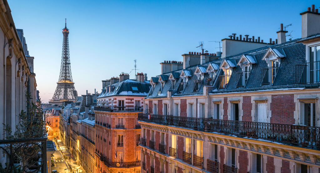
Positioned between Montmartre, Goutte d'Or, and Porte de Clignancourt, the neighborhood occupies a broad northern pocket where Rue du Mont-Cenis, Rue Ordener and Boulevard Ornano descend from the butte toward the former limits of Paris. Sloping streets, compact apartment blocks and surviving passages preserve sharp shifts in elevation across terrain once covered by vineyards, cherry orchards and cultivated fields. Rue du Mont-Cenis establishes the primary encounter through an inherited north-south route connecting the crest of Montmartre with the lower ground of the former Clignancourt hamlet. Rue du Poteau introduces a second scale through long commercial frontage running toward Jules Joffrin, where converging streets open suddenly around the church and mairie. Boulevard Ornano extends that transition north through a straighter nineteenth-century corridor created as construction replaced the agricultural territory beyond old Montmartre. The result is a neighborhood where village topography, metropolitan density and the physical expansion of Paris remain unusually legible across adjoining streets, preparing a history rooted in a rural hamlet absorbed first by Montmartre and then by the capital.
What defines Clignancourt.
Clignancourt is best known for developing from a hamlet between Montmartre and Saint-Ouen whose agricultural territory belonged to the Abbey of Saint-Denis until the fourteenth century before passing through several bourgeois families. Vineyards and cherry orchards occupied the slopes, giving the settlement an economy tied to cultivated ground beyond the northern edge of Paris. Jacques Liger, treasurer general to Cardinal de Bourbon, purchased the fief in 1569 and secured permission in 1579 to construct a chapel dedicated to the Holy Trinity, ending the inhabitants' complete dependence on Saint-Pierre de Montmartre for worship. The Abbey of Montmartre acquired the seigneury in 1669, bringing Clignancourt under another powerful religious landholder until the Revolution dissolved that arrangement. A new administrative order incorporated the hamlet into the commune of Montmartre, yet the surrounding landscape retained substantial agricultural ground into the nineteenth century. Population expansion then accelerated across the northern slopes as Parisian growth pushed housing and small industry outward. Annexation in 1860 absorbed Montmartre and Clignancourt into Paris and created the 18th Arrondissement, turning the former hamlet into one of its official quarters. Between 1860 and 1900, fields and orchards receded rapidly beneath residential construction and new streets, completing Clignancourt's conversion from seigneurial countryside into a dense northern district.
Religious and civic construction supplied a separate mechanism for giving the newly urbanized quarter a metropolitan center. Population growth had made the old arrangements inadequate by the 1850s, and the Paris municipal council approved construction of a new church on August 5, 1858, on ground that remained sparsely built. Paul-Eugène Lequeux designed Notre-Dame de Clignancourt, whose foundation work began on May 11, 1859 and whose inauguration followed on October 29, 1863. Expansion continued so quickly that the Arrondissement soon outgrew the former Montmartre mairie at Place des Abbesses, designed by Lequeux in 1836. Prefect Eugène Poubelle acquired a new municipal site in 1885 within the block bounded by Rue du Duc, Rue Hermel, Rue du Mont-Cenis and Rue Ordener. The resulting concentration of civic and religious architecture around present-day Place Jules Joffrin shifted institutional gravity north from old Montmartre as Clignancourt's population increased. Streets filled the surrounding agricultural parcels across the same decades, fixing the dense block structure that distinguishes the lower northern slope from the older village fabric above.
How Clignancourt fits.
Clignancourt works as the anchor for a daytime exploration connecting a nineteenth-century artists' compound, a church born from the explosive growth of neighboring La Chapelle and a garden whose ground preserves the memory of the vineyards that once spread across northern Paris.
Begin at Villa des Arts, where entrepreneurs Desmichel and Guéret worked with architect Henri Cambon 1889 and 1890 to develop one of Paris's largest surviving groups of artists' studios across former quarry ground at the foot of Montmartre. Cambon organized the ensemble around a central court with close to sixty studios oriented northeast, using metal elements and a complex double-flight staircase associated with the Exposition Universelle of 1889; Eugène Carrière, Paul Signac, Raoul Dufy and Louis Marcoussis later worked there, and Paul Cézanne completed his portrait of dealer Ambroise Vollard after 105 sittings in Carrière's studio. Continue to Église Saint-Bernard de la Chapelle, commissioned after population growth beginning in the 1830s overwhelmed the older Saint-Denys parish and prompted the former commune of La Chapelle to seek a larger church. Auguste Magne's project replaced an earlier proposal by Paul-Eugène Lequeux, construction began in 1858, and the first stone was laid on August 18 by Baron Lepic; annexation transferred the unfinished building to the City of Paris in 1860 before its consecration on October 29, 1861, binding the church directly to the territorial reorganization that created modern northern Paris. Conclude at Square Léon, where the surviving place-name reaches into the agricultural history of the Goutte d'Or slopes and their celebrated vineyards. Wine from these hills acquired a reputation during the reign of Saint Louis and entered competitions assigning ceremonial titles to favored vintages, with the City of Paris presenting quantities of the local wine to the king on his birthday; Passage Léon appeared by the mid-nineteenth century, and demolition during the 1970s later opened part of the built ground for a small adventure playground before the site developed into the present garden. The progression moves from Cambon adapting former quarry terrain for artists through Magne answering nineteenth-century population growth with a new parish church into a garden carrying traces of the cultivated slopes that preceded metropolitan expansion, revealing how art, urbanization and agriculture shaped the territory around Clignancourt.
Where your story begins.
Foresyte Travel reveals places that feel extraordinary long before you arrive.
Enjoy editorial crafted for luxury travelers.
Foresyte may earn a commission when you book.














































































































