Why Desplaines Street matters.
Desplaines Street is a storied corridor where the West Loop's industrial heritage, transportation innovation, architectural reinvention, and Chicago's commercial history intersect along one of the city's defining urban thoroughfares.
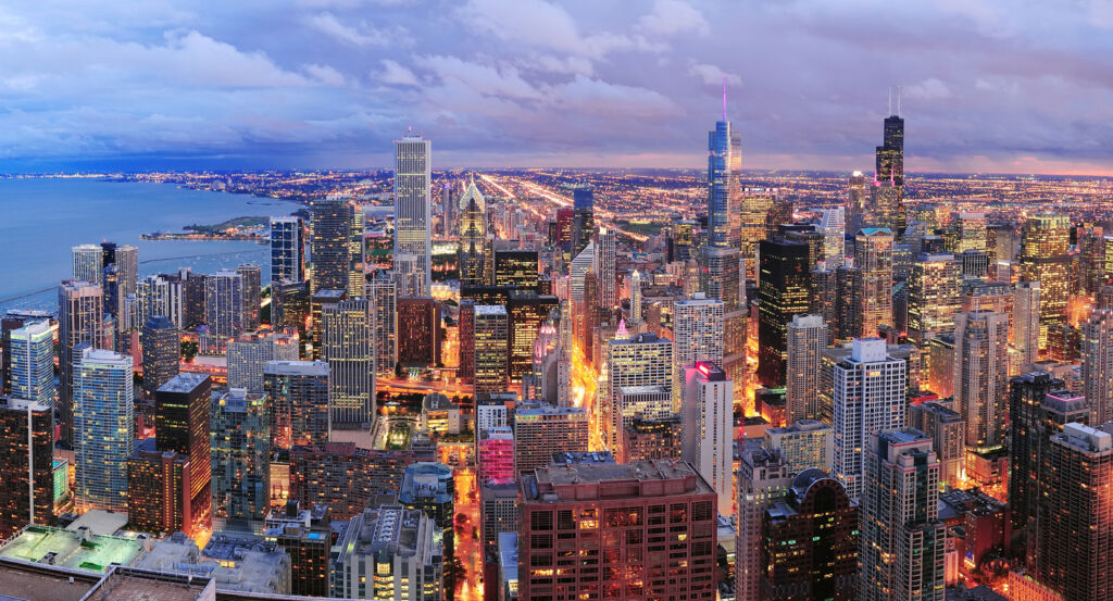
Running through the West Loop between the Chicago River and the Near West Side, Desplaines Street connects historic freight corridors, warehouse districts, civic institutions, adaptive reuse developments, residential towers, and neighborhood destinations that collectively reflect more than 180 years of metropolitan evolution. The corridor reveals how river commerce, rail transportation, wholesale trade, and contemporary redevelopment transformed one of Chicago's earliest industrial districts into a nationally recognized center of commerce, hospitality, and urban living. Preserved brick warehouses, loft buildings, modern high-rises, and restored industrial architecture continue defining the streetscape while reinforcing its enduring historical character. The result is a corridor distinguished by commercial resilience, architectural continuity, and one of Downtown's most successful urban transformations.
What defines Desplaines Street.
Desplaines Street is best known for following one of Chicago's earliest north-south alignments near the South Branch of the Chicago River, where construction of the Illinois and Michigan Canal in 1848, expansion of the Galena and Chicago Union Railroad, and rapid growth of regional freight infrastructure established the surrounding district as one of the Midwest's foremost transportation and wholesale centers. Reconstruction following the Great Chicago Fire of 1871 accelerated development of substantial brick warehouses, produce markets, cold-storage facilities, manufacturing plants, freight houses, and commercial loft buildings that served merchants throughout the expanding city. Completion of Union Station in 1925, growth of the nearby Fulton Market District, operation of the historic Randolph Street Market, and continued investment by the Chicago & North Western Railway and other railroads reinforced Desplaines Street's role within one of the nation's largest rail-served commercial districts. During the late twentieth and early twenty-first centuries, adaptive reuse preserved many industrial buildings while redevelopment introduced technology firms, hospitality venues, residential towers, restaurants, and office campuses that reshaped the West Loop. Continued planning by the Chicago Department of Planning and Development, infrastructure investment by the Chicago Department of Transportation, and designation of the Fulton-Randolph Market Historic District have sustained Desplaines Street as one of Chicago's most historically significant redevelopment corridors.
Formation of the West Loop Community Organization strengthened neighborhood stewardship through preservation advocacy, transportation improvements, economic development, housing initiatives, and community partnerships supporting the corridor's long-term revitalization. Architects including Burnham and Root, Holabird & Roche, Graham, Anderson, Probst & White, and Skidmore, Owings & Merrill contributed warehouses, railroad facilities, office buildings, and modern commercial architecture that collectively shaped the surrounding district across successive generations. National Register recognition of nearby historic resources, continued investment around Union Station, expansion of corporate headquarters, preservation of industrial masonry architecture, and implementation of long-range planning initiatives collectively demonstrate how freight transportation, wholesale commerce, architecture, historic preservation, and coordinated redevelopment transformed Desplaines Street from an industrial artery into one of Chicago's premier mixed-use corridors. Together, the Illinois and Michigan Canal, the Galena and Chicago Union Railroad, Union Station, the Fulton-Randolph Market Historic District, Burnham and Root, Holabird & Roche, Graham, Anderson, Probst & White, Skidmore, Owings & Merrill, the West Loop Community Organization, the Chicago Department of Planning and Development, and more than a century of transportation and commercial investment establish Desplaines Street among Chicago's most historically significant urban corridors.
How Desplaines Street fits.
Desplaines Street works as an exploration of the West Loop's industrial heritage, architectural evolution, and commercial renaissance.
Begin at Union Station, where expansive Beaux-Arts architecture and one of America's busiest passenger rail terminals introduce the transportation legacy that shaped Desplaines Street before naturally expanding into the surrounding district. Continue to Fulton Market District, where preserved warehouses, celebrated dining destinations, and adaptive redevelopment demonstrate the corridor's remarkable industrial transformation before guiding the experience toward its conclusion. Conclude at Chicago French Market, where local food vendors inside a historic transportation setting provide the historical and cultural payoff, demonstrating how commerce, mobility, and neighborhood reinvention continue defining Desplaines Street. The progression moves naturally from railroad history to industrial revitalization before concluding with one of the West Loop's enduring commercial gathering places.
Where your story begins.
Foresyte Travel reveals places that feel extraordinary long before you arrive.
Enjoy editorial crafted for luxury travelers.
Foresyte may earn a commission when you book.