Why Diamond Head matters.
Diamond Head State Monument is a commanding volcanic crater where Waikiki's coastal geography meets the geological forces that shaped southeastern Oʻahu, the military defenses of twentieth-century Honolulu and the Hawaiian cultural heritage preserved in the summit known as Lēʻahi.
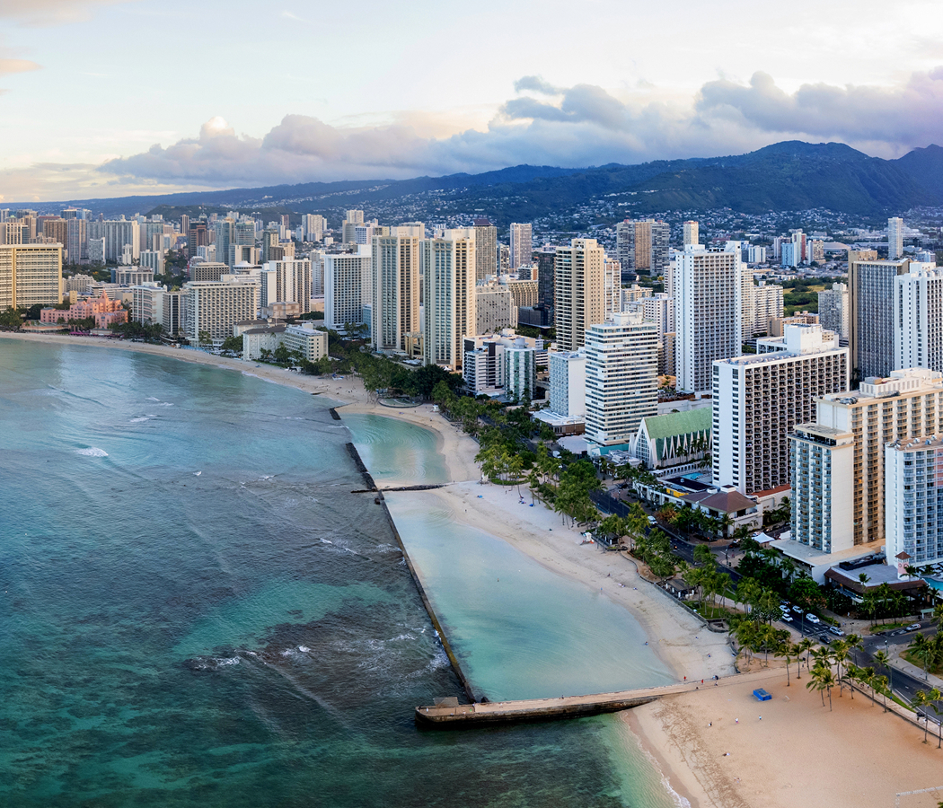
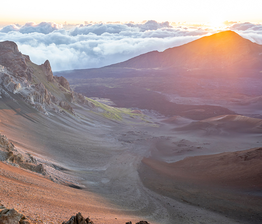
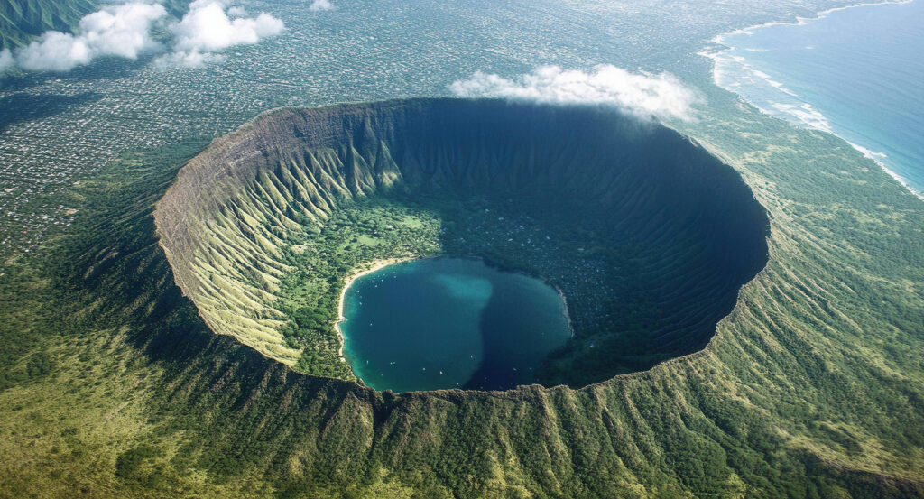
Rising above the eastern end of Waikiki between Kapiʻolani Park and the residential coastline of Kahala, the protected crater occupies a prominent headland overlooking Oʻahu's southern shore, with its inland slopes enclosing a broad volcanic basin and its seaward rim descending toward the Pacific. Steep tuff walls surround the crater floor, their exposed layers recording successive deposits of volcanic ash and fragmented rock. A winding summit trail crosses dry vegetation, rocky slopes and engineered passages before reaching observation platforms above the coast. Military structures remain embedded within portions of the elevated rim, connecting the natural formation with Honolulu's former coastal defense system. The result is a volcanic landscape whose geological structure, strategic elevation and preserved military installations reveal the forces that shaped Oʻahu's southern coastline.
What defines Diamond Head.
Diamond Head State Monument is best known for its distinctive volcanic crater, formed during a relatively recent phase of volcanic activity on Oʻahu and subsequently adapted for military observation and coastal defense. The formation belongs to the Honolulu Volcanics, a group of volcanic features produced after the principal shield-building stages that created the island's Koʻolau and Waiʻanae mountain ranges. Its eruption occurred during the late Pleistocene, when rising magma interacted with groundwater and seawater beneath the southeastern coastal plain. Explosive activity fragmented surrounding rock and magma, producing clouds of volcanic ash and debris that accumulated around the eruptive vent. Successive deposits formed a broad tuff cone whose steep outer slopes and enclosed central basin established the crater's recognizable profile. Geological erosion subsequently modified the formation, exposing layered volcanic deposits and shaping the surrounding coastal headland. Native Hawaiian communities recognized the summit as Lēʻahi, a name traditionally associated with the shape of a tuna's forehead. The elevated ridge served as an important geographical reference along Oʻahu's southern shoreline, where maritime navigation depended upon recognizable coastal features. British sailors and other European visitors later associated the formation with the name Diamond Head after mistaking sparkling calcite crystals for diamonds. Honolulu's expansion during the nineteenth century increased the strategic importance of the surrounding coastline as the Hawaiian Kingdom developed commercial and diplomatic relationships across the Pacific. American annexation in 1898 introduced a new military environment, with the United States establishing extensive defensive infrastructure around the island's principal harbor and coastal approaches. The federal government acquired the crater for military purposes in 1904, incorporating it into the developing coastal defense system of Oʻahu. Construction of Fort Ruger began during the following years, establishing artillery positions, observation facilities and military support structures across the surrounding terrain. The summit's commanding elevation made it particularly suitable for directing coastal artillery fire and monitoring maritime approaches. Military engineers constructed tunnels, stairways and observation stations within the crater rim, creating an integrated system of elevated defensive positions. The installation subsequently served military functions during the twentieth century as Honolulu became increasingly important to American operations in the Pacific. Diamond Head was designated a National Natural Landmark in 1968, recognizing the geological significance of the volcanic formation. Hawaiʻi established Diamond Head State Monument in 1962, protecting the crater and surrounding landscape as a public recreational and historical resource. The site's contemporary management preserves its geological features, military structures and historical associations with Hawaiian coastal geography.
Fort Ruger's surviving defensive infrastructure provides a substantial record of early twentieth-century military engineering within the volcanic crater. The installation developed as part of the Coast Artillery Corps' system of fortifications protecting Oʻahu's southern maritime approaches. Engineers adapted the crater's steep slopes and elevated rim to accommodate observation positions capable of directing artillery fire across extensive stretches of ocean. The summit trail originated through military construction completed in 1908, providing access between the crater floor and elevated defensive installations. Its route extends 0.8 miles from the trailhead to the summit, incorporating steep switchbacks, stairways and enclosed passages. The ascent crosses exposed volcanic terrain where layered tuff deposits reveal the fragmented materials produced during the crater's explosive formation. A substantial tunnel passes through the upper rim, preserving the engineering required to connect separated sections of the military route. Two major staircases, including a steep flight of ninety-nine steps, provide access toward the former observation structures. The Fire Control Station occupied a commanding position near the summit, allowing military personnel to calculate targeting information for coastal artillery batteries. Its reinforced concrete construction incorporated protected observation openings and communications facilities suited to military operations. The surrounding observation platforms provide extensive views across Honolulu, the Pacific Ocean and the southeastern coastline. The crater's interior contains dry coastal vegetation adapted to limited rainfall and exposed volcanic soils. Its enclosed basin contrasts with the densely developed neighborhoods surrounding the formation, preserving a substantial open landscape within metropolitan Honolulu. The summit's elevation reaches 762 feet above sea level, creating an unobstructed vantage point across the southern shore. The surviving military passages and observation structures demonstrate the practical adaptation of volcanic topography to twentieth-century coastal defense requirements. Their integration within the protected geological formation preserves an unusual combination of natural history and military engineering.
How Diamond Head fits.
Diamond Head State Monument works as the geological anchor for a Honolulu outing connecting Hawaiian royal recreation, the development of modern surfing and the historical institutions that preserve the political heritage of the Hawaiian Kingdom.
Begin at Kapiʻolani Park, the extensive public landscape situated at the eastern end of Waikiki. Dedicated in 1877 during the reign of King Kalākaua, the park was named in honor of Queen Kapiʻolani and developed as an important recreational ground for Honolulu's growing population. Its early history included horse racing and public gatherings, connecting the landscape with the social institutions of the Hawaiian Kingdom. Broad lawns, mature trees and walking paths now occupy the former recreational grounds, preserving substantial open space near the city's developed shoreline. The park's royal associations establish a historical connection between public recreation and the political institutions of nineteenth-century Hawaiʻi. Continue to Duke Kahanamoku Statue, the bronze memorial situated along the Waikiki beachfront. The sculpture commemorates the Hawaiian swimmer and surfer whose achievements introduced traditional Hawaiian wave riding to international audiences. Kahanamoku won Olympic swimming gold medals in 1912 and 1920, establishing an international reputation that extended beyond competitive athletics. His surfing demonstrations in Australia and California contributed to the worldwide development of the sport. The statue depicts him with outstretched arms, surrounded by surfboards and traditional Hawaiian floral offerings. Its location near the shoreline connects his athletic achievements with the ocean environment that shaped Hawaiian surfing traditions. Conclude at ʻIolani Palace, the former royal residence situated in Downtown Honolulu. Completed in 1882 during the reign of King Kalākaua, the palace incorporated advanced nineteenth-century building technologies and elaborate ceremonial interiors. Its architecture combines Renaissance Revival influences with design elements developed for the Hawaiian monarchy. The palace served as the official residence of Kalākaua and Queen Liliʻuokalani, whose reign ended following the overthrow of the monarchy in 1893. Restored state rooms, royal furnishings and historical collections preserve the political and cultural institutions of the Hawaiian Kingdom. The progression moves from Kapiʻolani Park's royal recreational heritage through Duke Kahanamoku Statue's surfing history and culminates at ʻIolani Palace's monarchical institutions, connecting Diamond Head State Monument with the cultural and political development of Honolulu.
Where your story begins.
Foresyte Travel reveals places that feel extraordinary long before you arrive.
Enjoy editorial crafted for luxury travelers.
Foresyte may earn a commission when you book.