
Why Picpus matters.
Picpus is a quietly absorbing enclave where eastern Paris meets the old road toward Vincennes through gardened institutions, residential avenues and inherited suburban routes shaped long before the capital absorbed the surrounding territory.
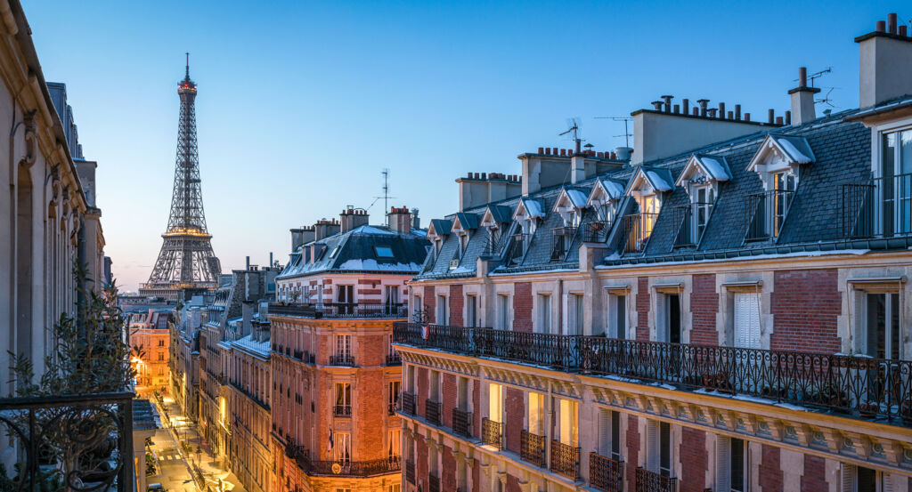
Positioned between Nation, Bel-Air, and Bercy, the neighborhood occupies a broad eastern pocket where Rue de Picpus, Avenue de Saint-Mandé and Boulevard de Picpus carry movement through terrain historically divided among religious enclosures, cultivated ground and settlements outside the old city. Long institutional walls, planted setbacks, private gardens and substantial residential blocks give the district an unusually open physical rhythm, with secluded interiors repeatedly appearing behind otherwise continuous street fronts. Rue de Picpus establishes the primary encounter through a route extending south from the old Vincennes axis, its changing width and succession of enclosed properties preserving the imprint of institutions that accumulated beyond Central Paris. Avenue de Saint-Mandé introduces a second spatial mechanism through its long east-west perspective, carrying the eye toward the former suburban territory incorporated into the capital during the nineteenth century. Smaller streets around Rue de la Gare-de-Reuilly and Rue Sibuet soften those larger axes through apartment buildings, planted courts and quieter residential passages whose scale marks another phase in the district's absorption into Paris. The result is a neighborhood where suburban geography, secluded enclosures and metropolitan expansion remain simultaneously legible, preparing a history that begins with Picpus centuries before the modern Arrondissement existed.
What defines Picpus.
Picpus is best known for emerging from an eastern settlement whose Picquepuce name predates its incorporation into Paris by centuries and whose position along the approaches to Saint-Mandé and Vincennes placed it beyond the dense medieval city. A tradition associated with 957 connects Picquepuce with a famine under King Lothair and the distribution of bread by monks from the Abbey of Saint-Antoine, an episode later associated with the distant origins of the fair that became the Foire du Trône. Religious establishments multiplied across the eastern territory during subsequent centuries as the faubourg expanded outward from Paris. The seventeenth century brought another institution when a community later occupied by the Chanoinesses de Saint-Augustin established itself inside an extensive walled property on Rue de Picpus. Fiscal geography altered the district again during the 1780s when Claude-Nicolas Ledoux designed barriers for the new Wall of the Farmers-General, including passages at Picpus, Saint-Mandé and the Trône along the eastern edge of Paris. The wall, constructed from 1784 to 1790, existed to collect taxes on goods entering the capital and placed Picpus directly across a new boundary between Paris and its outer settlements. Expansion finally absorbed that divide in 1860 when the capital extended to the Thiers fortifications, combining territory from Saint-Mandé and Bercy with the former eastern faubourg to create the modern 12th Arrondissement. Picpus consequently moved from an outlying settlement through religious colonization and fiscal enclosure into metropolitan Paris, with its inherited roads surviving the administrative absorption of the surrounding countryside.
Transportation and residential growth supplied a separate mechanism for remaking Picpus after annexation. The railway linking Paris with Vincennes opened in 1859 and crossed the southern part of the district on its route from the Bastille terminus toward the eastern suburbs, establishing a corridor that later supported denser construction across adjoining land. New streets and apartment blocks progressively occupied former gardens as Paris expanded toward its fortifications, yet the district retained a lower intensity than the commercial territory around Bastille. The opening of metropolitan rail service added another layer during the early twentieth century, connecting Picpus more directly with the center as stations appeared along the expanding network. Large educational and medical properties subsequently reinforced a pattern already established by earlier religious enclosures, preserving broad interior grounds amid increasingly continuous residential blocks. Twentieth-century housing filled remaining parcels around these institutions and the older suburban roads, creating the mixture of long avenues, enclosed compounds and secondary residential streets that distinguishes Picpus from the denser western reaches of the Arrondissement. The old Vincennes railway eventually ceased passenger operations, but its corridor survived as another physical trace of the infrastructure that had accelerated Picpus's transition from peripheral territory into a fully integrated part of eastern Paris.
How Picpus fits.
Picpus works as the anchor for a daytime exploration connecting Revolutionary commemoration, an interwar church conceived through modern concrete construction and an Art Deco palace built for the 1931 International Colonial Exposition.
Begin at Cimetière de Picpus, where the garden of the former Chanoinesses de Saint-Augustin convent became the burial ground for more than 1,300 people executed at Place du Trône-Renversé between June 14 and July 27, 1794. Two mass graves occupied the walled enclosure after the guillotine moved east during the Terror; families of victims subsequently organized to acquire the ground, Madame de Montagu and the Marquise de La Fayette helped launch a subscription for the wider property in 1802, religious life returned in 1805 and an expiatory chapel followed in 1840. Gilbert du Motier, Marquis de La Fayette, was later buried beside his wife Adrienne within the private cemetery created around the Revolutionary graves. Continue to Église du Saint-Esprit, Paul Tournon's major interwar church, conceived in response to population growth in eastern Paris after the First World War and completed in 1935. Tournon drew on Byzantine architecture and Sainte-Sophie for a reinforced-concrete building organized beneath fifteen domes, then brought some seventy artists into its extensive decorative program, including Maurice Denis, George Desvallières, Odette Pauvert and Raymond Subes; financial pressure following the 1929 crash prevented the domes from receiving Tournon's intended copper covering until a restoration completed that element in 2022. Conclude at Palais de la Porte Dorée, where Albert Laprade developed the permanent Musée des Colonies for the International Colonial Exposition after joining Léon Jaussely on the project in 1927. The first stone was laid in 1928 and construction finished for the exposition's May 1931 opening, producing a reinforced-concrete Art Deco building whose decorative program incorporated Alfred Janniot's immense facade relief, Edgar Brandt's ironwork and Eugène Printz's furnishings; the palace has since passed through successive museum functions and now houses the Musée national de l'histoire de l'immigration alongside the tropical aquarium. The progression moves from families converting the burial ground of the Terror into private commemoration through Tournon coordinating architecture and modern religious art in reinforced concrete into Laprade assembling architecture, sculpture and decorative arts for a state exhibition palace, tracing three radically different forms of institutional creation across eastern Paris.
Where your story begins.
Foresyte Travel reveals places that feel extraordinary long before you arrive.
Experience premium editorial crafted for luxury travelers.
Foresyte Travel may earn a commission when you book through the link on this page.














































































































