
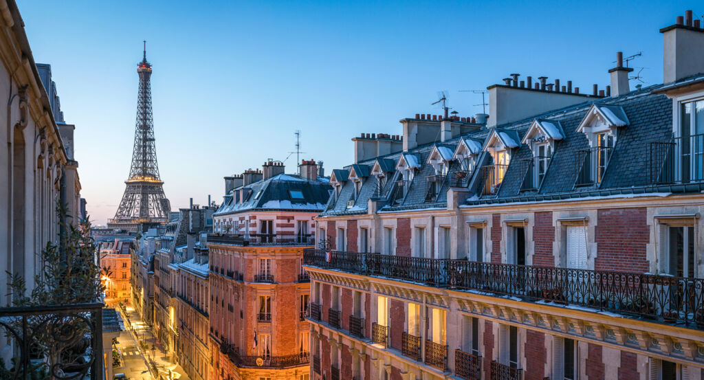
Why Porte des Lilas matters.
Porte des Lilas is a distinctive enclave where Paris meets its northeastern edge through sloping streets, interwar housing and an unusually porous boundary with Les Lilas and Le Pré-Saint-Gervais.
Positioned between Saint-Fargeau, Télégraphe, and Le Pré-Saint-Gervais, the neighborhood occupies elevated ground where Boulevard Sérurier, Avenue de la Porte-des-Lilas and Rue de Belleville converge before the city gives way to the neighboring communes of eastern Seine-Saint-Denis. Broad avenues and large residential ensembles create an open physical scale around the former gateway, then contract into quieter streets as the terrain descends toward Belleville or crosses the municipal boundary toward Les Lilas. Avenue de la Porte-des-Lilas establishes the primary encounter through a long eastern axis whose buildings frame views across terrain repeatedly reorganized as Paris expanded beyond its nineteenth-century defensive perimeter. Streets south toward Saint-Fargeau deepen the character through interwar blocks and an unusual concentration of road names honoring early aviation, connecting the neighborhood's twentieth-century construction with Blériot, Farman, Nungesser, Maryse Hilsz and other pioneers of flight. The northeastern edge adds another spatial mechanism through routes that continue directly into Les Lilas and Le Pré-Saint-Gervais, making the administrative limit feel permeable across an elevated urban landscape. The result is a neighborhood whose character emerged through the repeated conversion of peripheral ground into metropolitan territory, preparing a history shaped first by fortification and then by the disappearance of the defensive belt.
What defines Porte des Lilas.
Porte des Lilas is best known for occupying one of the former gateways through the fortified perimeter that enclosed nineteenth-century Paris and established a sharp physical boundary between the capital and its northeastern suburbs. Construction of the Thiers enclosure began in 1841 under a defensive program authorized during the reign of Louis-Philippe, producing a continuous military belt around Paris with bastions, gates and an exterior zone kept clear for defensive purposes. Porte des Lilas opened through that system beside Belleville and the commune of Les Lilas, whose creation in 1867 joined territory detached from Bagnolet, Pantin and Romainville on the opposite side of the capital's military boundary. The fortifications lost their strategic value as artillery developed, and their demolition after the First World War released a vast belt of land around Paris. Housing, public facilities and new streets subsequently occupied sections of the former military terrain during the 1920s and 1930s. Streets between Porte des Lilas and Boulevard Mortier acquired names honoring aviation pioneers as that territory was rebuilt, creating an intentional geographical memorial to the formative decades of powered flight. Construction of Boulevard Périphérique introduced another physical boundary across the former defensive belt during the postwar decades, restoring a powerful division between Paris and neighboring communes on ground where the fortifications had disappeared. The neighborhood developed through successive attempts to define, dismantle and rebuild the capital's northeastern edge.
Underground transportation supplied a separate mechanism for turning Porte des Lilas from a peripheral gateway into a point of connection between Central Paris and the eastern heights. Line 3 reached Porte des Lilas from Gambetta on November 27, 1921 through a 1.5-kilometer extension incorporating Pelleport and Saint-Fargeau. The new stations descended between 19 and 25 meters below street level, prompting direct elevator access and distinctive surface buildings designed by Charles Plumet in 1922 with ceramics, mosaics and decorative friezes. A shuttle simultaneously connected Porte des Lilas with Pré-Saint-Gervais until 1939, using infrastructure conceived for a more extensive connection between the two systems. Line 11 introduced another route on April 28, 1935 when service began between Châtelet and Porte des Lilas, then crossed the municipal boundary to Mairie des Lilas in 1937. The line became the first Paris route converted to rubber-tired operation in 1956, using its steep gradients and tight curves to test technology subsequently deployed elsewhere in the network. Reorganization of Line 3 in 1971 detached the Gambetta to Porte des Lilas section as Line 3bis, a four-station route extending 1.3 kilometers. One disused part of the older connection acquired an entirely different role as Porte des Lilas Cinéma, a closed station used for film production, giving infrastructure created for an unrealized transport connection a second career within French screen culture.
How Porte des Lilas fits.
Porte des Lilas works as the anchor for an exploration connecting Pierre Riboulet's late twentieth-century pediatric architecture, an itinerant circus collective given a permanent Parisian base and a contemporary garden constructed directly over infrastructure that once divided the capital from its northeastern neighbors.
Begin at Hôpital Robert-Debré, conceived by architect Pierre Riboulet and inaugurated in 1988 as a university hospital named for physician Robert Debré, a central figure in the development of modern French pediatrics. Riboulet rejected the detached pavilion model long associated with hospital construction and organized the institution as a unified architectural body, bringing pediatric medicine, teaching and research into a building conceived for children and families on the northeastern edge of Paris; its medical role subsequently developed around fields including perinatal care, neonatology and neurodevelopment. Continue to Cirque Électrique, founded in 1995 through Hervé Vallée's collaboration with Michel Nowak at the Arènes de Nanterre before moving through temporary sites in Paris, Rennes and Brussels. The collective developed circus-concerts and experimental productions across those residencies, reached the Festival d'Avignon in 2009 and accepted a City of Paris invitation to establish its tent, dance floor and caravans at Porte des Lilas in April 2010; the Association La Dalle aux Chaps followed in 2011, giving the traveling company a lasting base for circus, music and performance. Conclude at Jardin Serge Gainsbourg, a 1.4-hectare garden built directly above Boulevard Périphérique as part of the extensive reconstruction of Porte des Lilas. Coverage of the ring road was completed in 2007, reclaiming ground within a 25-hectare sector extending from the Boulevards des Maréchaux toward Les Lilas, Le Pré-Saint-Gervais and Bagnolet; the garden occupies that engineered surface with regional planting, turning infrastructure once experienced principally as a metropolitan barrier into continuous public ground. The progression moves from Riboulet concentrating pediatric medicine within a new architectural model through Vallée carrying an itinerant circus into a permanent eastern Paris base into reclaimed ground above the ring road becoming planted public space, tracing three distinct ways Porte des Lilas converted peripheral territory into institutions embedded within the city.
Where your story begins.
Foresyte Travel reveals places that feel extraordinary long before you arrive.
Enjoy editorial crafted for luxury travelers.
Foresyte may earn a commission when you book.














































































































