
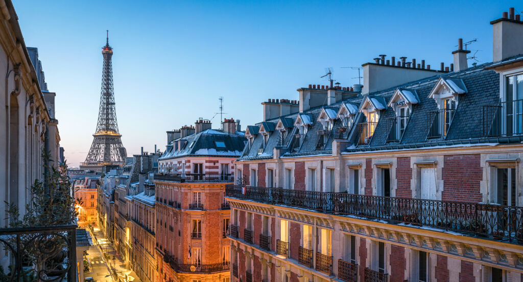
Why Saint-Fargeau matters.
Saint-Fargeau is a secluded enclave where the heights of eastern Paris meet a district of hillside streets, low-rise residential pockets and broad twentieth-century avenues shaped across former estates, quarries and the outer edge of the capital.
Positioned between Belleville, Ménilmontant, and Porte des Lilas, the neighborhood occupies elevated northeastern ground where Rue Pelleport, Rue Saint-Fargeau and Rue Haxo climb and cross a terrain whose slopes still distinguish it from the denser basin of Central Paris. Long residential streets rise toward the heights through an unusual mixture of apartment blocks, detached houses, planted setbacks and abrupt stairways, preserving the topographic character of land that remained beyond the capital for much of its history. Rue Saint-Fargeau establishes the primary encounter through a broad east-west line carrying the name of the aristocratic estate that once dominated this part of Belleville, with quieter side streets repeatedly opening into smaller domestic enclaves. Rue Pelleport supplies a second spatial mechanism as its extended ascent reveals the neighborhood's changing elevations and the larger scale introduced by twentieth-century housing along territory formerly occupied by gardens, quarry ground and peripheral development. The result is a neighborhood whose physical character emerges through the layering of country estates, difficult hillside terrain and later metropolitan expansion, preparing a history rooted in the immense property from which Saint-Fargeau inherited its name.
What defines Saint-Fargeau.
Saint-Fargeau is best known for taking its name from the château de Ménilmontant, also called the château de Saint-Fargeau, whose estate once occupied a vast section of the heights above eastern Paris. An earlier château stood here in the sixteenth century before Michel Le Peletier de Souzy, a minister under Louis XIV, rebuilt the residence during the seventeenth century for his family. The Saint-Fargeau name came from the Le Peletier family's seigneury in the Yonne, transferring the designation of a Burgundian possession onto their property outside Paris. The residence stood near the present intersection of Rue Pelleport and Rue Saint-Fargeau, commanding an estate that eventually covered more than one tenth of the territory forming the modern 20th Arrondissement. Michel Le Peletier's family belonged to the administrative elite of the monarchy, and the scale of the property placed an aristocratic domain across terrain still separated from the dense capital below. The château passed through later generations of the family as its gardens and dependencies occupied the surrounding heights. Fragmentation eventually dismantled the estate, yet its name survived in the street and then in the quartier administratif created after the former communes of Belleville and Charonne entered Paris under the territorial expansion enacted in 1859. Saint-Fargeau carries an aristocratic place-name into a district whose later physical development bears little resemblance to the enormous private domain that first established it.
Water engineering created a separate chapter across these eastern heights as Paris sought new ways to supply a rapidly expanding population during the nineteenth century. Engineer Eugène Belgrand reorganized the capital's water system under Napoleon III and Baron Haussmann, separating drinking-water distribution from other urban supply and constructing reservoirs capable of serving districts at different elevations. The Réservoir de Ménilmontant opened in 1865 as the first reservoir built inside Paris itself, placing major hydraulic infrastructure near Saint-Fargeau on terrain whose altitude made it strategically valuable for gravity-fed distribution. The hills already possessed a far older relationship with water: springs across Belleville had been captured from the Middle Ages through underground galleries feeding religious institutions and fountains farther west. Street names including Rigoles, Cascades and Mare still preserve that hydrographic history across the broader heights. Twentieth-century demand brought another major installation with the Réservoir des Lilas in 1963, creating one of the five principal reservoirs in the Paris system beside Ménilmontant and reinforcing the elevated northeast as a crucial component of the capital's water supply.
How Saint-Fargeau fits.
Saint-Fargeau works as the anchor for a daytime exploration connecting an early cooperative experiment in affordable homeownership, a church born from the memory of the Paris Commune and the sole surviving pavilion of an eighteenth-century aristocratic château.
Begin at La Campagne à Paris, where Jean-Louis Orange founded a cooperative housing society in 1907 to acquire former gypsum-quarry ground and create modest homes for workers and public employees under the possibilities opened by the Jules Siegfried housing law. Construction unfolded between 1911 and 1928 across streets including Rue Jules Siegfried and Rue Irénée Blanc, ultimately producing more than 90 one and two-story houses on elevated terrain reached by steep stairways; the project translated early social-housing reform into individual dwellings grouped within a distinctive hilltop residential enclave. Continue to Notre-Dame-des-Otages, whose origins lie in the execution of 49 hostages on Rue Haxo during the final days of the Paris Commune in May 1871. The Jesuits founded a commemorative work in 1872, successive chapels occupied the site, and Henri Diffiné launched a subscription for the present church designed by Julien Barbier; construction began in 1936 on unstable ground requiring 33 concrete wells linked by arches, Cardinal Jean Verdier inaugurated the Roman-Byzantine and Art Deco building in 1938, and the chapel became a parish under its present dedication in 1961. Conclude at Pavillon de l'Ermitage, the last surviving structure from the château de Bagnolet, acquired in 1719 by Françoise-Marie de Bourbon, duchesse d'Orléans and daughter of Louis XIV. Built between 1723 and 1727 at the western end of the château grounds, the Régence pavilion received grisaille paintings of meditating hermits by Jean Valade; after the main château disappeared in 1769, Baron de Bratz acquired the pavilion and used it from 1792 for royalist meetings connected with attempts to rescue Louis XVI, followed by plans targeting Marie-Antoinette's imprisonment in the Temple. The progression moves from cooperative housing reform translating social policy into a hilltop community through a religious memorial created from the political trauma of 1871 into an aristocratic retreat drawn into royalist conspiracy during the Revolution, exposing three sharply different episodes preserved across the eastern heights of Paris.
Where your story begins.
Foresyte Travel reveals places that feel extraordinary long before you arrive.
Enjoy editorial crafted for luxury travelers.
Foresyte may earn a commission when you book.














































































































