Why Chichén Itzá matters.
Chichén Itzá is an ancient Maya city where Yucatán's limestone landscape meets the political ambitions of the northern Maya lowlands, the astronomical precision of expansive architecture and the ceremonial traditions that shaped one of Mesoamerica's most influential urban centers.
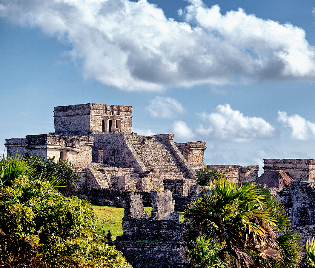
Set along the archaeological corridor near Pisté and just steps from the Gran Juego de Pelota, the ancient city occupies a broad expanse of tropical woodland in northern Yucatán, surrounded by limestone terrain, subterranean waterways and the agricultural communities of the peninsula's interior. Stepped pyramids, columned temples and expansive stone platforms rise from open ceremonial plazas, their geometric proportions and carved façades establishing a powerful architectural composition. The surviving buildings incorporate feathered serpents, warriors, jaguars and elaborate religious imagery, connecting expansive construction with the political and spiritual institutions of Maya society. Raised stone causeways extend between architectural groups, organizing movement through a settlement whose ceremonial buildings, residential compounds and sacred water sources occupied a substantial urban landscape. The result is an archaeological complex defined by exceptional architectural preservation, sophisticated astronomical knowledge and a historical legacy central to understanding the political and cultural development of the Maya world.
What defines Chichén Itzá.
Chichén Itzá is best known for El Castillo, the expansive stepped pyramid dedicated to Kukulcán, and for its exceptional concentration of Maya ceremonial architecture associated with the political transformation of northern Yucatán. The city's origins extend into the Late Classic period, when communities established substantial settlements around the natural sinkholes that provided access to freshwater beneath the peninsula's limestone surface. Its name derives from Maya words associated with the mouth of the well of the Itzá, connecting the settlement's historical character with the sacred cenotes that supported religious activity and urban development. The city expanded significantly during the Terminal Classic period, emerging as an influential political and commercial center as older Maya capitals in the southern lowlands experienced major institutional transformations. Its architectural development incorporated traditions associated with the Puuc region alongside sculptural and ceremonial forms connected with broader Mesoamerican exchange networks. The growth of Chichén Itzá coincided with changes in political organization, including the development of substantial public plazas, columned structures and expansive ceremonial platforms. El Castillo became the architectural centerpiece of the principal ceremonial precinct, rising through nine stepped terraces toward a temple positioned above the surrounding plaza. Four stairways ascend its sides, organizing the pyramid around a symmetrical arrangement associated with cosmological and calendrical interpretation. The northern staircase incorporates sculpted serpent heads at its base, connecting the structure with Kukulcán, the feathered serpent deity associated with religious and political authority. Seasonal patterns of sunlight and shadow produce a celebrated visual effect along the northern balustrade near the equinoxes, creating the appearance of a descending serpent. Archaeological investigations revealed an earlier pyramid incorporated within the later construction, demonstrating the successive rebuilding practices characteristic of major Maya ceremonial centers. The city reached a period of exceptional regional influence between the ninth and twelfth centuries, supporting extensive commercial relationships across the Yucatán Peninsula and beyond. Its political importance developed alongside the movement of goods, religious practices and artistic traditions connecting the Gulf Coast, Central Mexico and the Maya lowlands. The settlement's influence subsequently declined as political authority shifted toward other centers, including Mayapán, during the Postclassic period. Religious activity continued at important sacred locations after the decline of the city's principal political institutions. Spanish colonial accounts preserved references to the site's ceremonial significance, including rituals associated with the Sacred Cenote. Systematic archaeological investigation expanded during the nineteenth and twentieth centuries, bringing substantial attention to the city's architecture, inscriptions and material culture. Chichén Itzá entered the UNESCO World Heritage List in 1988, recognizing its outstanding significance within the architectural and cultural history of Mesoamerica. Its historical importance rests on the extraordinary concentration of expansive construction, political innovation and religious traditions developed during a decisive period in Maya civilization.
The Temple of the Warriors occupies a major position within the ceremonial complex, establishing one of the clearest architectural connections between Chichén Itzá and the wider artistic traditions of Mesoamerica. Its stepped platform supports a temple approached through a broad staircase, with sculpted figures and architectural elements associated with military authority and religious ceremony. A reclining Chac Mool figure occupies a prominent position near the upper sanctuary, representing a distinctive sculptural form associated with ritual offerings. The adjoining Group of the Thousand Columns contains extensive rows of stone supports that once carried substantial roofed structures. Their arrangement created large covered spaces associated with ceremonial gatherings, administrative functions and the movement of people through the urban center. Carved warriors and elaborate reliefs decorate important architectural surfaces, connecting the complex with representations of military organization and political power. The Great Ball Court provides another exceptional example of the city's ceremonial architecture, extending across a vast rectangular playing area enclosed by high masonry walls. Stone rings positioned above the playing surface formed part of the ritual ballgame, whose religious significance extended across numerous Mesoamerican societies. Relief panels depict players, ceremonial scenes and imagery associated with sacrifice, connecting athletic competition with political and religious institutions. The court's substantial dimensions establish its importance within the ceremonial organization of the city. Nearby structures include the Temple of the Jaguars, whose carved decorations and interior paintings contribute to the understanding of warfare, religious symbolism and elite representation. The Platform of the Skulls incorporates rows of carved skulls, reflecting ritual practices associated with sacrifice and the public display of religious authority. The Sacred Cenote occupies a natural limestone sinkhole north of the principal ceremonial precinct, reached through an ancient causeway. Archaeological exploration recovered objects including gold, jade, copper, pottery and human remains, demonstrating the importance of the water source within ceremonial offerings. The cenote's religious significance belonged to the broader Maya understanding of subterranean water as a connection with sacred realms. El Caracol, a circular building associated with astronomical observation, occupies another architectural group south of the principal plaza. Its distinctive rounded superstructure and carefully arranged openings have attracted sustained attention for their relationship with celestial observations, particularly the movements of Venus. The nearby Nunnery Complex incorporates elaborate Puuc-style façades with geometric decoration, masks and finely carved stonework. These architectural groups establish the breadth of Chichén Itzá's ceremonial and intellectual traditions, connecting military authority, religious performance, astronomical knowledge and elite architectural patronage within a substantial ancient city.
How Chichén Itzá fits.
Chichén Itzá works as the archaeological centerpiece for a northern Yucatán itinerary connecting the sacred freshwater systems of the Maya world, the colonial transformation of the peninsula and the enduring traditions of its regional communities.
Begin at Cenote Ik Kil, the dramatic limestone sinkhole located near the archaeological complex along the route toward Valladolid. The cenote occupies a deep circular depression surrounded by tropical vegetation, with long hanging roots descending toward the water below. Its exposed limestone walls reveal the geological processes responsible for the formation of the peninsula's extensive subterranean drainage network. A constructed stairway provides access to the water, establishing a direct encounter with the freshwater environment that supported ancient settlement across northern Yucatán. The site connects the archaeological landscape with the geological foundations of Maya agriculture, settlement and religious practice. Continue to Valladolid, the colonial city established by Francisco de Montejo the Younger in 1543 and subsequently relocated to its present site in 1545. Its historic center contains substantial ecclesiastical buildings, traditional residential architecture and public squares associated with Spanish colonial administration. The Cathedral of San Gervasio occupies a prominent position facing the principal plaza, contributing to the city's distinctive architectural character. Valladolid also preserves important connections with the Caste War of Yucatán, the nineteenth-century conflict that transformed political and social relations across the peninsula. The city's streets and historical institutions establish an important setting for understanding the colonial and postcolonial development of the region. Conclude at Ek Balam, the ancient Maya city north of Valladolid whose expansive architecture preserves exceptional examples of sculptural decoration and elite funerary construction. The settlement reached its greatest political importance during the Late Classic period, developing substantial ceremonial buildings and defensive structures. Its Acropolis contains elaborate stucco sculptures associated with the tomb of a prominent ruler, incorporating winged figures, elaborate architectural framing and finely modeled decorative elements. The surviving structures demonstrate the artistic sophistication and political organization of the northern Maya lowlands during a period preceding Chichén Itzá's greatest regional influence. The progression moves from the sacred geology of the Yucatán Peninsula through the colonial institutions of Valladolid and culminates in the architectural achievements of an earlier Maya political center.
Where your story begins.
Foresyte Travel reveals places that feel extraordinary long before you arrive.
Enjoy editorial crafted for luxury travelers.
Foresyte may earn a commission when you book.