Why The Arch of Cabo San Lucas matters.
The Arch of Cabo San Lucas is a sculptural granite formation where Land's End's dramatic coastal geography meets the Pacific Ocean, the Gulf of California and the geological forces that shaped the southernmost tip of Mexico's Baja California Peninsula.
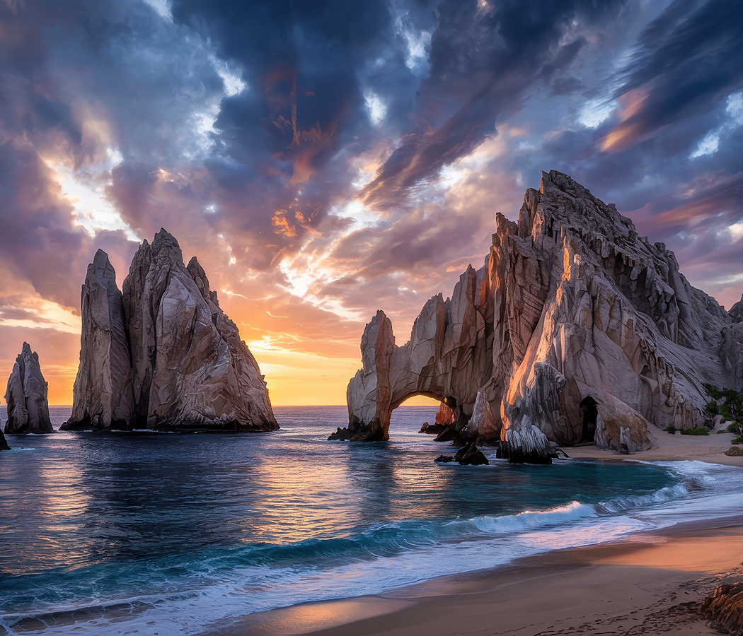
Rising from the sea at the southeastern edge of the Land's End headland, the natural arch occupies a narrow passage between towering granite outcrops, with the exposed Pacific coastline extending westward and the sheltered waters of Cabo San Lucas Bay opening toward the northeast. Its curved stone span connects two weathered rock masses above the waterline, creating a distinctive opening through which waves and changing light reveal the surrounding marine landscape. Steep cliffs, isolated sea stacks and fractured granite surfaces extend across the adjoining headland, their pale surfaces contrasting with the deep blue water below. Powerful Pacific swells and shifting coastal currents shape the narrow channels around the formation, creating changing conditions along the rocky shoreline. The result is a striking coastal formation whose sculptural geometry, exposed ocean setting and relationship with the surrounding headland establish one of Mexico's most recognizable natural attractions.
What defines The Arch of Cabo San Lucas.
The Arch of Cabo San Lucas is best known for its naturally eroded granite opening, its position at the southern tip of the Baja California Peninsula and its association with the dramatic meeting of the Pacific Ocean and the Gulf of California. The formation belongs to the rocky headland commonly known as Land's End, where ancient crystalline rocks rise directly from the sea along the peninsula's southern extremity. The granite originated through the cooling and crystallization of molten rock deep within Earth's crust during the geological development of the Baja California region. Subsequent tectonic movements uplifted and exposed these formations, establishing the rugged coastal terrain that characterizes the southern peninsula. The opening of the Gulf of California developed through tectonic separation between the Baja California Peninsula and mainland Mexico, beginning several million years ago as movement along the Pacific and North American plate boundary reshaped the region. Long-term erosion exploited natural fractures within the granite, gradually removing weaker sections of rock through wave action, weathering and the movement of sediment. The resulting arch developed as an isolated opening within a resistant coastal outcrop, preserving a distinctive example of marine erosion. The surrounding cliffs and sea stacks underwent related processes, producing the irregular rock formations that distinguish the headland. Indigenous Pericú communities occupied the southern Baja California region before European contact, maintaining maritime traditions associated with fishing, shellfish gathering and the use of coastal resources. Spanish navigators explored the peninsula during the sixteenth century, incorporating its southern cape into the developing maritime routes of the Pacific coast of New Spain. The waters surrounding Cabo San Lucas subsequently became associated with commercial shipping, privateering and the movement of vessels between the Pacific and the Gulf of California. During the nineteenth and early twentieth centuries, the settlement developed primarily through fishing and maritime commerce, with its exposed headland serving as an important geographic reference for coastal navigation. The expansion of sportfishing during the twentieth century attracted travelers interested in the region's abundant marine life, gradually establishing Cabo San Lucas as a recreational destination. The completion of the Transpeninsular Highway in 1973 improved overland access to southern Baja California, encouraging substantial growth in tourism and supporting the development of the Los Cabos resort corridor. International air connections and the expansion of waterfront facilities subsequently increased the prominence of the region's natural coastal attractions. The arch became a widely recognized symbol of Cabo San Lucas, appearing in travel photography and regional promotional imagery as the most distinctive geological feature of the southern peninsula.
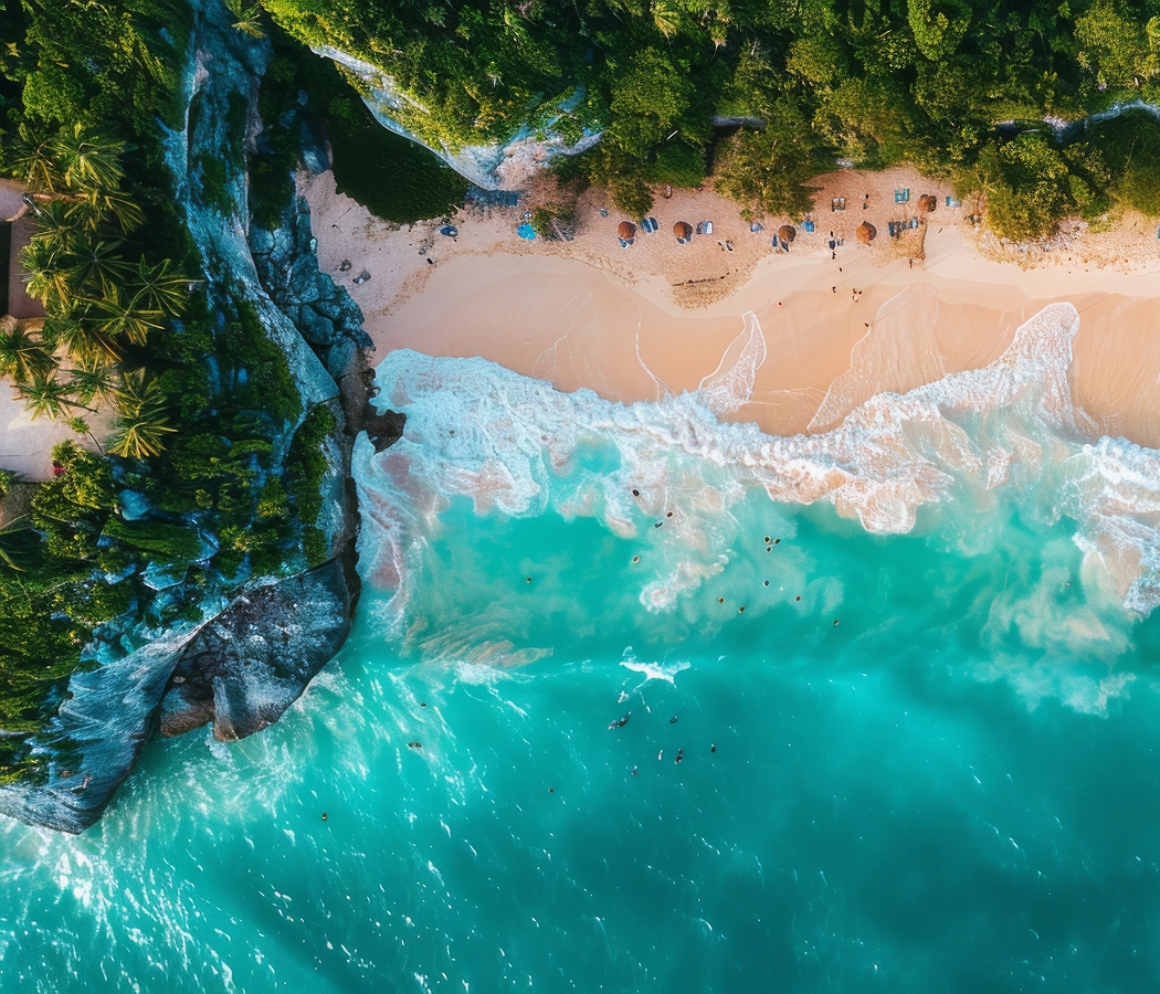
Playa del Amor, commonly known as Lover's Beach, occupies a sheltered stretch of sand within the Land's End rock formations, accessible primarily by water from Cabo San Lucas. The beach lies along the calmer side of the headland, where granite cliffs partially protect the shoreline from the stronger swells of the open Pacific. Its sandy surface changes with tides, currents and seasonal sediment movement, creating variations in the amount of exposed beach throughout the year. Narrow passages between the rocks connect the sheltered shoreline with adjoining coastal areas, allowing visitors to observe the headland's geology at close range. Playa del Divorcio, or Divorce Beach, occupies the Pacific-facing side of the same rocky peninsula and presents markedly different ocean conditions. Strong shorebreak, powerful currents and unpredictable waves make swimming hazardous along this exposed beach, establishing an important distinction between the headland's opposing coastlines. The surrounding marine environment supports diverse fish populations, seabirds and seasonal movements of larger marine animals. California sea lions gather on nearby rocky outcrops, using exposed surfaces for resting and social interaction between feeding excursions. Pelicans, cormorants and other coastal birds occupy the cliffs and surrounding waters, exploiting the productive marine environment created by local currents. Humpback whales migrate through the waters off southern Baja California during the winter breeding season, providing opportunities for observation from vessels operating around the cape. The region's underwater topography includes steep rocky slopes and submarine formations that support varied marine habitats. Boat excursions approach the arch through channels bordered by granite cliffs, revealing changing perspectives of the opening and the surrounding sea stacks. The formation's appearance varies substantially with the direction of sunlight, ocean conditions and the position of the observer, creating distinctive visual compositions throughout the day. Periodic changes in sediment accumulation also influence the appearance of the arch's base, with sandy surfaces occasionally becoming exposed beneath portions of the opening. The arch's continuing importance rests in its geological character, its relationship with the surrounding marine environment and its enduring prominence within the natural landscape of southern Baja California.
How The Arch of Cabo San Lucas fits.
The Arch of Cabo San Lucas works as the natural anchor for a Cabo San Lucas outing connecting the historic waterfront, the region's maritime traditions and the protected coastal environments that distinguish the southern Baja California Peninsula.
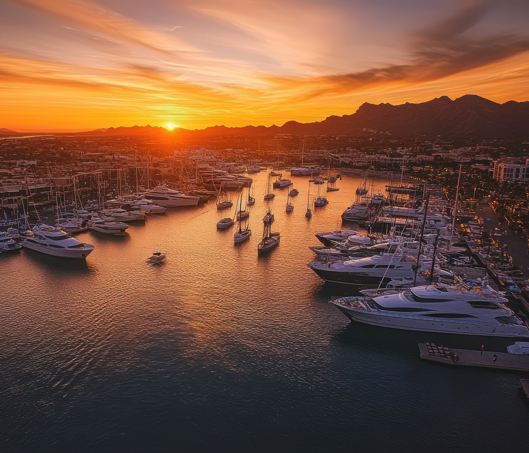
Begin at Cabo San Lucas Marina, the principal recreational harbor and waterfront district serving the city's sportfishing and marine tourism industries. The marina occupies a sheltered basin surrounded by restaurants, shops, hotels and pedestrian promenades, with numerous charter vessels operating excursions along the surrounding coastline. Its development accompanied the expansion of Los Cabos as an international resort destination, introducing substantial facilities for sportfishing tournaments, recreational boating and marine transportation. The harbor supports excursions targeting marlin, dorado and other species associated with the productive waters off southern Baja California. Its waterfront promenades provide views of the fishing fleet and the commercial activity that continues to shape the city's maritime economy. Continue to Playa El Médano, the principal recreational beach extending along the eastern side of Cabo San Lucas Bay. The beach's broad sandy shoreline and comparatively sheltered waters support swimming, paddleboarding, kayaking and other marine activities. Its beachfront includes restaurants, recreational operators and resort properties developed during the region's expansion as a major tourism center. The beach also provides expansive views toward the granite headland at the bay's entrance, establishing a direct visual connection between the developed waterfront and the surrounding natural landscape. Its long shoreline supports pedestrian access between the marina district and the eastern sections of the bay. Conclude at San José del Cabo Art District, the historic cultural quarter centered on the streets surrounding the main plaza of San José del Cabo. The district occupies a traditional urban setting distinguished by colonial-era street patterns, restored buildings and a concentration of independent galleries. Its artistic community includes painters, sculptors, photographers and craftspeople whose work draws upon the landscapes and cultural traditions of Baja California Sur. The district's weekly Art Walk, held seasonally, brings galleries and visitors into the streets for exhibitions and cultural events. Nearby historic buildings and the town's central plaza preserve the architectural character of the older settlement, providing a complementary perspective on the region's development. The progression moves from Cabo San Lucas Marina's maritime activity through Playa El Médano's sheltered beachfront and culminates at San José del Cabo Art District's historic cultural quarter, connecting The Arch of Cabo San Lucas with the recreational, commercial and artistic character of the Los Cabos region.
Where your story begins.
Foresyte Travel reveals places that feel extraordinary long before you arrive.
Enjoy editorial crafted for luxury travelers.
Foresyte may earn a commission when you book.