
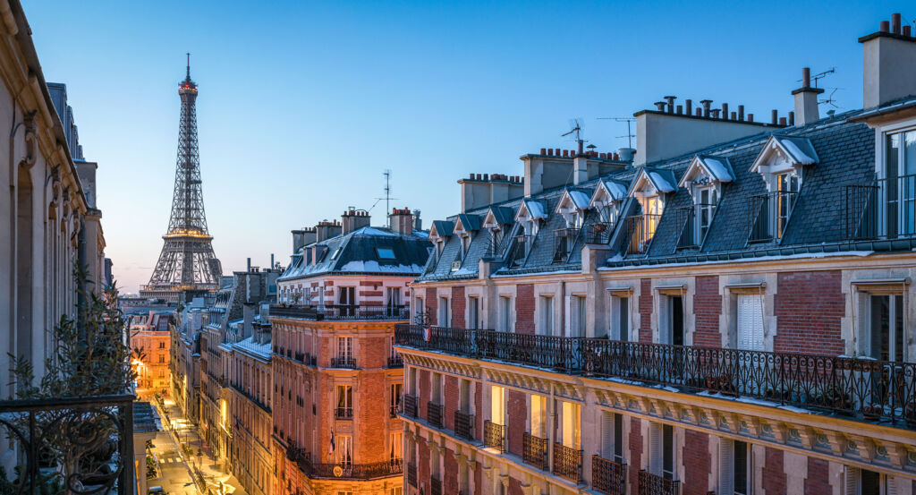
Why Île Saint-Louis matters.
Île Saint-Louis is a distinctive enclave where the Seine meets seventeenth-century Paris through continuous stone quays, aristocratic houses and an unusually intact street plan created during one concentrated episode of urban expansion.
Positioned between Île de la Cité, the Marais, and the Latin Quarter, the neighborhood occupies a slender island at the division of the Seine whose four embankments establish unusually clear boundaries between architecture, water and the surrounding city. Continuous riverfront facades rise directly behind the quays, with carriage entrances, stone portals and restrained elevations concealing deeper courts and former aristocratic residences across an island whose compact dimensions keep both banks of the Seine perpetually close. Rue Saint-Louis-en-l'Île establishes the primary encounter through a central east-west spine lined by narrow frontages and intersected by streets running directly toward the water. Quai d'Anjou and Quai de Béthune deepen that experience through long riverside perspectives in which seventeenth-century facades face the Right and Left Banks across open water, giving the island an architectural coherence uncommon in Central Paris. The eastern point brings those geometries together where the two branches of the Seine separate around a tapering edge that still makes the island's engineered shape immediately comprehensible. The result is a neighborhood whose physical unity emerged from a deliberate seventeenth-century operation, preparing a history in which two pastoral river islands became one of Paris's most concentrated experiments in planned urban development.
What defines Île Saint-Louis.
Île Saint-Louis is best known for emerging from the seventeenth-century union and development of Île Notre-Dame and Île aux Vaches, two largely undeveloped river islands whose earlier functions included grazing and storage. Île Notre-Dame appears under that name by 867, and a footbridge connected it with the Left Bank near the present Pont de la Tournelle. Construction of Philippe Auguste's fortifications during the thirteenth century introduced a channel through the land, leaving Île Notre-Dame to the west and the smaller Île aux Vaches to the east. A decisive change arrived in 1614 when entrepreneur and engineer Christophe Marie joined Poulletier and Le Regrattier in an agreement authorized by the royal council to develop the territory. Their undertaking required construction of Pont Marie and a new Pont de la Tournelle, creation of quays and filling of the medieval channel in exchange for the right to subdivide the reclaimed land. This arrangement tied infrastructure directly to property development, turning river engineering into the mechanism through which a new Parisian district became financially possible. Work continued through successive interruptions and disputes before reaching completion 1655, by which point streets, embankments and building parcels had imposed a coherent urban order across the joined islands. The territory acquired the Île Saint-Louis name in 1725, honoring Louis IX and connecting its new residential geography with the medieval king traditionally associated with the site.
Later centuries altered the social position of the island without dismantling the seventeenth-century structure that defined it. During the Revolution, Île Saint-Louis became Île de la Fraternité, replacing its royal and religious association with republican nomenclature before the historic name returned. Nineteenth-century Paris expanded dramatically around it, yet the island remained outside many of the broad street interventions that transformed districts on both banks. That relative architectural continuity did not preserve its original social hierarchy: former elite residences were subdivided, workshops entered older properties and parts of the island experienced physical decline as aristocratic domestic architecture acquired denser uses. The Seine simultaneously became more intensely engineered around the island as navigation, embankments and rebuilt crossings integrated its edges into the infrastructure of the modern capital. Twentieth-century conservation increasingly treated the surviving seventeenth-century fabric as a unified historic environment, protecting an urban composition whose importance rests not on a single building but on the persistence of its quays, parcels, streets and river boundaries. The island consequently carries an unusual chronological clarity within Central Paris, retaining the physical order of its founding century after the social world that produced it had disappeared.
How Île Saint-Louis fits.
Île Saint-Louis works as the anchor for an afternoon tracing Baroque religious architecture, mercantile wealth converted into elaborate private decoration and aristocratic patronage expressed through one of the island's grandest seventeenth-century residences.
Begin at Église Saint-Louis-en-l'Île, where rapid population growth following development of the island rendered the first Notre-Dame-de-l'Île chapel of 1620 to 1622 inadequate and led Louis XIII to prescribe a larger church in 1634. Construction began in 1664 from designs by François Le Vau, continued under Gabriel Le Duc after Le Vau's death in 1670 and passed through Pierre Bullet, Nicolas Liévain and Jacques Doucet before completion of the transept and cupola in 1725 and consecration in 1726, giving the new district a religious building assembled through six decades of architectural work. Continue to Hôtel de Lauzun, commissioned in 1656 by wealthy merchant Charles Gruyn from architect Charles Chamois, a collaborator of Le Vau, and later named for Antonin Nompar de Caumont, duc de Lauzun. Sculpted wood ceilings, painted Italianate ceilings, gilded paneling and a sequence of decorated rooms preserve the ambitions of its first building campaign; Baron Jérôme Pichon acquired and restored the deteriorated house in 1842, then rented rooms to figures including Charles Baudelaire and Théophile Gautier, whose gatherings became associated with the Club des Hashischins before the City of Paris acquired the property in 1928. Conclude at Hôtel Lambert, where financier Jean-Baptiste Lambert commissioned Louis Le Vau during the 1640s to create a residence on the island's eastern point, producing a complex whose riverfront position gave the architect an exceptional site for aristocratic domestic design. Charles Le Brun and Eustache Le Sueur contributed major painted decorations, linking the house with artists who would become central to French court culture under Louis XIV, and later ownership carried the residence through the du Châtelet family and the Polish Czartoryski circle, which turned it into a nineteenth-century gathering place for Polish political and cultural life in exile. The progression moves from a growing island parish demanding decades of architectural construction through mercantile wealth financing an intensely decorated private residence into Le Vau, Le Brun and Le Sueur joining architecture and painting for elite patronage, revealing how religious expansion, commerce and aristocratic culture shaped the new island during its ascent in seventeenth-century Paris.
Where your story begins.
Foresyte Travel reveals places that feel extraordinary long before you arrive.
Experience premium editorial crafted for luxury travelers.
Foresyte Travel may earn a commission when you book through the link on this page.














































































































