Why Río Secreto matters.
Río Secreto is a subterranean natural reserve where Riviera Maya's limestone geology meets an extensive network of crystalline freshwater passages, intricate mineral formations and the conservation of one of the Yucatán Peninsula's most consequential underground ecosystems.
Set along Federal Highway 307 south of Central Playa del Carmen, near the forested limestone terrain surrounding the southern approaches to the city, the ecological reserve occupies a substantial tract of tropical woodland above an interconnected system of caves and underground waterways. A reception complex provides the transition from the highway into the protected landscape, with transportation carrying groups toward the cave entrances. Narrow forest paths lead to natural openings in the limestone, where descending passages connect the surface vegetation with chambers extending beneath the ground. The subterranean environment contains vaulted ceilings, mineral columns, shallow pools and partially flooded corridors, with limestone surfaces displaying successive stages of geological development. The result is a protected cave system whose forested surface, natural entrances and interconnected waterways expose the geological foundations of the eastern Yucatán Peninsula.
What defines Río Secreto.
Río Secreto is best known for preserving an extensive network of partially flooded limestone caves whose development connects the geological history of the Yucatán Peninsula with the conservation of its subterranean freshwater resources. The peninsula originated from the accumulation of marine carbonate sediments across an extensive limestone platform, creating the geological foundation for its later underground drainage systems. Changes in sea level exposed portions of this platform to rainfall, allowing slightly acidic water to penetrate fractures and gradually dissolve the carbonate rock. Successive periods of erosion enlarged these fractures into interconnected passages, chambers and underground drainage routes. The absence of extensive surface rivers across much of the northern peninsula made subterranean groundwater particularly important to the region's hydrology. Freshwater collected within the limestone aquifer, forming a system whose water levels responded to rainfall, geological structure and proximity to the Caribbean coastline. Mineral-rich water dripping through cave ceilings deposited calcite, producing stalactites, stalagmites and columns through processes continuing across thousands of years. The cave system entered modern public awareness following an accidental discovery associated with a local landowner pursuing an iguana into an opening among the rocks. Subsequent exploration revealed interconnected galleries containing extensive mineral formations and clear underground water. Speleological expeditions mapped passages and examined the cave environment, establishing the basis for organized access and conservation. The attraction opened to the public in 2008, introducing a guided exploration program designed around the protection of fragile geological features. Its Mexican-owned operating organization developed environmental practices intended to safeguard the cave system and the tropical forest covering it. Conservation activities expanded through collaboration with Centinelas del Agua, an organization concerned with groundwater protection, environmental education and the ecological importance of the peninsula's freshwater systems. The reserve's environmental program connects cave preservation with the protection of surface vegetation, recognizing the relationship between rainfall infiltration, forest conditions and groundwater quality. Its development established a model of organized subterranean tourism in which geological interpretation and controlled access support the protection of a vulnerable natural environment.
Río Secreto's guided exploration develops through the physical transition from tropical forest into a series of naturally formed chambers, with walking, wading and floating providing different perspectives on the underground landscape. Specialized guides lead small groups through the entrance passages, explaining the relationship between the surrounding limestone and the water that gradually shaped the cave. Helmets equipped with lamps provide illumination, allowing the mineral formations to emerge against the darkness of the surrounding chambers. Wetsuits and flotation vests support movement through the cool freshwater, whose temperature generally remains between 22 and 24 degrees Celsius. The route extends through one kilometer of underground terrain, combining rocky passages with shallow pools and deeper sections that require floating. Stalactites descend from the ceilings in elongated mineral structures, formed as dissolved calcium carbonate accumulated through successive drops of water. Stalagmites rise from the cave floor where those drops deposited additional calcite, creating formations whose shapes record prolonged changes in water movement. Columns develop where descending and ascending formations eventually join, producing continuous structures connecting floor and ceiling. Flowstone covers sections of the walls in layered mineral deposits, following the surfaces over which groundwater once moved. The surrounding limestone displays variations in color and texture associated with mineral composition and the gradual development of individual chambers. Clear water reveals submerged rock formations beneath the surface, extending the visible geological environment below the passages used for walking. Floating sections place the waterline close to the cave ceiling, changing the apparent proportions of the surrounding chambers and emphasizing the relationship between rock and groundwater. Guides incorporate periods of complete darkness, allowing the absence of natural light to become a defining characteristic of the subterranean environment. Group sizes are limited to ten participants on the classic route, reducing congestion within narrow passages and supporting controlled movement around fragile formations. The conservation program also requires participants to rinse away cosmetics and other surface products before entering the water, protecting the cave's delicate aquatic conditions. Photography is managed through the attraction's designated system, limiting the equipment carried through the passages. The guided route concludes with a return to the surface and a regional meal, reconnecting the geological exploration with the cultural and natural environment of the peninsula. Río Secreto's defining character lies in the close physical encounter with an underground freshwater system whose mineral formations, enclosed passages and natural darkness reveal geological processes ordinarily concealed beneath the forest.
How Río Secreto fits.
Río Secreto works as the geological centerpiece for a Riviera Maya itinerary connecting the ancient Maya occupation of the Caribbean coastline, the ecological importance of the peninsula's tropical forests and the maritime geography that shaped settlement along eastern Quintana Roo.
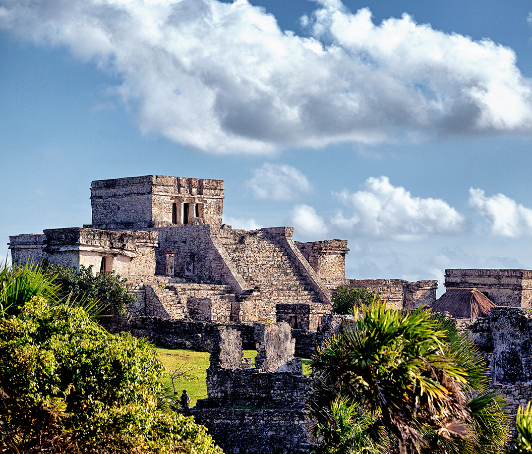
Begin at Xcaret Archaeological Site, the remains of the Maya coastal settlement historically associated with the name Polé. Its location near a sheltered Caribbean inlet supported maritime commerce and movement between communities along the eastern Yucatán Peninsula. During the Postclassic period, the settlement participated in trading networks connecting coastal ports with inland population centers. Surviving masonry buildings, ceremonial platforms and plazas preserve elements of its religious and commercial organization. The settlement also served as a departure point for journeys to Cozumel, whose sanctuaries attracted pilgrims associated with the worship of Ixchel. Continue to Xaman-Há Archaeological Site, the remains of a Maya settlement within Playa del Carmen's Playacar district. Its position facing the Cozumel Channel connected the community with maritime routes crossing the western Caribbean. The surviving architectural groups contain stone platforms and building foundations associated with occupation during the Postclassic period. Their placement within the coastal landscape preserves evidence of a settlement whose inhabitants participated in regional exchange and maintained connections with neighboring communities. The archaeological remains establish the historical foundations of Playa del Carmen within a wider network of Maya coastal settlements. Conclude at Punta Venado, a forested coastal property south of Playa del Carmen where tropical woodland extends toward the Caribbean shoreline. The surrounding vegetation includes species adapted to the peninsula's thin limestone soils and seasonal rainfall. Forest trails cross terrain shaped by the interaction between tropical vegetation, exposed bedrock and natural drainage. The adjoining coastline connects the inland woodland with the marine environment that supported fishing and maritime travel across successive periods of settlement. Its preserved natural setting provides a direct perspective on the coastal landscape that preceded the region's extensive resort development. The progression moves from the ceremonial and commercial foundations of Maya coastal settlement through Playa del Carmen's archaeological inheritance and culminates in the forested shoreline that shaped the region's environmental history.
Where your story begins.
Foresyte Travel reveals places that feel extraordinary long before you arrive.
Enjoy editorial crafted for luxury travelers.
Foresyte may earn a commission when you book.