
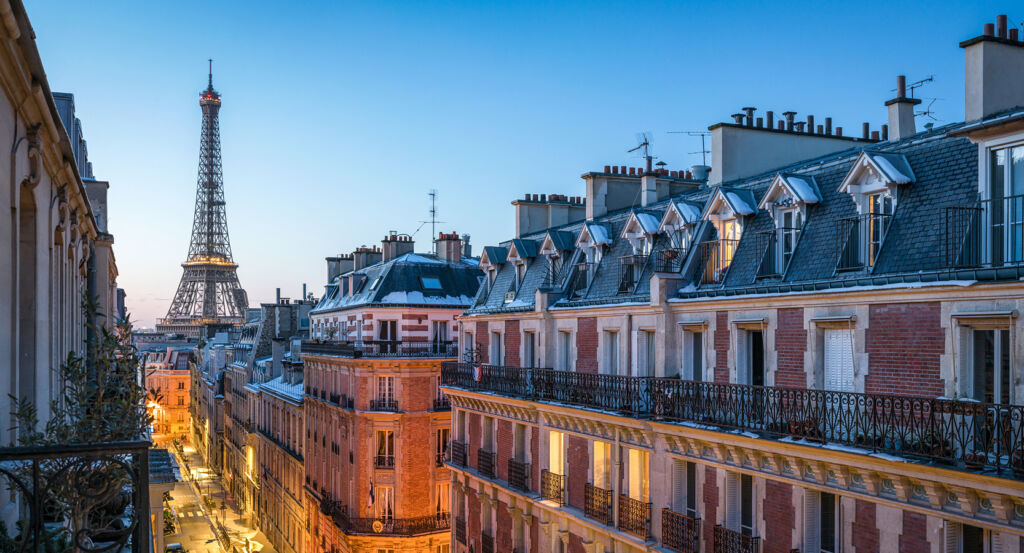
Why Saint-Merri matters.
Saint-Merri is an intricate enclave where medieval Paris meets the modern cultural core through ancient commercial routes, compressed residential streets and bold twentieth-century interventions layered across one of the Right Bank's oldest continuously urbanized quarters.
Positioned between Les Halles, Sainte-Avoye, and the Seine, the neighborhood occupies a central pocket where Rue Saint-Martin, Rue de la Verrerie and Rue du Renard cross a street network formed between the river approaches and the northern expansion of medieval Paris. Narrow passages, irregular intersections and deep building plots retain an intimate grain around Saint-Merri even as Rue de Rivoli, Boulevard de Sébastopol and later redevelopment introduced radically larger dimensions along its edges. Rue Saint-Martin establishes the primary encounter through an ancient north-south route that once carried movement toward the city's northern gates, its close building fronts repeatedly opening into short cross streets and secluded courts. Rue de la Verrerie adds a second spatial mechanism through an inherited east-west alignment where compact facades and changing street widths preserve the scale of the commercial city that developed between Les Halles and the Seine. Rue du Renard creates a sharper architectural transition as older masonry blocks encounter the broad clearances and modern construction that remade Beaubourg during the twentieth century. The result is a neighborhood where medieval circulation, dense historic fabric and dramatic urban intervention occupy the same few blocks, preparing a history centered on the parish that organized this section of the Right Bank for centuries.
What defines Saint-Merri.
Saint-Merri is best known for developing around the parish of Saint-Merri, whose religious history grew from the cult of Médéric, a seventh-century monk from the abbey of Saint-Martin d'Autun who traveled to Paris and was buried near a chapel dedicated to Saint Peter. A sanctuary associated with his burial became the nucleus of a parish positioned beside Rue Saint-Martin, among the principal routes carrying traffic north from the Seine through the expanding Right Bank. Medieval development tightened around the church as commerce spread across adjoining streets linking Saint-Martin with Les Halles and the river approaches. The present church rose principally during the sixteenth century, replacing its medieval predecessor with a late Gothic building whose construction extended from 1500 into the 1560s. Revolutionary closure in 1793 converted the building into a saltpeter factory, followed in 1795 by its use as the Temple du commerce for the Theophilanthropists before Catholic worship returned in 1803. A new sculptural campaign began in 1842 after Revolutionary destruction had stripped the facade and portal of their original figures, bringing Sylvestre-Joseph Brun and Étienne-Hippolyte Desprez into a nineteenth-century reconstruction partly derived from casts connected with the southern portal of Notre-Dame. The resulting church carries successive medieval, sixteenth-century, Revolutionary and nineteenth-century chapters inside the institution that supplied the surrounding quarter with its name.
Water supply and commercial circulation developed another historical mechanism across the streets immediately north of the parish. Fontaine Maubuée was already mentioned in the fourteenth century at Rue Saint-Martin and Rue Simon-le-Franc, distributing water from the Belleville aqueduct to private concessions in the surrounding district. The system shifted to the pump at Pont Notre-Dame in 1673, connecting a neighborhood fountain to a different piece of Parisian hydraulic infrastructure. Jean Beausire and his son Jean-Baptiste reconstructed the fountain in 1733 with carved decoration facing Rue Saint-Martin, preserving a public water point along one of the quarter's busiest routes. Nineteenth-century reconstruction altered the surrounding terrain on a far greater scale when extension of Rue de Rivoli reached Saint-Martin 1854 and required the level of Rue Saint-Martin itself to be lowered. Henri Le Secq photographed the works with Saint-Merri visible beyond the excavation, capturing the physical collision between an inherited street and the engineered axis cutting across Central Paris. Twentieth-century intervention reached deeper into the surrounding blocks when the densely built territory containing Rue Beaubourg, Rue du Renard, Rue Brise-Miche, Rue Nicolas Flamel and Rue du Cloître Saint-Merri became the focus of extensive clearance 1930, beginning another chapter in the neighborhood's repeated reconstruction.
How Saint-Merri fits.
Saint-Merri works as the anchor for a daytime exploration connecting a surviving Gothic bell tower born from the wealth of medieval butchers, the reconstructed seat of Parisian municipal government and the dramatic cultural complex that recast Beaubourg during the 1970s.
Begin at Tour Saint-Jacques, where the parish of Saint-Jacques-de-la-Boucherie served the prosperous Grande Boucherie district near the principal medieval Seine crossings before its parishioners financed a new Flamboyant Gothic bell tower beginning in 1509. Completed in 1523, the tower survived after the church became national property during the Revolution and was sold for stone in 1797 under a condition preserving its belfry; the City of Paris acquired the isolated structure in 1836 as plans developed for a new east-west urban axis, allowing a fragment of the vanished church to enter a radically changed nineteenth-century city. Continue to Hôtel de Ville, whose municipal history on Place de Grève began when provost of merchants Étienne Marcel acquired the Maison aux Piliers in 1357 and established the site as the seat of Parisian government. Pierre de Chambiges and Dominique de Cortone designed its Renaissance successor, begun in 1533 and completed in 1628, before fire during the Commune destroyed the building in 1871; Théodore Ballu and Édouard Deperthes won the subsequent architectural competition, reconstructing the exterior in Renaissance form and creating a technologically advanced civic palace completed in 1882 with electricity, telephones, elevators and central heating. Conclude at Centre Pompidou, born from Georges Pompidou's 1969 decision to create a new museum of modern art on the Beaubourg plateau and the 1970 merger of that project with plans for a major public library. An international competition drew 681 proposals before a jury chaired by Jean Prouvé selected project 493 by Renzo Piano, Richard Rogers and Gianfranco Franchini in July 1971; construction began in 1972 with Ove Arup & Partners contributing engineering expertise, and Valéry Giscard d'Estaing inaugurated the completed center on January 31, 1977. Its ten-level glass-and-metal structure externalized circulation and technical systems to release expansive interior floors, and the Musée national d'art moderne subsequently broadened its collection model to encompass drawing, photography, experimental film and video alongside painting and sculpture. The progression moves from guild wealth financing a Gothic parish tower through municipal power rebuilding its Renaissance seat after revolutionary destruction into Piano, Rogers and Franchini turning Beaubourg toward modern and contemporary culture, compressing medieval commerce, civic authority and twentieth-century architectural experimentation around Saint-Merri.
Where your story begins.
Foresyte Travel reveals places that feel extraordinary long before you arrive.
Experience premium editorial crafted for luxury travelers.
Foresyte Travel may earn a commission when you book through the link on this page.














































































































