Why Santa Maria Beach matters.
Santa Maria Beach is a sheltered coastal sanctuary where the Tourist Corridor's desert mountains meet the clear waters of the Gulf of California, a protected marine environment and one of Los Cabos' most accessible settings for exploring the underwater ecosystems of southern Baja California Sur.
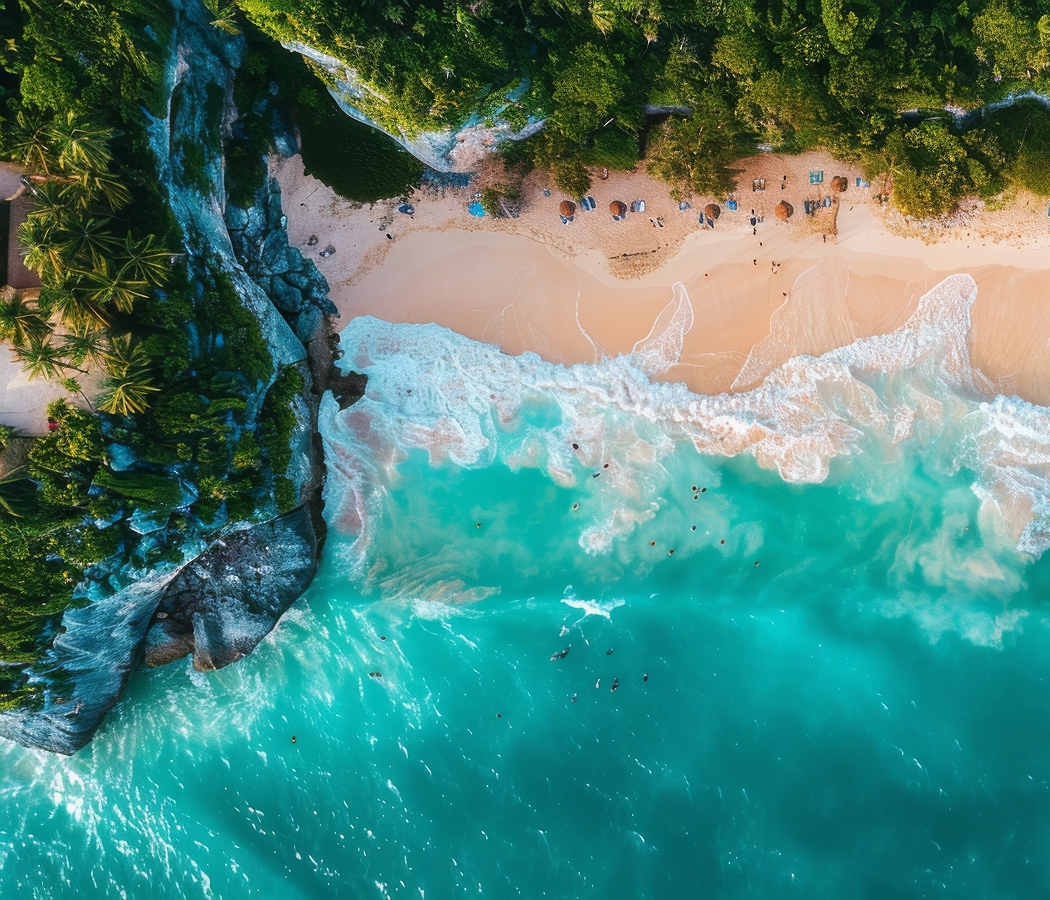
Set along the Tourist Corridor between Cabo San Lucas and San José del Cabo, the crescent-shaped beach occupies a natural cove below the Transpeninsular Highway, with rocky headlands enclosing its northern and southern approaches and the open waters of the Gulf of California extending eastward. Its coarse golden sand curves around a sheltered bay framed by weathered granite formations, creating a compact shoreline distinguished by steep desert slopes and clear coastal water. Submerged rocks and scattered reef structures extend outward from the headlands, supporting marine habitats visible from the surface during calm conditions. A designated public access route connects the beach with parking facilities, pedestrian paths and basic visitor infrastructure integrated into the surrounding terrain. The result is a protected coastal setting whose natural enclosure, distinctive geological formations and accessible marine habitats establish a particularly valuable recreational landscape within the developed Los Cabos coastline.
What defines Santa Maria Beach.
Santa Maria Beach is best known for its sheltered horseshoe-shaped bay, its popularity as a snorkeling destination and its inclusion within the protected marine environment of Bahía de Santa María. The beach occupies a section of the southern Baja California Peninsula characterized by ancient crystalline rocks exposed through tectonic uplift and prolonged erosion. The surrounding granite formations originated deep within Earth's crust before geological processes brought them to the surface, establishing the resistant headlands that enclose the cove. Wave action and weathering gradually shaped the rocky shoreline, producing a natural indentation that reduces exposure to prevailing ocean conditions. The Gulf of California developed through tectonic separation between the Baja California Peninsula and mainland Mexico, creating a marine basin distinguished by substantial biological productivity and complex coastal habitats. The bay's underwater terrain incorporates rocky substrates, sandy areas and scattered coral communities that support a diverse assemblage of tropical and subtropical marine species. Its relatively protected configuration allows sediment to accumulate along the inner shoreline, producing the beach's characteristic crescent shape. Indigenous Pericú communities occupied the southern peninsula before European contact, maintaining maritime practices associated with fishing, shellfish gathering and the use of coastal resources. Spanish exploration during the sixteenth century incorporated the surrounding coastline into the maritime geography of New Spain, although the region remained sparsely settled for generations. Fishing and small-scale coastal activity subsequently shaped the economy of southern Baja California before the expansion of modern tourism. The completion of the Transpeninsular Highway in 1973 substantially improved access between the peninsula's northern settlements and its southern communities. The development of the Los Cabos Tourist Corridor encouraged the construction of resorts, recreational facilities and transportation infrastructure along the coastline connecting Cabo San Lucas with San José del Cabo. Santa Maria Beach became an established destination for snorkeling excursions and independent beach visits, attracting travelers interested in the region's marine environment. Federal conservation measures subsequently incorporated Bahía de Santa María into a protected coastal system associated with the Cabo San Lucas marine region. Public access improvements introduced parking facilities, pedestrian infrastructure and visitor amenities intended to accommodate recreational use while protecting the surrounding landscape. The beach's continuing significance rests in the relationship between its natural coastal geography, accessible underwater habitats and the preservation of public recreational access within a rapidly developing resort region.
Bahía de Santa María supports a marine community shaped by the interaction of rocky coastal habitats, seasonal water temperatures and the biological productivity of the southern Gulf of California. The cove's submerged rock formations create shelter for reef-associated fish, including sergeant majors, angelfish, butterflyfish and parrotfish. These species occupy different ecological positions within the marine environment, feeding on algae, small invertebrates and other organisms associated with rocky substrates. Schools of smaller fish move through the shallows, using the irregular underwater terrain for protection from larger predators. The bay's relatively clear water supports underwater observation near the headlands, where marine organisms concentrate around submerged rock surfaces. Seasonal changes in ocean conditions influence visibility, water temperature and the distribution of marine life throughout the year. The surrounding coastal environment also supports pelicans, gulls and other seabirds that feed in the productive waters of the Gulf of California. Brown pelicans frequently patrol the shoreline, diving into the water to capture fish near the surface. Frigatebirds and other coastal species occupy the broader marine environment, exploiting the air currents and feeding opportunities associated with the peninsula's southern coast. The beach's coarse sand consists of mineral fragments derived from the erosion of surrounding rock formations, producing a texture distinct from the finer sediments of some neighboring beaches. Its steeply sloping underwater profile requires attention to changing depth, particularly near the rocky margins of the cove. Snorkeling excursions generally concentrate on calmer periods when wave conditions permit safe entry and clear underwater observation. The bay's protected configuration also supports kayaking and other nonmotorized recreational activities under suitable conditions. Conservation measures regulate activities that could damage marine habitats, including the disturbance of wildlife and sensitive underwater formations. Santa Maria Beach's ecological importance rests in its combination of accessible coastal habitats, relatively sheltered water and the preservation of marine biodiversity within one of Mexico's principal tourism regions.
How Santa Maria Beach fits.
Santa Maria Beach works as the marine anchor for a Los Cabos outing connecting the region's coastal scenery, historic maritime development and the geological formations that distinguish the southern Baja California Peninsula.
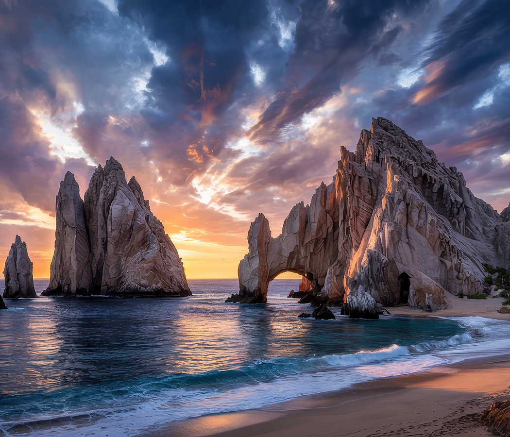
Begin at Chileno Beach, the sheltered recreational shoreline situated along the Tourist Corridor northeast of Santa Maria Beach. The beach occupies a broad sandy cove bordered by rocky headlands, with comparatively calm waters supporting swimming and snorkeling during favorable conditions. Its underwater environment includes rocky formations inhabited by tropical fish and other marine organisms associated with the Gulf of California. Public access facilities include parking areas, pedestrian paths and basic visitor amenities, establishing an accessible coastal destination within the surrounding resort corridor. The beach's Blue Flag recognition has supported its reputation for environmental management, water-quality monitoring and organized public facilities. Continue to Cabo San Lucas Marina, the principal recreational harbor serving the city's sportfishing and marine tourism industries. The marina occupies a sheltered basin surrounded by restaurants, shops and pedestrian promenades, with charter vessels operating excursions along the surrounding coastline. Its development accompanied the expansion of Los Cabos as an international resort destination, introducing substantial facilities for sportfishing tournaments, recreational boating and marine transportation. The harbor supports excursions targeting marlin, dorado and other species associated with the productive waters off southern Baja California. Its waterfront promenades provide views of the fishing fleet and the commercial activity that continues to shape the city's maritime economy. Conclude at The Arch of Cabo San Lucas, the natural granite formation situated at Land's End near the southern extremity of the Baja California Peninsula. The arch developed through prolonged marine erosion acting upon resistant crystalline rock, producing a distinctive opening between weathered coastal outcrops. Its position near the transition between the Pacific Ocean and the Gulf of California establishes a dramatic geological setting characterized by sea stacks, steep cliffs and narrow marine passages. Boat excursions approach the formation through surrounding channels, providing close perspectives of the arch and the adjoining rocky coastline. California sea lions gather on nearby outcrops, contributing to the area's ecological interest. The progression moves from Chileno Beach's accessible snorkeling habitats through Cabo San Lucas Marina's recreational maritime activity and culminates at The Arch of Cabo San Lucas' distinctive coastal geology, connecting Santa Maria Beach with the natural and commercial environments that characterize the Los Cabos coastline.
Where your story begins.
Foresyte Travel reveals places that feel extraordinary long before you arrive.
Enjoy editorial crafted for luxury travelers.
Foresyte may earn a commission when you book.