
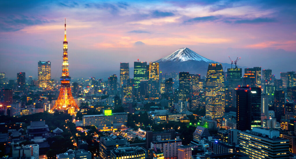
Why Shiba Park matters.
Shiba Park is a deeply layered urban landscape where Shibakoen's Tokugawa temple district meets early Japanese park design, ancient topography and broad green spaces beneath Tokyo Tower.
Set along Hibiya-dori near Sakurada-dori and just steps from Zojo-ji Temple, the 122,501-square-meter park wraps around the temple precinct in separate wooded sections that preserve an unusual amount of open ground within Central Minato. Mature camphor, zelkova and ginkgo trees create substantial overhead cover, then give way to lawns and slopes where Tokyo Tower repeatedly appears above the canopy at dramatically different distances and angles. Shiba Maruyama Kofun raises the southern section onto an ancient earthen mound, and the terrain around Momiji Valley drops into dense planting, rockwork and a waterfall descending 10 meters. Movement through the park shifts between open grass, shaded paths, elevated ground and compact garden compositions, with the fragmented plan continually changing the relationship between vegetation and the surrounding city. The result is a metropolitan park whose varied terrain and mature planting make its extraordinary historical depth physically perceptible, placing contemporary Tokyo inside landscapes formed across radically different periods of the city's development.
What defines Shiba Park.
Shiba Park is best known for belonging to the first generation of public parks established in Japan after the Meiji government issued Daijokan Proclamation No. 16 in January 1873. Tokyo Prefecture selected five sites that March, and Shiba Park opened on October 19 alongside Ueno Park, with Asakusa, Fukagawa and Asukayama forming the remainder of the original group. The choice drew upon an older Japanese precedent: temple and shrine grounds already functioned as established places of recreation, so the new park incorporated Zojo-ji Temple and territory that had attracted people throughout the Edo period. Its early boundaries covered a far greater area than the present park and made Buddhist precincts part of a new imported concept of public recreational land. Yasuhei Nagaoka entered Tokyo Prefecture service in 1878 and became the decisive figure in Shiba Park's later landscape development, eventually working on parks and gardens across 26 prefectures as one of the foundational practitioners of Japanese public landscape design. He exploited existing topography, selected planting for seasonal change and pursued naturalistic scenery, principles concentrated in Momiji Valley, which he designed in 1905 on ground where springs and a natural waterfall had survived into the early Meiji period. Nagaoka lived beside the park at Chohakuen until his death in 1925, making Shiba both a major professional project and his home landscape. Earthquake and wartime damage erased much of his original work, leaving Momiji Valley as its principal surviving component before restorations in 1984, 1993 and 2020 recovered aspects of the earlier composition. Postwar separation of religion and government subsequently removed Zojo-ji from the park boundaries, producing the discontinuous ring of green space that now surrounds the independent temple precinct.
Long before the Meiji park existed, the southern plateau held one of the largest surviving keyhole-shaped burial mounds in Tokyo. Shiba Maruyama Kofun extends more than 100 meters and was constructed around the fifth century on the edge of a plateau rising 16 meters, indicating the presence of a powerful regional leader during the Kofun period. The surrounding ground also contained a group of ten smaller circular tumuli, although later investigation established that these belonged to a period some two centuries after the principal mound. Anthropologist Shogoro Tsuboi of Tokyo Imperial University undertook excavation in 1898, finding that the principal burial facilities had already disappeared after centuries of alteration associated with Zojo-ji and later development. An even earlier archaeological layer survives on the southeastern slope through the Maruyama shell midden, which has been dated to the latter half of the Middle Jomon period and establishes human occupation around the site thousands of years before the tumulus was raised. Modern Tokyo added another historical marker to the mound through the Ino Tadataka Surveying Monument, commemorating the cartographer whose nationwide measurements underpinned the first scientifically rigorous map of Japan. The protected park contains an archaeological sequence extending from Jomon settlement through Kofun political authority into modern scientific commemoration, giving its elevated southern ground a historical scale far deeper than the nineteenth-century park surrounding it.
How Shiba Park fits.
Shiba Park works as the anchor for a Shiba route through three nearby religious sites that connect the district with Tokugawa power, Edo popular culture and the political negotiations surrounding the collapse of the shogunate.
Begin at Shiba Toshogu Shrine, whose origins lie inside the enormous Zojo-ji complex that once dominated this part of Edo. Tokugawa Ieyasu ordered a statue of himself made shortly before his death in 1616, and the figure became the sacred object of Ankoku-den within Zojo-ji before the shrine developed into a Toshogu dedicated to the deified founder of the shogunate. Tokugawa Iemitsu rebuilt the sanctuary during the seventeenth century, and a ginkgo traditionally associated with his patronage still rises beside the approach, reaching 25.5 meters and holding designation as a Tokyo natural monument. The Meiji separation of Buddhism and Shinto detached the shrine from Zojo-ji, and wartime destruction eliminated its historic buildings, yet Ieyasu's seated statue survived and remains a Tokyo-designated tangible cultural property inside the postwar sanctuary. Continue to Shiba-daijingu Shrine, whose history opens another side of the neighborhood through popular worship and Edo entertainment. Founded in 1005 and dedicated to Amaterasu Omikami and Toyouke no Okami, the shrine became known as the Ise of Kanto and prospered under Tokugawa protection after moving to its present vicinity during the Keicho era. Its precinct hosted theatrical performances from the seventeenth century and sumo events, embedding religious ground within the commercial recreation of the surrounding monzen district. March 1805 produced the famous Megumi Fight, when members of the Megumi firefighting brigade clashed with sumo wrestlers including Yotsuguruma Daihachi and Mizuhiki Seigoro, an episode later carried into kabuki and other popular culture. The continuing September Daradara Festival, also known for its ginger market, preserves a festival tradition from the same densely inhabited world beyond the gates of Zojo-ji. Conclude at Atago Shrine, founded on Tokugawa Ieyasu's order in 1603 atop the 25.7-meter natural summit of Mount Atago as protection against the fires that repeatedly threatened Edo. The shrine became associated with another celebrated Tokugawa episode in 1631, when the horseman Magaki Heikuro ascended its steep stone staircase to retrieve plum blossoms for Iemitsu, creating the tradition behind the present 86-step Stairway of Success. Its elevation once commanded views toward Tokyo Bay and later placed the hill inside the political drama ending Tokugawa rule: tradition holds that Katsu Kaishu brought Saigo Takamori to the summit in 1868 and showed him Edo below as negotiations advanced toward the bloodless surrender of Edo Castle. The site carries the route from the dynasty's founder through its mature urban culture to the final transition away from shogunal government. The progression moves from Shiba Toshogu Shrine's surviving connection with Ieyasu through Shiba-daijingu Shrine's fusion of worship and Edo popular entertainment into Atago Shrine's association with the negotiations surrounding the end of Tokugawa rule, placing Shiba Park inside the political and cultural geography that shaped the surrounding district for centuries.
Where your story begins.
Foresyte Travel reveals places that feel extraordinary long before you arrive.
Enjoy editorial crafted for luxury travelers.
Foresyte may earn a commission when you book.

















































































































