Why Table Mountain matters.
Table Mountain is a sandstone mountain massif where Cape Town's dramatic coastal geography meets the geological history of southern Africa, the exceptional biodiversity of the Cape Floristic Region and the cultural heritage of a landscape that has shaped human settlement around Table Bay for thousands of years.
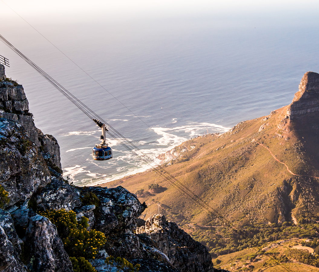
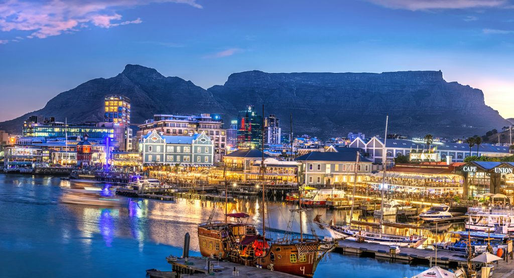
Rising immediately south of Cape Town's City Bowl, between Devil's Peak to the east and Lion's Head to the northwest, Table Mountain forms a broad, elevated sandstone plateau above the neighborhoods of Gardens, Oranjezicht and Tamboerskloof, with its western escarpment descending toward the Atlantic coastline above Camps Bay. Its horizontal summit contrasts with steep cliffs, deeply incised ravines and densely vegetated lower slopes, creating one of the most recognizable mountain profiles in southern Africa. Pale sandstone outcrops define the upper elevations, with fractured rock faces and substantial boulder formations extending across the exposed plateau. Indigenous fynbos vegetation covers extensive sections of the mountainside, introducing low-growing shrubs, flowering plants and seasonal grasses between the rocky surfaces. Narrow hiking paths traverse the summit and descend through sheltered valleys, connecting exposed viewpoints to streams, woodland and protected mountain habitats. The result is a commanding coastal mountain whose distinctive geological structure, exceptional plant diversity and elevated position establish the natural centerpiece of Cape Town's urban landscape.
What defines Table Mountain.
Table Mountain is best known for its ancient sandstone geology, its central place in the history of Cape Town and its exceptional ecological importance within the Cape Floristic Region, among the world's most concentrated centers of plant diversity. The mountain's geological foundations originated through the accumulation of sediments in an ancient basin during the early Paleozoic Era, when extensive deposits of sand and mud gradually developed into the rock formations underlying the Cape Peninsula. The Malmesbury Group contains sedimentary rocks dating back 540 million years, preserving evidence of marine environments that preceded the formation of the mountain's characteristic sandstone plateau. Granitic intrusions subsequently transformed portions of the surrounding geological structure, introducing substantial crystalline formations visible across the peninsula. The Table Mountain Group developed through further sedimentation 520 million years ago, establishing the resistant sandstone formations that define the upper mountain. Its Peninsula Formation comprises thick beds of pale quartzitic sandstone, creating the massive cliffs and comparatively level summit that distinguish the landscape. Subsequent tectonic movements associated with the formation of the Cape Fold Belt altered the surrounding terrain, and prolonged erosion removed softer geological formations, leaving the resistant sandstone as a substantial elevated massif. The mountain's flat-topped appearance developed through the interaction of ancient sedimentary processes, tectonic deformation and differential erosion across hundreds of millions of years. Human relationships with the mountain extend into the Stone Age, with archaeological evidence of occupation and resource use in the surrounding landscape reaching back 30,000 years. Indigenous communities developed extensive knowledge of the mountain's water sources, vegetation and seasonal environmental conditions, incorporating its slopes into patterns of settlement, hunting and gathering. The Khoekhoe name Hoerikwaggo, commonly translated as Mountain in the Sea, preserves an important association between the massif and the coastal geography of Table Bay. Indigenous routes provided access to the upper mountain long before European maritime expeditions reached the Cape. Portuguese navigator António de Saldanha ascended the mountain in 1503, establishing an early European association with the elevated landscape during the expansion of maritime trade around southern Africa. The establishment of the Dutch East India Company's provisioning station at the Cape in 1652 introduced substantial changes to the surrounding settlement, agricultural economy and political relationships with Indigenous communities. Jan van Riebeeck's administration developed the settlement beneath the mountain, using the surrounding freshwater resources to support maritime provisioning and colonial expansion. The mountain's streams contributed to the establishment of gardens, water channels and domestic infrastructure that supported the growing settlement. Dutch colonial authorities subsequently developed systems of water collection and distribution, connecting the upper slopes to the expanding urban community. British occupation during the late eighteenth and early nineteenth centuries introduced further administrative changes, and the growth of Cape Town increased demand for reliable municipal water supplies. The construction of substantial reservoirs on the mountain during the nineteenth century established a major engineering response to the city's expanding population. Woodhead Reservoir, completed in 1897, became an important component of this infrastructure, incorporating substantial masonry construction within the elevated watershed. Hely-Hutchinson Reservoir followed in 1904, expanding the capacity of the mountain's water-storage system. The development of these facilities required the transportation of equipment and construction materials across difficult terrain, demonstrating the engineering challenges associated with the mountain's steep topography.
How Table Mountain fits.
Table Mountain works as the starting point for an exploration connecting Cape Town's botanical conservation, the architectural development of its colonial agricultural estates and the historical significance of the city's principal waterfront fortress.
Begin at Kirstenbosch National Botanical Garden, the internationally important botanical institution established in 1913 on the eastern slopes of the Cape Peninsula mountain chain. Its creation followed the bequest of land associated with Cecil John Rhodes, establishing a substantial public garden devoted to the conservation and presentation of southern African indigenous plants. Botanist Harold Pearson became its first director, introducing a scientific program that contributed to the development of botanical research and conservation in South Africa. The garden encompasses 528 hectares, incorporating cultivated collections and protected natural vegetation across the surrounding slopes. The Boomslang canopy walkway opened in 2014, introducing a curved elevated structure that passes through the forest canopy and provides extensive views of the surrounding botanical landscape. Continue to Groot Constantia, the historic wine estate established in 1685 when Simon van der Stel received a substantial agricultural grant from the Dutch colonial administration. Its development contributed to the expansion of viticulture in the Cape, establishing a wine-producing tradition associated with the international trade networks of the Dutch East India Company. The estate's principal manor house incorporates Cape Dutch architectural features, including substantial whitewashed walls, a symmetrical façade and an elaborately shaped central gable. A destructive fire in 1925 damaged the historic residence, prompting restoration work intended to preserve its eighteenth-century architectural character. The property subsequently became an important heritage institution incorporating historic buildings, wine production and museum exhibitions devoted to the development of Cape agriculture. Conclude at Castle of Good Hope, the fortified complex constructed by the Dutch East India Company between 1666 and 1679 to protect its settlement and maritime provisioning operations. Its five-pointed star plan incorporates substantial stone bastions named Leerdam, Buuren, Katzenellenbogen, Nassau and Oranje, establishing a defensive arrangement influenced by contemporary European military engineering. The fortress replaced an earlier timber-and-earth structure associated with the first Dutch settlement, introducing more permanent military infrastructure. Its interior accommodated administrative offices, residential quarters, military facilities and ceremonial spaces associated with colonial government. The castle subsequently developed into an important military and historical institution, preserving substantial architectural evidence of the early colonial period. The progression moves from Kirstenbosch National Botanical Garden's conservation landscape through Groot Constantia's agricultural architecture and culminates in Castle of Good Hope's seventeenth-century fortifications, connecting the botanical, agricultural and military foundations of Cape Town.
Where your story begins.
Foresyte Travel reveals places that feel extraordinary long before you arrive.
Enjoy editorial crafted for luxury travelers.