Why Canal Ring matters.
Canal Ring is a historic urban district where Amsterdam's seventeenth-century mercantile prosperity meets an ambitious system of engineered waterways, the architectural legacy of the Dutch Golden Age and a UNESCO World Heritage landscape that fundamentally shaped the modern European city.
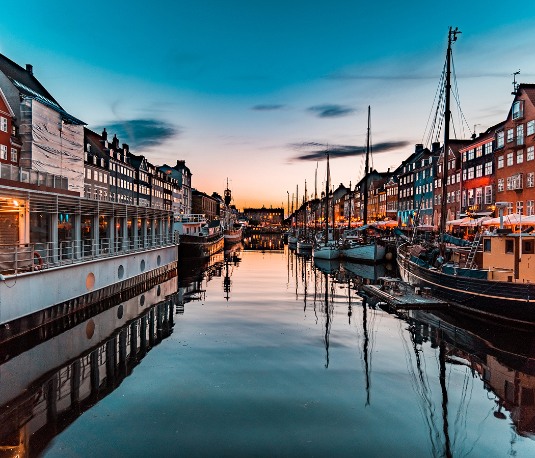
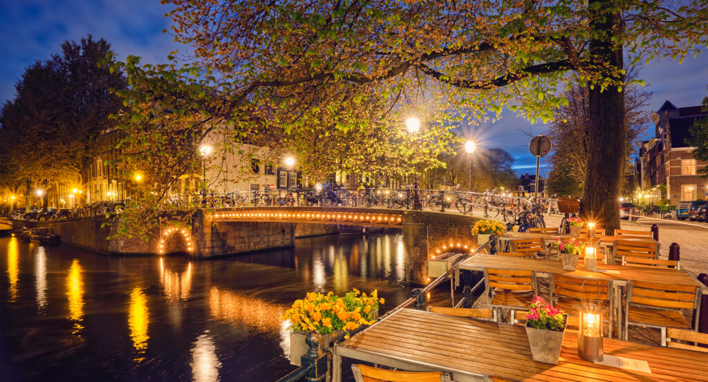
Encircling Amsterdam's medieval center between the Singel and the outer Singelgracht, the historic district occupies a series of concentric waterways extending from the Brouwersgracht in the northwest toward the Amstel in the southeast, with Herengracht, Keizersgracht and Prinsengracht defining its principal residential and commercial corridors. Narrow canal houses stand shoulder to shoulder along tree-lined embankments, their brick facades, stepped gables and tall windows creating continuous architectural frontages above the water. Arched bridges connect the intervening streets, and historic warehouses retain the large upper openings and hoisting beams once used to move merchandise between boats and storage floors. Quayside trees, moored vessels and carefully maintained masonry establish a distinctive relationship between the city's buildings and its engineered waterways. The result is an exceptionally coherent urban landscape whose architecture, hydraulic infrastructure and preserved street pattern express Amsterdam's rise as a major center of international commerce.
What defines Canal Ring.
Canal Ring is best known for its seventeenth-century concentric canal system, its exceptionally preserved merchant houses and its designation as a UNESCO World Heritage Site in 2010. Amsterdam originated around a dam on the Amstel, developing into a trading settlement whose maritime connections expanded during the late medieval period. The city's growth accelerated following the Dutch Revolt and the establishment of the Dutch Republic, which created conditions for substantial commercial expansion. Antwerp's fall to Spanish forces in 1585 encouraged merchants, skilled workers and religious refugees to relocate northward, contributing to Amsterdam's growing population and economic importance. The establishment of the Dutch East India Company in 1602 strengthened the city's position within international trading networks connecting Europe with Asia. The Amsterdam Exchange Bank, founded in 1609, provided financial services that supported increasingly complex commercial transactions. Rapid population growth placed substantial pressure on the medieval city, encouraging municipal authorities to undertake an ambitious program of planned expansion. In 1613, Amsterdam began constructing a new semicircular system of canals and streets extending westward from the established center. Surveyors and municipal engineers organized the expansion through coordinated land acquisition, excavation, drainage and the subdivision of building plots. The plan separated principal residential waterways from commercial and industrial areas, establishing distinct functions within the growing city. Herengracht became associated with prosperous merchants and governing families, whose residences expressed their commercial standing through substantial architectural investment. Keizersgracht developed as a broad residential canal, and Prinsengracht accommodated a varied concentration of houses, warehouses and workshops. A further expansion beginning in 1662 extended the planned canal system eastward toward the Amstel, completing much of the characteristic semicircular arrangement. The construction program required extensive engineering within Amsterdam's waterlogged landscape, including timber foundations, embankments and controlled connections between waterways. Canal construction also facilitated the movement of goods and building materials, integrating transportation infrastructure into the organization of residential and commercial property. Amsterdam's economic fortunes changed during the eighteenth and nineteenth centuries, but the principal canal pattern survived successive phases of industrialization and urban redevelopment. Twentieth-century preservation policies strengthened protection of the historic buildings and waterways, culminating in UNESCO recognition of the seventeenth-century canal ring as an outstanding example of planned urban expansion.
Philips Vingboons helped define Amsterdam's seventeenth-century domestic architecture through carefully proportioned canal houses incorporating classical decorative elements. His designs introduced restrained stone ornament, symmetrical facades and distinctive neck gables that became influential within the city's prosperous residential districts. The narrow width of many canal-front plots encouraged buildings to extend deeply into their parcels, producing elongated interiors organized around staircases, reception rooms and rear courtyards. High property values and limited street frontage contributed to the characteristic vertical proportions of Amsterdam's merchant houses. Timber piles driven into the underlying ground supported substantial masonry structures in conditions where conventional shallow foundations were unsuitable. Brick became the dominant facade material, frequently combined with sandstone or limestone around entrances, windows and decorative gables. Stepped gables retained forms associated with earlier Dutch building traditions, and later neck and bell gables introduced changing architectural fashions. Hoisting beams projected above upper windows, allowing merchandise and furnishings to be raised directly from the street or canal to elevated storage areas. Wealthy households commissioned elaborate interiors containing painted ceilings, carved fireplaces and ornamental plasterwork, demonstrating the relationship between domestic architecture and mercantile prosperity. Rear gardens and coach houses occupied larger properties, creating private green spaces behind the continuous canal-facing facades. The waterways also required coordinated maintenance, including dredging, quay repairs and regulation of water levels across the connected system. Bridges established pedestrian and commercial connections between adjoining districts, creating a dense network of short crossings within the semicircular plan. Canal-side warehouses supported the storage and distribution of commodities arriving through Amsterdam's maritime trading networks. The gradual conversion of historic properties into residences, offices, museums and cultural institutions preserved substantial portions of the original building stock. Canal Ring's architectural importance rests in the unusually complete survival of an integrated seventeenth-century city plan, including its waterways, residential buildings, bridges and commercial infrastructure.
How Canal Ring fits.
Canal Ring works as the architectural anchor for an Amsterdam outing connecting the city's religious history, the domestic world of a seventeenth-century merchant family and the cultural institutions that developed within its historic canal houses.
Begin at Westerkerk, the Dutch Renaissance church constructed between 1620 and 1631 near the western edge of Amsterdam's historic center. Designed by Hendrick de Keyser and completed following his death, the church became an important Protestant place of worship during the Dutch Republic. Its tall Westertoren rises above the surrounding streets, crowned by the imperial crown associated with Amsterdam's historic civic symbolism. Rembrandt was buried in the church in 1669, connecting the building with one of the most consequential figures in Dutch painting. The church's spacious interior and prominent tower preserve the architectural ambitions of a city whose religious and commercial institutions expanded during the seventeenth century. Continue to Museum Van Loon, the historic residence occupying a canal house at Keizersgracht 672. The house was constructed in 1672 and is associated with the Van Loon family, whose members held important positions within Amsterdam's commercial and political establishment. Its preserved interiors contain period furniture, portraits, decorative objects and architectural details associated with wealthy urban households. A formal rear garden separates the principal residence from a historic coach house, preserving the arrangement of a substantial canal-side property. The museum provides a detailed introduction to the domestic environments and social institutions of Amsterdam's merchant elite. Conclude at Museum Willet-Holthuysen, the historic canal house at Herengracht 605 whose preserved interiors illuminate the domestic life of Amsterdam's nineteenth-century upper class. The property was bequeathed to the city in 1895 by Louisa Willet-Holthuysen, whose collection and residence became the foundation of the museum. Its ceremonial rooms contain decorative furnishings, paintings and objects associated with the household's artistic interests and social position. The formal garden and service areas preserve the spatial distinction between reception rooms and the domestic work required to maintain an affluent residence. The museum's interiors demonstrate the continuing use and adaptation of seventeenth-century canal houses during later periods of Amsterdam's history. The progression moves from Westerkerk's Protestant architecture through Museum Van Loon's merchant household and culminates at Museum Willet-Holthuysen's preserved domestic interiors, connecting Canal Ring with the religious, commercial and social institutions that shaped historic Amsterdam.
Where your story begins.
Foresyte Travel reveals places that feel extraordinary long before you arrive.
Enjoy editorial crafted for luxury travelers.
Foresyte may earn a commission when you book.