Why The Golden Circle matters.
The Golden Circle is a geological and historical sightseeing route where Southwest Iceland's volcanic terrain meets the tectonic boundary of the North American and Eurasian plates, the origins of Icelandic parliamentary government and the geothermal forces shaping the country's interior.
Extending northeast and east of Reykjavík through the Þingvellir rift valley, the Haukadalur geothermal district and the upper reaches of the Hvítá River, the route occupies a circuit of roads crossing volcanic plateaus, agricultural lowlands and river valleys between the capital region and Iceland's southern interior. Its principal attractions lie along roads 36, 365, 37 and 35, with connecting routes forming a circuit accessible from Reykjavík. Lava fields and mountain ridges distinguish the western approaches, followed by geothermal basins and glacial river systems farther inland. The surrounding terrain incorporates active geological formations alongside farms, lakes and protected natural areas. The result is a regional itinerary connecting Iceland's earliest national institutions with the tectonic, geothermal and hydrological processes that continue to shape the island.
What defines The Golden Circle.
The Golden Circle is best known for connecting Þingvellir National Park, the Geysir geothermal area and Gullfoss waterfall within a single circuit through Southwest Iceland. Its historical significance begins at Þingvellir, where the Alþingi assembled in 930 and developed into the principal legislative and judicial gathering of the Icelandic Commonwealth. The assembly brought representatives from settlements across the island to a central meeting ground where laws were proclaimed and disputes adjudicated. The establishment of this institution followed the settlement of Iceland during the late ninth and early tenth centuries. Þingvellir continued to serve as the assembly site through major changes in Iceland's political organization, including submission to the Norwegian Crown in the thirteenth century. Its geological setting lies within the Mid-Atlantic Ridge system, where the North American and Eurasian tectonic plates diverge. The resulting extension has produced faults, fissures and subsidence across the rift valley. The surrounding volcanic formations belong to an active geological zone associated with Iceland's position above a mantle plume and a divergent plate boundary. Farther east, the Haukadalur geothermal field developed through underground circulation of water heated by volcanic activity. Geysir became internationally known through accounts of its intermittent eruptions, and its Icelandic name supplied the word used for similar geothermal features worldwide. Strokkur developed as the district's principal regularly erupting geyser, projecting heated water and steam above the surrounding basin. Gullfoss occupies a separate geological setting along the Hvítá River, whose waters originate from the Langjökull glacier system. During the early twentieth century, proposals to harness the waterfall for hydroelectric generation prompted disputes concerning its ownership and preservation. Sigríður Tómasdóttir, the daughter of a local farmer, became associated with efforts to protect the falls. The growing popularity of automobile travel subsequently connected these previously separate destinations through a recognized regional sightseeing circuit. Þingvellir was inscribed on the UNESCO World Heritage List in 2004, acknowledging its association with Icelandic parliamentary history and the cultural landscape of the historic assembly site.
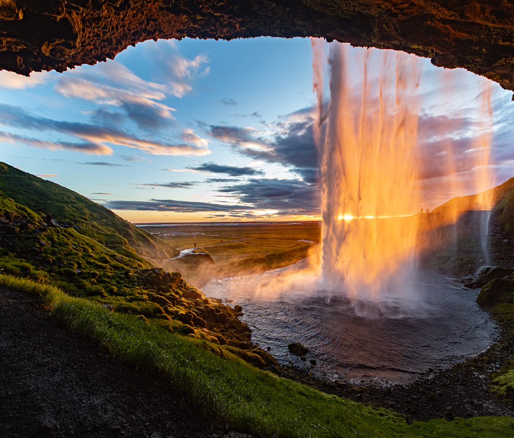
Almannagjá forms one of the principal geological features at Þingvellir, where a substantial fault escarpment marks the western boundary of the rift valley. Its exposed rock walls reveal layers of volcanic material affected by tectonic extension. Walking paths follow the fissure toward the historic assembly grounds, connecting the physical structure of the rift with the former gathering places of the Alþingi. Þingvallavatn occupies the southern portion of the valley and forms Iceland's largest natural lake. Its waters fill a tectonic basin shaped by faulting and volcanic activity. Silfra, a water-filled fissure within the national park, contains groundwater filtered through porous lava formations. The fissure's clear water and submerged rock walls distinguish it as a site for diving and snorkeling. At Haukadalur, Strokkur erupts at intervals of several minutes, releasing a column of boiling water and steam through a narrow geothermal vent. The eruption begins as water rises into a rounded dome before breaking through the surface. Nearby hot springs, steaming ground and mineral deposits expose different expressions of the geothermal system. Geysir itself has experienced substantial variations in eruptive activity over time. At Gullfoss, the Hvítá descends through two principal drops before entering a narrow canyon cut into sedimentary rock. The upper cascade extends across a broad ledge, followed by a steeper plunge into the gorge below. The waterfall's combined descent reaches 32 meters. Spray rises from the canyon as the river passes through the confined channel. The surrounding walking paths provide views of the waterfall's stepped formation and the river valley extending toward the highlands. The route's principal sites preserve the relationship between tectonic extension, geothermal circulation and glacial river erosion across Southwest Iceland.
How the Golden Circle fits.
The Golden Circle works as the geological and historical centerpiece for an Iceland outing connecting volcanic crater formation, geothermal agriculture and the settlement history of the country's southern lowlands.
Begin at Kerið, the volcanic crater lake situated near the town of Selfoss. The crater belongs to a volcanic field associated with the western volcanic zone and contains a lake enclosed by steep slopes of red and dark volcanic rock. Its formation dates to 6,500 years ago, placing it among the younger volcanic features of the surrounding region. The crater measures 270 meters in length and 170 meters in width, with a depth reaching 55 meters. Walking paths follow the rim and descend toward the water, exposing the contrast between volcanic scoria, moss-covered slopes and the lake's mineral-rich water. Continue to Friðheimar, the greenhouse farming enterprise near Reykholt in the Bláskógabyggð municipality. The property uses geothermal energy to heat greenhouses devoted principally to tomato cultivation. Artificial lighting and controlled growing conditions support agricultural production during Iceland's long winter months. The enterprise incorporates biological pest management and greenhouse technologies developed for cultivation in a northern climate. Its restaurant serves tomato-based dishes within the greenhouse environment, connecting agricultural production with Iceland's use of geothermal energy. The surrounding district contains farms and horticultural enterprises that draw upon geothermal resources for heating and cultivation. Conclude at Skálholt, the historic ecclesiastical center established during the eleventh century. The settlement became the seat of one of Iceland's two medieval bishoprics in 1056, establishing its importance within the country's religious and educational institutions. Bishops based at Skálholt exercised substantial influence over ecclesiastical administration, manuscript production and intellectual life. The site remained a principal religious center for centuries before the bishopric was transferred to Reykjavík during the nineteenth century. The surviving cathedral, completed in 1963, occupies the historic precinct and incorporates modern architectural forms alongside archaeological remains associated with earlier church buildings. The progression moves from volcanic crater formation through geothermal cultivation and culminates at Iceland's medieval ecclesiastical center, connecting The Golden Circle with the geological and institutional development of Southwest Iceland.
Where your story begins.
Foresyte Travel reveals places that feel extraordinary long before you arrive.
Enjoy editorial crafted for luxury travelers.
Foresyte may earn a commission when you book.