Why Monteliusvägen matters.
Monteliusvägen is a cliffside pedestrian corridor where Mariaberget's nineteenth-century residential architecture meets Stockholm's waterfront topography, the preservation of Södermalm's historic hillside and panoramic views across Riddarfjärden toward the city's medieval center.
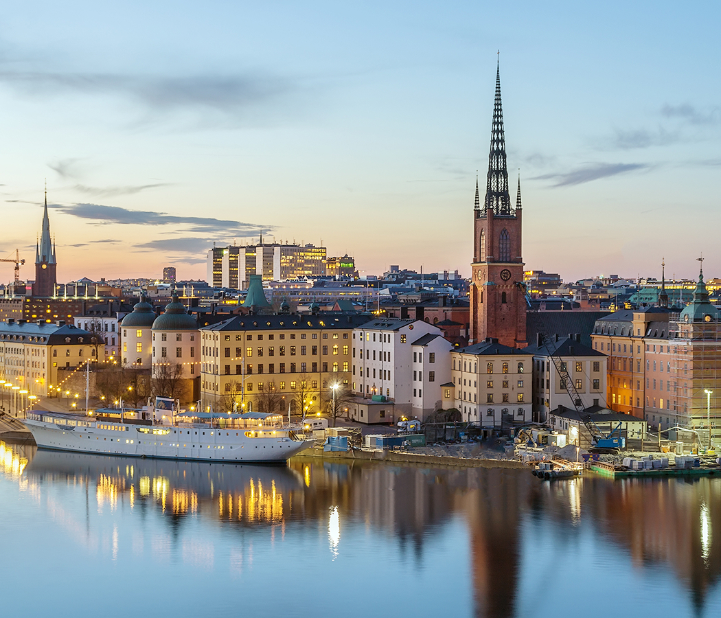
Running through Mariaberget between the residential streets of Bastugatan and the western slopes above Söder Mälarstrand, the pedestrian corridor follows a narrow cliffside route from Kattgränd toward Skolgränd, overlooking Riddarfjärden, Riddarholmen and the northern waterfront of Kungsholmen. A gravel pathway follows the contours of the hillside between timber fencing and landscaped slopes. Historic residential buildings stand immediately uphill, their courtyards and gardens occupying terraces above the waterfront. Benches and viewing areas face the water, with the island of Riddarholmen and its church spire forming prominent elements of the northern skyline. The result is a pedestrian route whose preserved hillside setting connects Södermalm's residential history with Stockholm's medieval waterfront and central island geography.
What defines Monteliusvägen.
Monteliusvägen is best known for its elevated views across Riddarfjärden, its preserved hillside setting and its position within the historic residential district of Mariaberget. The route follows the northern escarpment of Södermalm, an island whose steep waterfront slopes influenced the development of Stockholm's southern neighborhoods. During the medieval period, Södermalm lay beyond the principal fortified settlement on Stadsholmen and contained agricultural land, religious properties and scattered buildings. The district expanded during the seventeenth century as Stockholm's population increased and the city extended across its surrounding islands. Urban planning introduced more regular street arrangements in accessible areas, although the steep slopes above the northern waterfront retained irregular passages and building plots. Artisans, laborers and maritime workers occupied portions of the hillside, contributing to the development of densely arranged residential properties. Fires and subsequent rebuilding altered the district's architectural character during the eighteenth and nineteenth centuries. Timber houses, plastered masonry buildings and enclosed courtyards developed across terraces shaped by the underlying bedrock. The construction of waterfront streets and harbor facilities strengthened connections between the hillside settlements and commercial activities along Lake Mälaren. During the nineteenth century, Stockholm's industrial expansion increased residential pressure across Södermalm and encouraged further construction on available slopes. Twentieth-century urban redevelopment threatened sections of the district's older building stock, prompting preservation efforts directed toward Mariaberget's historic streets and houses. Conservation programs retained substantial portions of the neighborhood's traditional residential architecture and irregular street network. Monteliusvägen developed as a publicly accessible pedestrian route along the escarpment, opening the hillside's views toward the city center. Its name commemorates Oscar Montelius, the Swedish archaeologist whose work contributed to the development of modern archaeological chronology. The path became an established public viewpoint within a district whose architectural preservation connects Stockholm's earlier residential development with its modern urban landscape.
Oscar Montelius, born in Stockholm in 1843, became internationally influential through his archaeological work on prehistoric European material culture. His research advanced typological methods for arranging artifacts into chronological sequences based on changes in their forms and decorative characteristics. The pedestrian route bearing his name occupies a hillside whose physical structure reveals a different aspect of Stockholm's historical development. Its gravel surface follows a gently curving alignment between residential properties and the steep descent toward the waterfront. Timber railings mark exposed sections of the path, preserving views across the open water. The route passes garden walls, planted terraces and building façades associated with the surrounding residential quarter. Several sections widen into small viewing areas equipped with benches. The panorama extends toward Stockholm City Hall on Kungsholmen, whose brick tower rises above the western waterfront. Farther east, the historic buildings of Riddarholmen stand above the water, including the openwork spire of Riddarholmen Church. The northern edge of Södermalm forms a continuous elevated boundary above Söder Mälarstrand, with the path occupying a position between the residential streets and the lower embankment. Seasonal vegetation changes the visibility of the surrounding buildings and shoreline. The route's western and eastern approaches connect with narrow streets that retain the scale of the historic hillside settlement. The surrounding architecture incorporates painted plaster façades, timber details and masonry foundations adapted to uneven terrain. These features place the pedestrian corridor within the preserved residential fabric of Mariaberget. Its elevated alignment provides a continuous perspective on Stockholm's island arrangement, connecting the physical geography of the city with the historical development of its waterfront neighborhoods.
How Monteliusvägen fits.
Monteliusvägen works as the elevated walking centerpiece for a Södermalm itinerary connecting Stockholm's preserved residential quarters, nineteenth-century literary history and the civic architecture surrounding Riddarfjärden.
Begin at Mariatorget, the public square established during the nineteenth century within the residential district of western Södermalm. Originally known as Adolf Fredriks torg, the square acquired its later name through its association with the surrounding Maria parish. Its landscaped grounds contain pathways, planted areas and sculptural features developed through successive phases of urban improvement. Residential and commercial buildings around the square preserve elements of Stockholm's nineteenth-century expansion. The surrounding streets include cafés, shops and institutions occupying historic properties. The square provides a starting point for examining the transition between Södermalm's regular urban blocks and the older hillside settlement farther north. Continue to Ivar Lo-Johansson's Home and Museum, the former residence of the Swedish writer associated with the development of proletarian literature during the twentieth century. Lo-Johansson, born in 1901, wrote extensively about rural labor, social conditions and the experiences of agricultural workers within Sweden's changing economic system. His literary work contributed to public discussion of the statare system, under which agricultural laborers received part of their compensation through housing and provisions. The preserved apartment contains furnishings, books and personal objects associated with his working life. Its location within Södermalm connects the writer's social concerns with the urban environment in which he lived and worked. Conclude at Münchenbryggeriet, the former brewery complex overlooking Riddarfjärden along Söder Mälarstrand. Brewing operations developed on the site during the nineteenth century, and the industrial buildings expanded as Stockholm's demand for commercially produced beer increased. The complex incorporates substantial brick structures, large windows and architectural details associated with industrial construction of the period. Production ceased during the twentieth century, and the buildings subsequently underwent conversion for conferences, exhibitions and public events. Its waterfront position preserves the relationship between Södermalm's industrial economy and the transport routes of Lake Mälaren. The progression moves from a nineteenth-century public square through the preserved residence of a major Swedish writer and culminates at a former industrial complex, connecting Monteliusvägen with the residential, literary and commercial development of western Södermalm.
Where your story begins.
Foresyte Travel reveals places that feel extraordinary long before you arrive.
Enjoy editorial crafted for luxury travelers.
Foresyte may earn a commission when you book.