
Why Nakameguro matters.
Nakameguro is a river-centered neighborhood where Nakameguro's independent character meets an engineered urban waterway, railway-driven growth and a dense culture of small shops, studios and restaurants threaded through former village terrain.
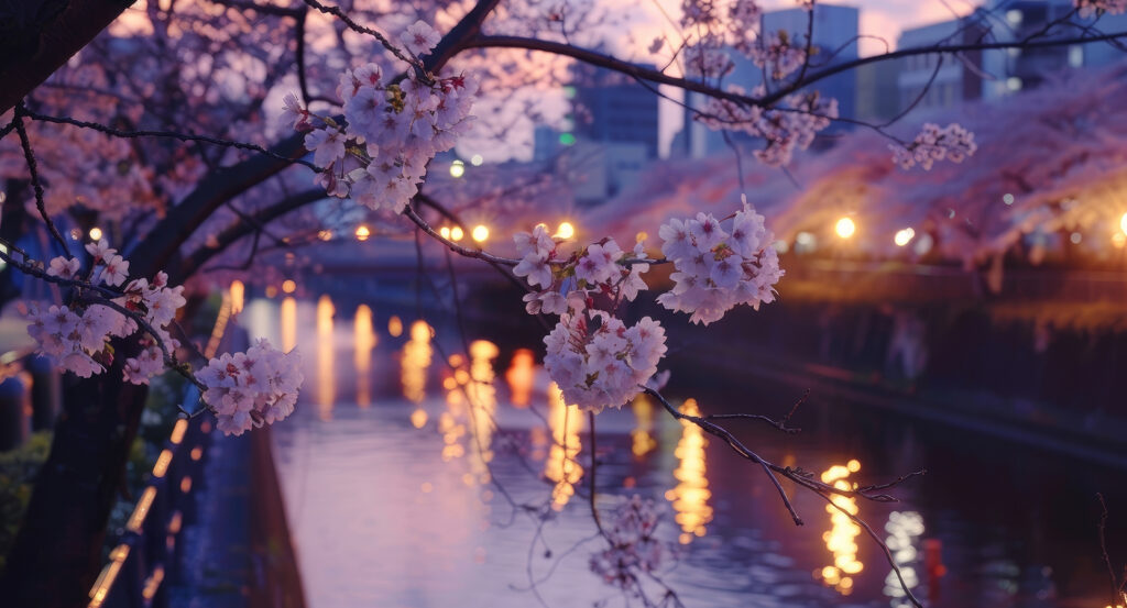
Set along the Meguro River near Yamate-dori and just steps from Nakameguro Station, the neighborhood spreads from the low river corridor into Kamimeguro and the rising ground of Aobadai, creating pronounced changes in elevation and urban scale within short distances. The river supplies its strongest physical axis, with narrow roads following both banks as bridges repeatedly reconnect commercial pockets divided by the water. Elevated railway tracks cross this corridor beside the station, concentrating movement around Yamate-dori before smaller lanes disperse toward residential hills, independent businesses and older religious precincts. Cherry trees intensify the river's linear form in spring, yet the underlying structure remains legible throughout the year in the contrast among water, viaduct, arterial road and surrounding slopes. The result is a neighborhood whose contemporary cultural prominence remains anchored to geography, with river engineering and transportation repeatedly redirecting activity through terrain inherited from the older settlements of Meguro.
What defines Nakameguro.
Nakameguro is best known for developing from settlements along the Meguro River into a major southern Tokyo interchange whose growth accelerated through railway construction, flood-control engineering and metropolitan transportation. The decisive transportation shift began on August 28, 1927, when the Toyoko Line opened between Shibuya and Maruko-Tamagawa with Nakameguro among the stations on the new corridor. The railway connected the river valley directly with Shibuya as surrounding farmland gave way to denser residential and commercial development during the early Showa period. Another major change arrived during construction of the Hibiya Line, which required Nakameguro Station to be rebuilt with two island platforms and four tracks to accommodate subway trains and Toyoko Line services. The Hibiya Line reached Nakameguro from Ebisu on July 22, 1964, opening direct subway service toward Kasumigaseki. Full operation followed on August 29, when through-service began among the Hibiya Line, Toyoko Line and Tobu Isesaki Line, and Nakameguro became a Toyoko express stop. Daily station traffic rose from 26,494 entries and exits in 1962 to 110,160 in November 1964, including 70,018 passengers transferring to or from the subway. The new connection simultaneously reduced pressure on Shibuya by giving Toyoko passengers a route into Central Tokyo. Through-service between the Toyoko and Hibiya lines ended in 2013 as the Toyoko Line entered a new operating relationship with the Fukutoshin Line, but Nakameguro retained its interchange function as the Hibiya Line terminus. The neighborhood's metropolitan importance was built through successive transportation layers, turning a river settlement into a junction where suburban rail, subway movement and the older valley geography converge.
The celebrated cherry corridor along the Meguro River grew out of flood-control work, binding Nakameguro's most recognizable seasonal landscape to repeated reconstruction of the waterway. Residents planted cherry trees along both banks during river improvements in the early Showa period, establishing the first generation of the present avenue. Air raids, environmental deterioration and later embankment projects eliminated many of those trees, requiring successive rounds of replacement. Severe flooding in 1981 inundated more than 2,000 buildings and triggered another major intervention, with about two kilometers of embankment between Nakameguro 1-chome and Ohashi 1-chome rebuilt across five years. Most existing trees along that section were removed during the 1981 to 1986 works, although community requests preserved selected specimens through transplantation and returned cherry planting to the reconstructed banks. Further riverside improvements between 1992 and 1995 introduced new trees downstream from the Funairiba area. The Meguro City section now extends for 3.8 kilometers with 800 cherry trees, principally Somei-yoshino accompanied by varieties including yaezakura, shidarezakura and Amanogawa. Many belong to the third generation planted along the river, making the spring canopy the cumulative product of flood control, reconstruction and repeated community replanting across nearly a century.
How Nakameguro fits.
Nakameguro works as the anchor for an Aobadai route through three nearby sites that move from a reconstructed Edo daimyo garden through a Meiji statesman's former estate and into a rare Taisho residence preserved on the adjoining Daikanyama ridge.
Begin at Sugekari Park, whose ground belonged during the Edo period to the lower residence of the Oka domain of Bungo, where a circuit-style daimyo garden arranged a pond and waterfall across the natural slope and gained recognition as an Edo destination. Saigo Tsugumichi purchased the property in 1874 and rebuilt the estate with Japanese and Western residences, a pond, waterfall and broad lawn; the grounds also supported agriculture, sericulture and food production during his occupation. Later institutional use altered the property, but a 1997 archaeological investigation enabled part of the daimyo garden to be reconstructed, and the present park opened in 2001 across more than 20,000 square meters. Continue directly uphill to Saigoyama Park, occupying the northeastern portion of the same former Saigo estate and preserving the topographic character that gave the surrounding height its enduring local name. Tsugumichi originally acquired the land as a possible Tokyo residence for his elder brother Saigo Takamori, who returned to Kagoshima and died during the Satsuma Rebellion without living there; Tsugumichi subsequently developed his own residence on the property and remained until his death in 1902. A Western house created with French architect Jules Lescasse and master carpenter Suzuki Kotaro incorporated unusual earthquake-resistant techniques, including continuous corner posts, brick inside the walls and a lightened roof; it was transferred to Meiji-mura in 1963 and later designated an Important Cultural Property. Conclude at Kyu Asakura House, built in 1919 by Torajiro Asakura, who later served as chairman of the Tokyo Prefectural Assembly and Shibuya council. The two-storey timber residence combines reception rooms, family quarters and a tea room with a circuit-style garden descending across the Sarugakucho escarpment, preserving a form of upper-class domestic architecture once widespread around expanding metropolitan Tokyo. The Great Kanto Earthquake damaged its storehouse in 1923, prompting reinforcement of that structure, yet the principal residence endured and passed through later governmental uses before receiving national Important Cultural Property designation in 2004. The progression moves from Sugekari Park's reconstructed daimyo garden through Saigoyama Park's connection with Saigo Tsugumichi and early Meiji residential experimentation into Kyu Asakura House's surviving Taisho architecture, climbing from Nakameguro's river valley into the estate landscape that developed across its western ridge.
Where your story begins.
Foresyte Travel reveals places that feel extraordinary long before you arrive.
Enjoy editorial crafted for luxury travelers.
Foresyte may earn a commission when you book.

















































































































