
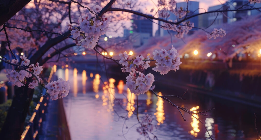
Why Meguro River matters.
Meguro River is a sinuous urban waterway where Nakameguro's river-valley character meets centuries of agriculture, flood engineering, industrial expansion and a pedestrian landscape that now cuts continuously through western Tokyo toward Shinagawa.
Set through Nakameguro near Yamate-dori and just steps from Nakameguro Station, the river occupies the bottom of a pronounced valley before continuing south through Meguro, Gotanda and Osaki toward Tokyo Bay. Concrete embankments hold the channel below adjoining streets, with closely spaced bridges repeatedly crossing between residential blocks, commercial strips and railway infrastructure. Its dimensions change substantially along the route, tightening through the upper reaches before widening downstream as tributary water and tidal influence become more prominent. Roads and paths follow long sections of both banks, making the river an unusually legible geographic axis through neighborhoods whose surrounding hills frequently conceal their relationship with one another. The result is a waterway that remains central to understanding this part of Tokyo, revealing how settlement, transportation and industry accumulated around a valley whose physical constraints repeatedly demanded intervention.
What defines Meguro River.
Meguro River is best known for an engineered channel whose present form emerged from a major twentieth-century campaign to control flooding and create a navigable industrial waterway through Tokyo's southwestern districts. Its upper system divides at Mishuku into the Kitazawa and Karasuyama rivers, both of which once carried runoff through a wider network of streams draining the surrounding uplands. The combined river entered Meguro as a narrow, shallow channel whose tendency to overflow repeatedly inundated fields across the valley. Plans developed during the Taisho period to solve that problem while giving boats access farther inland, and construction began in 1923. Work straightened the winding course, reinforced the banks and widened sections intended to accommodate water transport before reaching completion in 1937. Funairiba became a particularly visible product of that ambition, with an expanded basin designed to receive vessels carrying goods inland from Shinagawa. The river continued to exceed its engineered boundaries during intense rainfall, and later flood-control projects altered the channel again as urbanization increased runoff across the watershed. A severe 1981 flood drove extensive rebuilding through the Nakameguro corridor, and Tokyo added an underground flood-control reservoir near Funairiba in 1994. Downstream, the waterway had already become integral to Shinagawa's industrial growth: factories multiplied beside the Meguro River from the late Meiji period onward, helping accelerate population growth and urbanization around Osaki and Gotanda. The contemporary river carries the physical imprint of two linked ambitions, first as infrastructure intended to restrain destructive water and then as a transport and industrial corridor connecting inland districts with the older port geography of Shinagawa.
Long before concrete embankments fixed the channel into its present geometry, water powered an economy built around farming, milling, dyeing and fishing. Numerous waterwheels operated across Meguro's river system as agricultural production shifted toward commercial crops, using flowing water to grind grain and support processing work. The river remained sufficiently clean for children to swim and catch fish before the Pacific War, and fireflies inhabited sections of the valley. Textile workers later rinsed brightly dyed yuzen cloth directly in the current, a practice that survived into the latter half of the 1950s. Industrial discharge and household wastewater subsequently degraded water quality as postwar population and manufacturing intensified along the watershed. Downstream history reaches much further into maritime commerce: medieval Shinagawa developed around the Meguro River mouth as a major port linking the Pacific coast and Edo Bay with northern Kanto and Tohoku. Shinagawa-ura later supported a fishing community beside the river, where boats, net-drying ground and Yoriki Shrine occupied a headland extending into Edo Bay. Environmental improvement eventually returned aquatic life to sections of the river, leaving the present channel as the successor to agricultural stream, industrial artery, fishing landscape and heavily polluted postwar waterway.
How Meguro River fits.
Meguro River works as the anchor for a route along its valley through three nearby sites that move from an elevated contemporary landscape built over highway infrastructure through a local historical collection spanning prehistoric settlement to modern urbanization and into a shrine whose relocation preserves the river's long history of flooding.
Begin at Meguro Sky Garden, where the river's upper valley intersects one of Tokyo's most complex pieces of contemporary transportation infrastructure. The garden occupies the roof of the loop-shaped Ohashi Junction, rising through an elevation difference of 24 meters as vegetation wraps around the structure on a gradient near six percent. Its planting includes 691 tall trees representing 39 species, 1,201 medium trees representing 43 species, 2,876 shrubs across 45 species and more than 32,000 ground-cover plants across 73 species, turning the junction into an elevated ecological link above the heavily engineered meeting of the Central Circular Route and Route 3 Shibuya Line. Continue downstream to Meguro History Museum, opened on September 21, 2008 inside the converted former Meguro No. 2 Junior High School building in Nakameguro. Its permanent exhibition traces local history from the Paleolithic period through medieval settlement, Edo communities, modernization and the contemporary city, bringing archaeological objects and evidence of changing domestic life into a chronology centered on the same territory crossed by the river. The institution marked its fifteenth anniversary in 2023, and its former museum facility entered a new phase in January 2026 when it closed for a transfer of functions, making the building itself part of the continuing evolution of Meguro's cultural infrastructure. Conclude farther downstream at Irugi-jinja Shrine in Osaki, whose history is physically bound to the river's destructive capacity. The shrine originated beside the Meguro River during the early Edo period and later moved to higher ground to escape flooding. Four other local shrines were incorporated into it, producing the earlier name Gosha Myojin that remained in use into the early Meiji period. The progression moves from Meguro Sky Garden's conversion of transportation infrastructure into elevated landscape through Meguro History Museum's concentration of the district's long human chronology into Irugi-jinja Shrine's retreat from the floodplain, following Meguro River through three different responses to the valley, its settlement and the recurring challenge of building beside water.
Where your story begins.
Foresyte Travel reveals places that feel extraordinary long before you arrive.
Enjoy editorial crafted for luxury travelers.
Foresyte may earn a commission when you book.

















































































































