
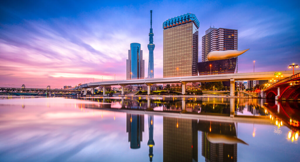
Why Sumida River matters.
Sumida River is a defining urban waterway where Asakusa's historic riverside character meets Edo entertainment culture, successive generations of bridge engineering and a long metropolitan corridor extending south toward Tokyo Bay.
Set along Asakusa near Azumabashi and just steps from Sumida Park, the river forms a broad north-south opening through eastern Tokyo, separating Taito from Sumida before continuing between dense neighborhoods toward Chuo and Koto. Its banks offer an unusually low and continuous perspective on the city, with riverside terraces dropping beneath street level as bridges, expressways, residential towers and older neighborhoods assemble in layers above the water. Azumabashi frames Tokyo Skytree upstream from the Asakusa waterfront, then successive crossings change character downstream through steel arches, suspension structures and broad road decks inherited from different phases of metropolitan growth. Boats move beneath these structures throughout the day, and the river widens noticeably toward its lower reaches as tributaries, canals and reclaimed waterfront districts begin to alter the scale of the surrounding city. The result is a waterway that makes Tokyo's physical evolution exceptionally legible, carrying a single sightline from Asakusa's older eastern neighborhoods through twentieth-century infrastructure and into the open metropolitan landscape approaching the bay.
What defines Sumida River.
Sumida River is best known for functioning as one of Edo and Tokyo's great urban waterways, a role transformed by flood control, catastrophic earthquake and an exceptional campaign of bridge construction during the twentieth century. The river historically formed part of the Lower Arakawa system, whose narrow channel and low embankments repeatedly exposed the growing capital to flooding. National authorities answered with construction of the Arakawa Floodway beginning in 1911, creating the large diversion channel east of the established city and fundamentally reorganizing the hydrology of the lower river system. Another rupture arrived with the Great Kanto Earthquake on September 1, 1923, when bridges across the Sumida failed or burned amid the destruction spreading through eastern Tokyo. Reconstruction produced nine major iron bridges across the river: the national government built Ryogoku, Umaya and Azuma, and Tokyo City built Aioi, Eitai, Kiyosu, Kuramae, Komagata and Kototoi. Their designs deliberately avoided a single standardized form, giving the reconstructed river a succession of distinct structural profiles. Eitai Bridge emerged in 1926 as a powerful steel arch after the destruction of its predecessor, and Kiyosu Bridge followed as an elegant suspension structure whose design drew on contemporary German engineering. Umaya Bridge, completed in 1929, introduced three arches across a location whose name preserved the memory of Edo-period horse stables. Kachidoki Bridge extended the engineering sequence in 1940 with a double-leaf bascule mechanism allowing large vessels to pass into the working river, and its movable spans remained operational until 1970. Eitai, Kiyosu and Kachidoki received national Important Cultural Property designation together in 2007, formalizing the exceptional architectural significance of infrastructure created across different chapters of the river's modernization. Flood diversion and reconstruction bridges reshaped Sumida River from a vulnerable artery of Edo into a controlled metropolitan corridor whose infrastructure became one of its most consequential cultural inheritances.
The Sumida River Fireworks Festival preserves a different historical mechanism reaching directly into the social culture of eighteenth-century Edo. The Kyōhō famine struck Japan in 1732 and coincided with epidemic disease, producing widespread death during the rule of the eighth Tokugawa shogun, Yoshimune. A water-god festival held to memorialize victims and pray for the end of disease preceded the authorized launching of fireworks by restaurants around Ryogoku Bridge in 1733, an event associated with the origin of Ryogoku Kawabiraki. The river was also known as Okawa during the Edo period, and its banks around Ryogoku became famous for restaurants, temporary entertainments and crowds drawn toward the summer performance. Fireworks businesses including Kagiya and Tamaya became closely associated with the display culture that developed there, embedding pyrotechnics into the river's public image. Modern changes to transportation and the waterfront interrupted the old Kawabiraki tradition, but the event returned in 1978 under the Sumida River Fireworks Festival name with launch areas shifted upstream and divided between two sites. A separate memorial practice now appears at Azumabashi through Sumida River Toro Nagashi, where lanterns are released onto the water for victims of the Great Kanto Earthquake and wartime destruction and as a prayer for peace. Fireworks and floating lanterns give the river a continuing ceremonial role, preserving collective memory through public events whose meaning remains inseparable from the water itself.
How Sumida River fits.
Sumida River works as the anchor for a riverside route through three nearby sites connecting Tokugawa landscape design, the modern preservation of metropolitan history and a Meiji-era garden shaped by industrial wealth.
Begin at Former Yasuda Garden, whose origins reach to a daimyo garden established during the Genroku era for Honjo Munesuke, lord of the Kasama domain. Its pond once admitted water from Sumida River so the landscape rose and fell with the tide, and ownership later passed through the Ikeda family to industrialist Yasuda Zenjiro before his heirs donated the property to Tokyo City in 1922; a mechanical system now reproduces the changing water level after the direct river connection disappeared. Continue to Edo-Tokyo Museum, opened in Ryogoku in 1993 inside Kiyonori Kikutake's vast elevated structure to preserve and interpret the history of the metropolis from the Edo period forward. Its permanent collection grew through urban artifacts, architectural models, prints, household objects and large-scale reconstructions, and a four-year renovation beginning in 2022 renewed the building before its March 31, 2026 reopening. Conclude at Kyu-Iwasaki-tei Gardens, the former Iwasaki family estate where Mitsubishi's third president, Hisaya Iwasaki, commissioned Josiah Conder to design a Western residence completed in 1896. Conder joined Jacobean massing with Renaissance and Islamic-derived decorative elements, and the surviving Western house, Japanese residence and billiard building preserve part of an estate that once contained more than twenty structures across extensive grounds. The progression moves from a daimyo garden once physically regulated by Sumida River through a museum devoted to the metropolis that developed around it into Conder's surviving architecture for the Iwasaki family, tracing the political, urban and industrial transformations that reshaped Tokyo beyond the riverbanks.
Where your story begins.
Foresyte Travel reveals places that feel extraordinary long before you arrive.
Enjoy editorial crafted for luxury travelers.
Foresyte may earn a commission when you book.

















































































































