Why Wailea Coastal Path matters.
Wailea Coastal Path is a scenic oceanfront promenade where Wailea's volcanic shoreline meets the architectural ambitions of South Maui's master-planned resort district, Hawaiʻi's tradition of public coastal access and an uninterrupted walking route connecting some of Maui's most celebrated beaches.
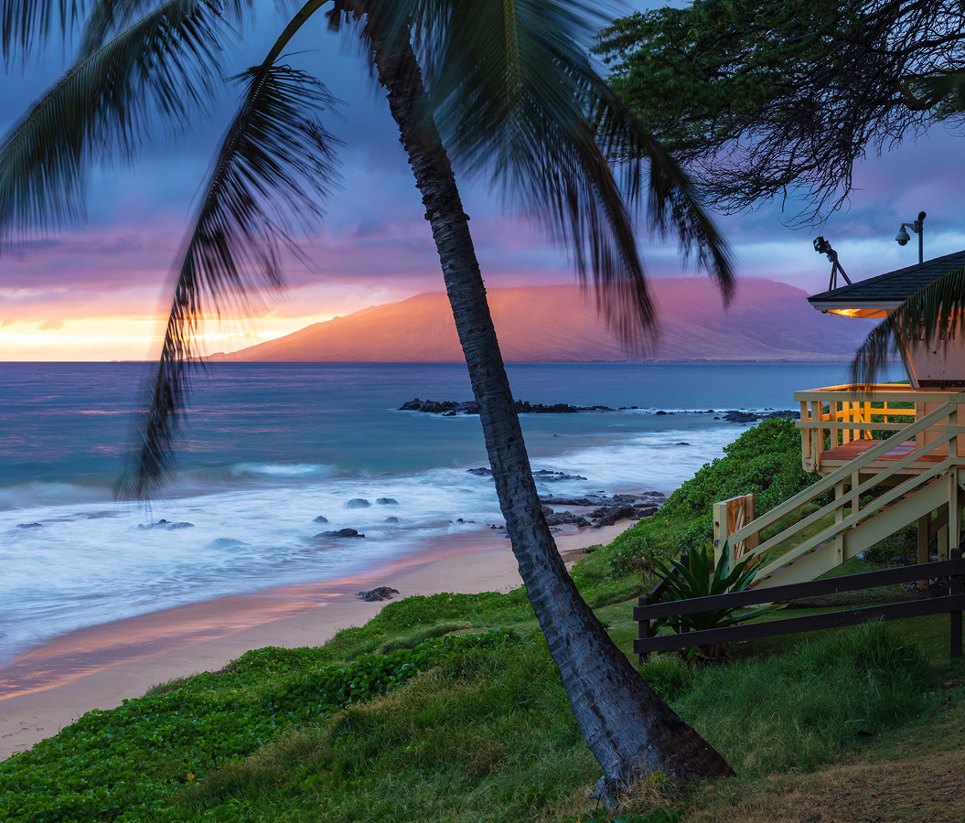
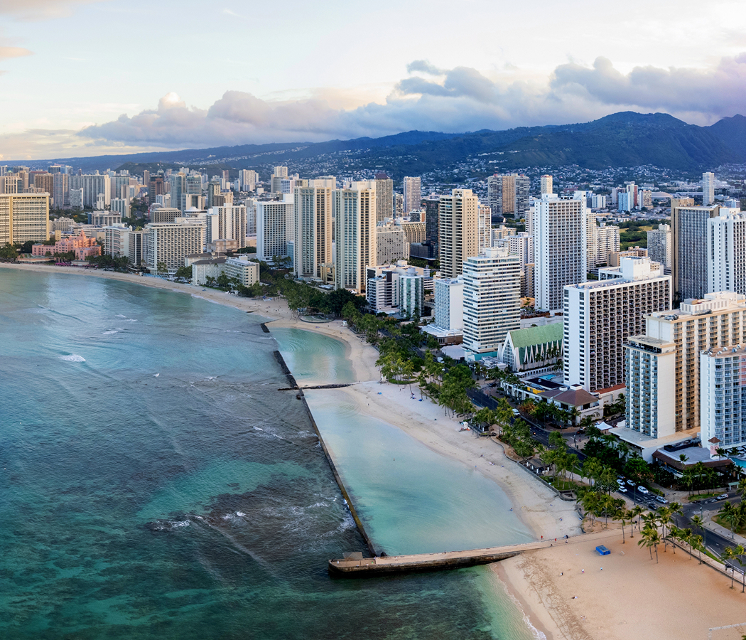
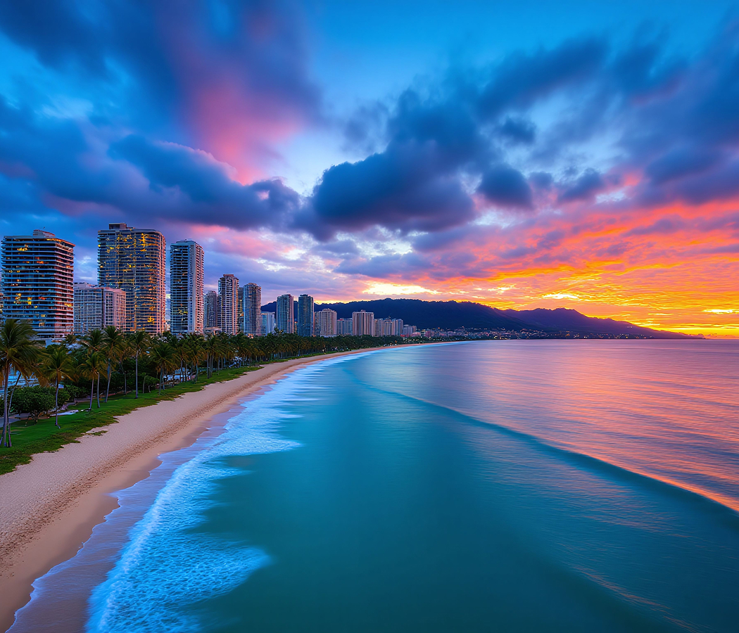
Following the southwestern Maui shoreline from the Mōkapu and Ulua beach area south toward Polo Beach, Wailea Coastal Path runs seaward of Wailea Alanui Drive, passing Andaz Maui, Wailea Beach Resort, Grand Wailea, Four Seasons Resort Maui and Fairmont Kea Lani. The paved walkway extends for one and a half miles, tracing a succession of sandy coves, rocky volcanic headlands and landscaped oceanfront terraces. Its surface alternates between smooth concrete and decorative paving, with gentle changes in elevation following the contours of the coastal bluffs. Low stone walls, planted borders and occasional seating areas frame views toward Kahoʻolawe, Molokini and the distant West Maui Mountains. Public access paths descend toward the beaches, and landscaped resort gardens create transitions between the walkway and the adjoining hospitality properties. The result is a continuous coastal promenade whose accessible design, volcanic geography and carefully maintained public spaces connect Wailea's resort architecture with the natural landscape of South Maui.
What defines Wailea Coastal Path.
Wailea Coastal Path is best known for its incorporation into the original Wailea Resort master plan, which established a continuous public oceanfront corridor as a central feature of South Maui's transformation into an international resort destination. The surrounding land formed part of the traditional Hawaiian district of Honuaʻula, where coastal fishing communities maintained relationships with agricultural settlements on the southwestern slopes of Haleakalā. Hawaiian land tenure changed substantially following the Great Māhele of 1848, contributing to the consolidation of large agricultural and ranching properties across the region. Cattle grazing subsequently occupied extensive portions of the dry coastal plain, establishing the landscape that preceded modern resort development. Matson Navigation Company purchased 1,500 acres of Wailea land in 1957, initiating the process that would eventually transform the former ranchlands into a planned hospitality community. Alexander & Baldwin subsequently assumed control of the property through its corporate relationship with Matson, developing the commercial foundations for the future resort. In 1971, Alexander & Baldwin established Wailea Development Company in partnership with Northwestern Mutual Life Insurance Company, bringing substantial financial and planning resources to the project. Construction began in 1972, with infrastructure development establishing roads, utilities, recreational facilities and the physical organization of the emerging community. The master plan organized the property into zones running parallel to the shoreline, placing a protected open-space corridor between the ocean and the principal hotel developments. This arrangement preserved a continuous pedestrian route along the coastal bluffs and established a clear separation between public shoreline access and private resort facilities. Individual hotels and condominium developments became responsible for constructing and maintaining their adjoining sections of the walkway, creating a coordinated public amenity across separately managed properties. The first hotel and condominium developments opened in 1976, initiating the gradual construction of the oceanfront hospitality district. Wailea Shopping Village followed in 1977, expanding the commercial infrastructure supporting the growing resort community. The development accelerated during the 1980s as international investment brought additional hotels, condominium complexes and recreational facilities to the coastline. Alexander & Baldwin sold Wailea Development Company to Japan's Shinwa Golf Group for $197.5 million in 1989, introducing a major change in the property's ownership and development trajectory. Four Seasons Resort Maui opened in 1990, followed by Grand Wailea in 1991, establishing two substantial hospitality properties along the central portion of the coastal promenade. Additional resort construction expanded the connected pedestrian corridor, preserving public access as the surrounding coastline became increasingly developed. The Urban Land Institute subsequently examined Wailea Resort as a case study in master-planned development, emphasizing the importance of its preserved coastal open-space zone and public walkway. The route's public character became particularly significant as shoreline erosion and the maintenance of access structures introduced legal and environmental questions along the adjoining beaches. At Ulua Beach, a stairway originally constructed during the 1970s connected the public coastal walkway to the sand, becoming the subject of later disputes concerning shoreline encroachment. Maui County issued a reconstruction permit in September 2009, relying on earlier shoreline surveys to determine the structure's position relative to the legally defined shoreline. Subsequent state review raised concerns about the reconstructed staircase, whose footprint extended into the shoreline area. In 2021, the Hawaiʻi Legislature considered resolutions addressing the staircase and the importance of preserving public access to Ulua Beach. State land-management proceedings continued in 2022, examining the relationship between coastal erosion, private maintenance responsibilities and the public's ability to reach the shoreline. These developments demonstrated the practical complexity of maintaining a continuous public promenade along a changing coastal environment. Wailea Coastal Path represents an important achievement in resort planning, combining private hospitality development with a publicly accessible oceanfront corridor whose preservation requires ongoing cooperation among property owners, government agencies and the surrounding community.
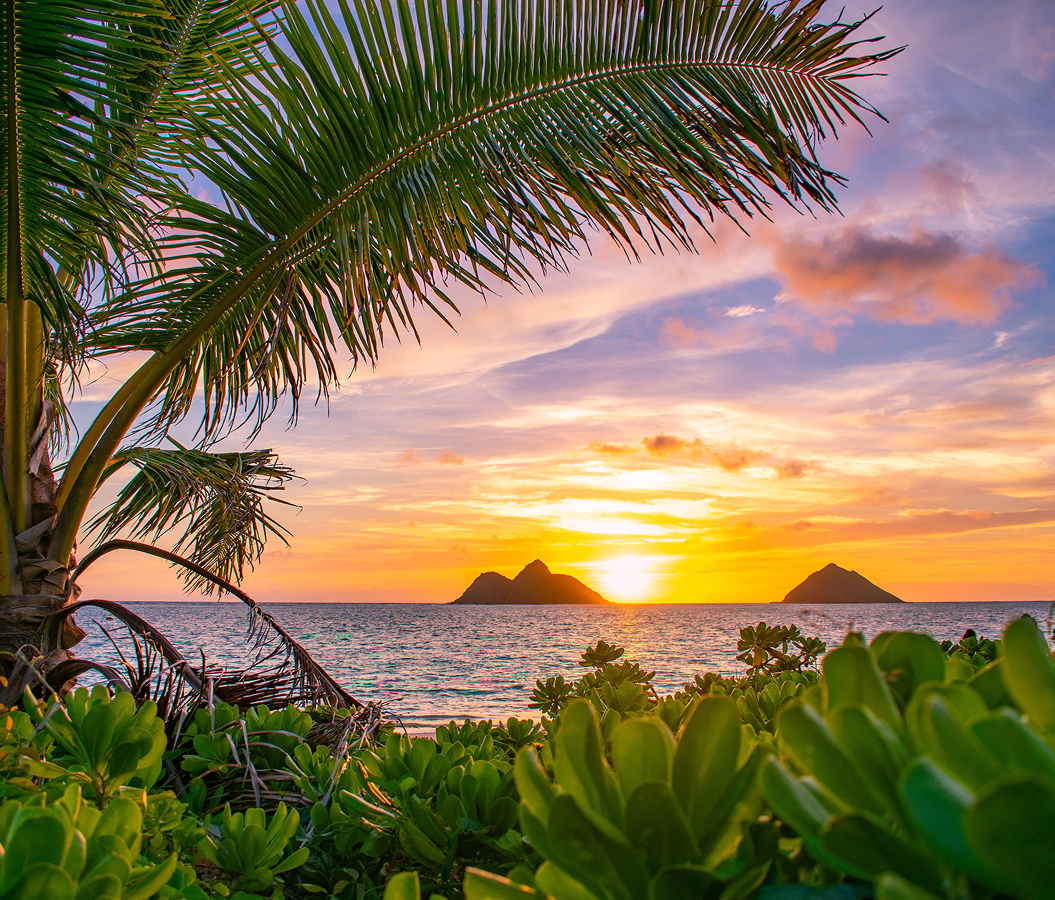
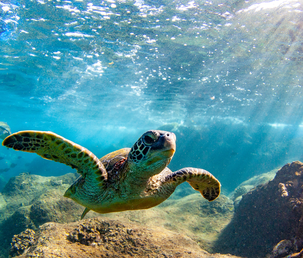
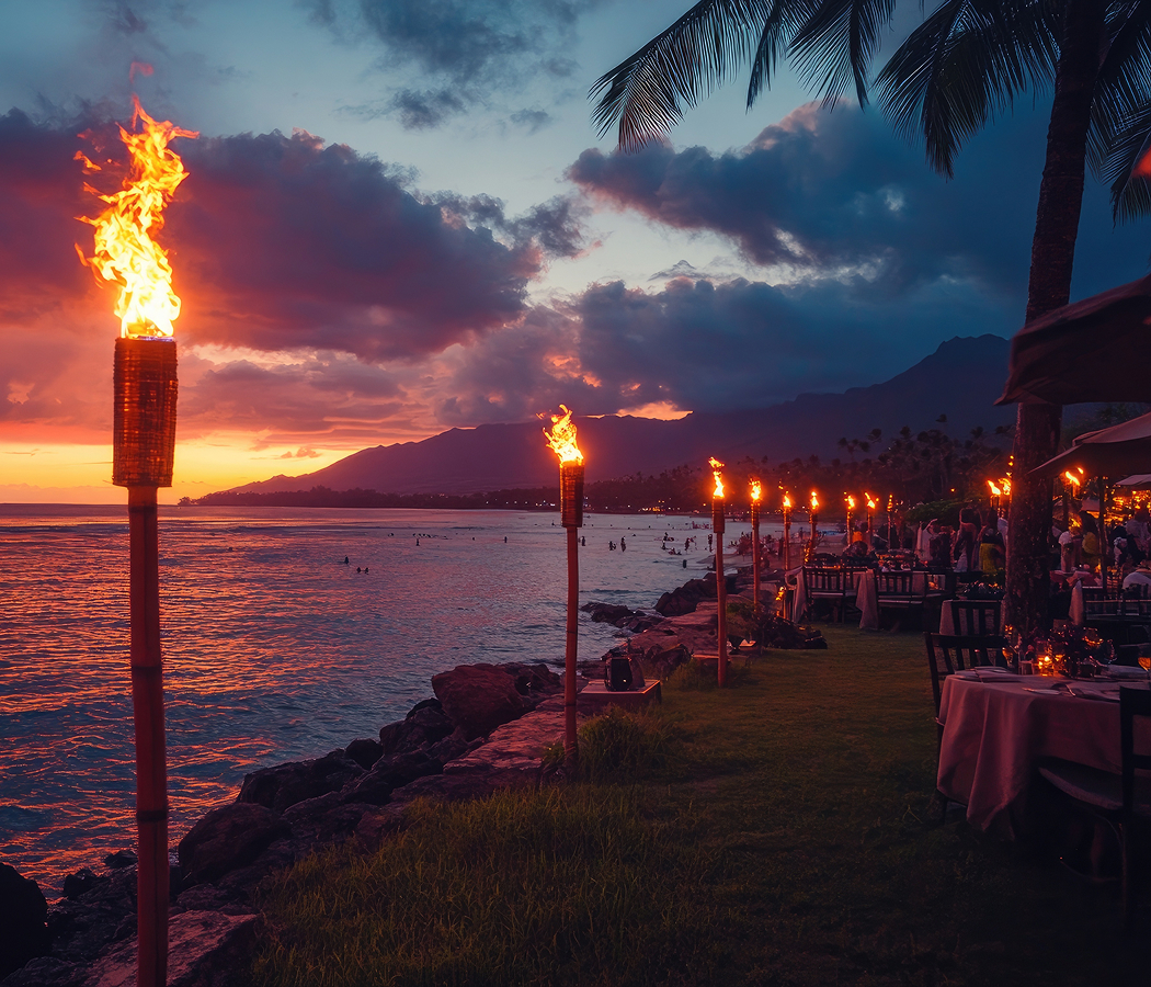
Haleakalā's southwestern volcanic slopes establish the geological foundation of Wailea Coastal Path, descending toward a shoreline shaped by ancient lava flows, marine erosion and the accumulation of carbonate sand. The walkway follows the changing boundary between these formations, moving above rocky headlands before approaching sandy coves whose pale sediment contains fragments of coral, shells and other marine organisms. Its northern section passes the Mōkapu and Ulua shoreline, where adjoining beaches are separated by a low volcanic formation supporting shallow reef habitats. The surrounding marine environment contains reef fish, sea urchins and Hawaiian green sea turtles, known as honu, whose feeding grounds include the rocky underwater surfaces near the coast. The paved route rises gently above portions of the shoreline, providing elevated views into the clear water and allowing the changing character of the seabed to become visible from land. Farther south, the walkway crosses landscaped oceanfront grounds where mature palms, tropical planting and open lawns frame the adjoining resort architecture. Its position above the beaches establishes a consistent relationship between the built environment and the Pacific, with ocean views preserved through carefully maintained gaps in the vegetation. The central section approaches Wailea's broad sandy crescent, where the volcanic headlands enclose a relatively sheltered bay and the surrounding waters support swimming during favorable conditions. Seasonal south swells introduce larger breaking waves and stronger nearshore currents, changing the character of the beach and the surrounding marine environment. The walkway continues along the rocky terrain above the southern edge of the bay, approaching Wailea Point and its exposed basalt formations. This section provides particularly expansive views across the ʻAlalākeiki Channel toward Kahoʻolawe, whose broad volcanic profile dominates the southwestern horizon. Molokini rises offshore as a partially submerged volcanic crater, preserving a distinctive crescent-shaped formation associated with Haleakalā's ancient eruptive history. The exposed promontory also provides views toward Lānaʻi and the distant West Maui coastline, establishing a broad geographical panorama across the surrounding channels. During the winter breeding season, humpback whales migrate into Hawaiian waters, and the channels surrounding Maui become important areas for mating, calving and nursing. Their offshore movements are visible from the elevated sections of the promenade, connecting the walking route to one of the Pacific's major seasonal marine migrations. The path's southern section descends toward Polo Beach, where adjoining sandy areas and rocky outcrops create another sheltered coastal environment. Public access points connect the promenade to parking areas, restrooms and outdoor showers, supporting recreational use independently of the neighboring hotels. The walkway's paved surface accommodates walking, jogging and other pedestrian recreation, with occasional slopes and narrower sections reflecting the natural contours of the coastal terrain. Early morning conditions provide cooler temperatures and softer light across the water, and the western orientation establishes extensive views of the setting sun during the evening. The coastal landscape also contains surviving archaeological features associated with traditional Hawaiian habitation, including stone foundations preserved near sections of the walkway. These remains connect the contemporary recreational corridor to the communities that occupied the shoreline before the development of the resort district. Wailea Coastal Path's distinctive character emerges through this sustained relationship between volcanic geography, marine ecology, Hawaiian cultural heritage and public pedestrian access, creating a route that reveals successive dimensions of South Maui's coastal landscape.
How Wailea Coastal Path fits.
Wailea Coastal Path works as the connecting thread for an exploration of South Maui's volcanic coastal formations, the development of its public beaches and the preservation of Hawaiian cultural heritage within Wailea's master-planned resort district.
Begin at Ulua Beach, the sheltered sandy cove occupying the northern portion of Wailea's principal coastal promenade. Its shoreline lies between Mōkapu Beach and the rocky headlands extending south toward Wailea Beach, with submerged lava formations supporting coral growth and reef fish near the margins. The beach developed as a public recreational destination during the expansion of Wailea Resort, and its adjoining access facilities provide parking, restrooms and outdoor showers. Historical shoreline research conducted by the University of Hawaiʻi established substantial erosion along portions of Ulua Beach, with the public beach park losing thirty-five percent of its width during the preceding century. The changing shoreline contributed to disputes concerning beach-access structures and the maintenance of public pedestrian connections. Continue to Wailea Beach, the broad crescent of pale sand extending between Grand Wailea and Four Seasons Resort Maui. Its shoreline occupies a volcanic embayment enclosed by rocky headlands, with clear Pacific waters extending toward offshore reef formations. The beach's public character became an important feature of Wailea's resort development, preserving access independently of the surrounding hotel properties. Its western orientation provides extensive views toward Kahoʻolawe and Molokini, and the adjoining oceanfront grounds establish a landscaped transition between the sand and the surrounding hospitality buildings. During favorable ocean conditions, the sandy central section supports swimming, and the rocky margins contain marine habitats associated with Hawaiian green sea turtles and reef fish. Conclude at Wailea Point, the exposed volcanic promontory separating Wailea Beach from the smaller coves approaching Polo Beach. Its basalt formations originated through ancient lava flows descending from Haleakalā's southwestern slopes, and subsequent marine erosion shaped the irregular rocky shoreline. The elevated coastal terrain provides extensive views across the ʻAlalākeiki Channel, with Kahoʻolawe occupying the principal southwestern horizon and Molokini rising offshore. Surviving Hawaiian stone foundations near the coastal walkway preserve evidence of former habitation within the surrounding Honuaʻula district. The promontory's position also establishes a clear geographical relationship between the adjoining sandy bays and the volcanic formations that separate them. The progression moves from Ulua Beach's changing shoreline through Wailea Beach's public resort frontage and culminates in Wailea Point's volcanic and cultural landscape, connecting the environmental and historical forces that shaped Wailea's celebrated coastal corridor.
Where your story begins.
Foresyte Travel reveals places that feel extraordinary long before you arrive.
Enjoy editorial crafted for luxury travelers.
Foresyte may earn a commission when you book.