Why Petit-Montrouge matters.
Petit-Montrouge is a grounded enclave where the southern edge of Montparnasse meets the former Montrouge plain through long rectilinear streets, secluded villas and an urban fabric whose nineteenth-century expansion still governs the neighborhood's rhythm.
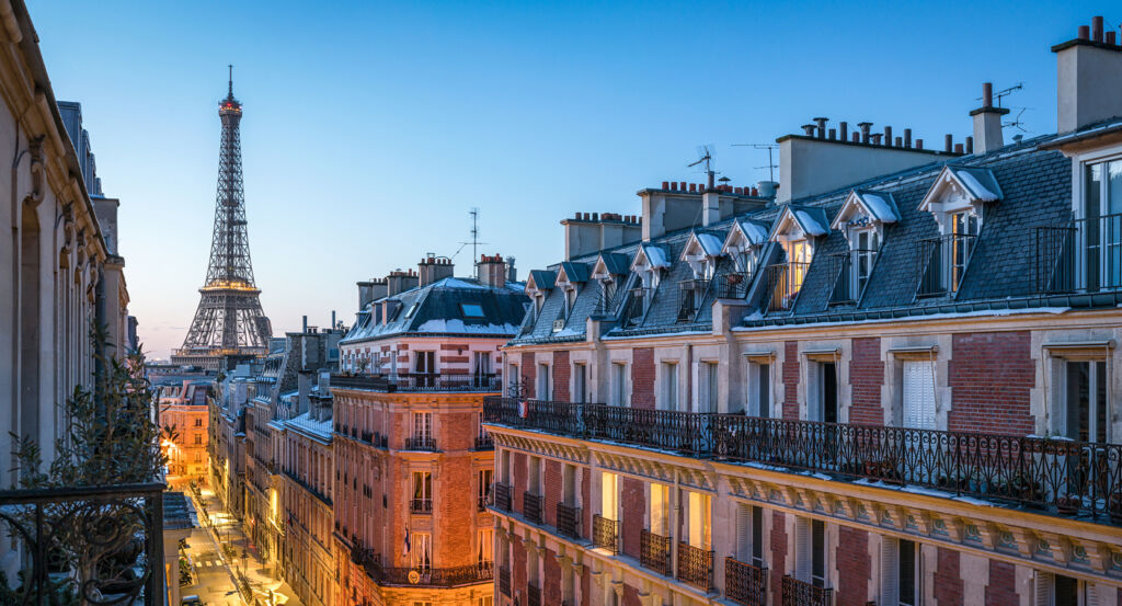
Positioned between Montparnasse, Parc-de-Montsouris, and Plaisance, the neighborhood occupies a broad southern Parisian pocket where Avenue du Général-Leclerc, Rue d'Alésia and Avenue du Maine cross a plateau historically separating the Seine and Bièvre valleys. Long residential streets, modest nineteenth-century houses and taller apartment buildings preserve the varied scale of a district urbanized later than Central Paris, with successive building generations still visible across individual blocks. Avenue du Général-Leclerc establishes the primary encounter through the former Route d'Orléans, an old approach to Paris that became the organizing spine for development spreading across the surrounding plain. Rue Daguerre and the streets around Mouton-Duvernet deepen the physical character through smaller frontages, passages and residential courts whose proportions retain the intimacy of the suburban settlement absorbed by the capital. South of Rue d'Alésia, quieter streets and private villas introduce another spatial layer as twentieth-century architects and artists occupied parcels beyond the denser Montparnasse blocks. The result is a neighborhood whose broad avenues and sheltered side streets preserve the transition from agricultural outskirts to metropolitan Paris, preparing a history rooted in the extraordinary nineteenth-century growth of the Petit-Montrouge settlement.
What defines Petit-Montrouge.
Petit-Montrouge is best known for emerging as the rapidly expanding northern settlement of Montrouge before its incorporation into Paris in 1860 fundamentally divided the old commune. The wider territory had carried the Montrouge name since the medieval period, with Rubeo Monte appearing in 1194 and agriculture, windmills and stone extraction shaping the plain for centuries. An ancient route toward Orléans crossed the territory, joined after 1730 by a newer road that strengthened movement between Paris and the southern countryside. Two population centers eventually formed: Grand-Montrouge around the historic village to the south and Petit-Montrouge closer to the capital, where development accelerated after 1830. Quarrying and early industrial growth strengthened the northern settlement, and by the middle of the nineteenth century Petit-Montrouge contained 7,000 inhabitants against 3,000 in Grand-Montrouge. The Thiers fortifications, erected during the 1840s, physically separated the two communities and anticipated the political division that followed. Montrouge responded to the population shift by constructing a new town hall under architect Claude Naissant between 1851 and 1855 on ground acquired from the Assistance Publique, placing the commune's administrative center inside Petit-Montrouge shortly before losing it. Paris annexed the northern territory on January 1, 1860, and the former Montrouge town hall became the mairie of the new 14th Arrondissement as Petit-Montrouge entered the capital.
Urban consolidation after annexation changed the scale of Petit-Montrouge through coordinated streets, public buildings and residential construction. The population of the new 14th Arrondissement rose from 16,000 in 1860 to 145,000 by 1914 as industrial employment drew newcomers into the southern districts. Rue d'Alésia, descended from the former Chemin des Boeufs, was widened and extended toward Avenue Reille between 1868 and 1870, creating a major east-west axis lined by regular stone apartment buildings. Development remained uneven: northern Avenue d'Orléans retained a more modest built character, and older streets survived beside the new interventions. Around the former Montrouge town hall, schools, a market and later residential construction established a concentrated urban center, with Rue Ernest-Cresson opened in 1906 to strengthen connections toward Avenue d'Orléans. These successive interventions did not erase the suburban pattern wholesale. Petit-Montrouge entered the twentieth century as a dense Parisian district whose older roads, nineteenth-century subdivisions and newer metropolitan axes remained visibly interlocked.
How Petit-Montrouge fits.
Petit-Montrouge works as the anchor for a daytime exploration connecting an interwar artists' enclave, a vast engineering work created to supply Paris with spring water and an international university campus conceived after the First World War.
Begin at Maison-atelier Lurçat, where architect André Lurçat designed a residence and studio for his brother Jean Lurçat in 1925 as part of Villa Seurat, a private street that became an exceptional concentration of modern architecture and artistic life. André Lurçat designed houses at numbers 1, 3, 4, 5, 8, 9 and 11, and Auguste Perret created the neighboring residence-studio of sculptor Chana Orloff at number 7 bis, bringing distinct strands of French modernism onto a single short street. Jean Lurçat's house joined double-height working space with domestic rooms inside an austere geometric composition, and Simone Lurçat later bequeathed the property to the Académie des beaux-arts. Continue to Réservoir Montsouris, conceived by engineer Eugène Belgrand as part of the nineteenth-century restructuring of Paris's water supply and constructed from 1869 to 1874 on one of southern Paris's highest points. Originally supplied by the Vanne aqueduct carrying spring water more than 150 kilometers from the Sens region, the underground work contains two levels, four immense compartments and 1,800 pillars supporting a network of vaults and arches; later aqueducts brought water from the Loing, Lunain and Voulzie, extending Belgrand's engineering system into the twentieth century. Conclude at Cité internationale universitaire de Paris, conceived after the First World War by André Honnorat and University of Paris rector Paul Appell as a residential campus where international students would live and study together. Paris transferred nine hectares of former fortification ground in 1921, the first stone was laid in 1923 and Émile Deutsch de la Meurthe financed the inaugural residence, designed by Lucien Bechmann and opened in 1925 as seven pavilions drawing architectural cues from English colleges. Expansion accelerated through foreign governments and private patrons, producing 19 houses accommodating 2,400 students from more than 50 nationalities by 1939 and turning the southern edge of Paris into an international architectural campus. The progression moves from André Lurçat and Auguste Perret concentrating modern artists' houses along a private street through Belgrand carrying distant spring water beneath southern Paris into Honnorat, Appell and international patrons converting former fortification ground into a university campus, tracing three architectural responses to art, metropolitan engineering and international education around Petit-Montrouge.
Where your story begins.
Foresyte Travel reveals places that feel extraordinary long before you arrive.
Enjoy editorial crafted for luxury travelers.
Foresyte may earn a commission when you book.