
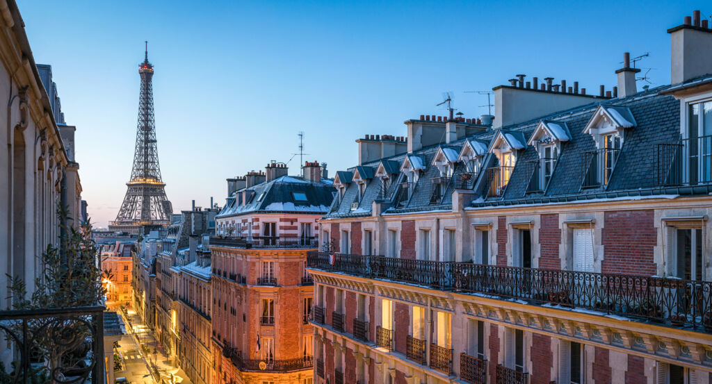
Why 10th Arrondissement matters.
10th Arrondissement is a kinetic enclave where historic faubourgs meet northeastern Paris through canal basins, railway approaches, covered passages and long commercial streets carrying the physical imprint of the capital's expansion beyond its early boundaries.
Positioned between 9th Arrondissement, 11th Arrondissement, and 19th Arrondissement, the neighborhood occupies a broad northeastern sector where the Grands Boulevards give way to the rising axes of Rue du Faubourg Saint-Denis and Rue du Faubourg Saint-Martin before railway infrastructure spreads across the northern edge. Dense apartment blocks, interior courtyards, narrow passages and broad transportation corridors produce rapid shifts in scale, preserving traces of older suburban settlement inside a district transformed by nineteenth-century growth. Rue du Faubourg Saint-Denis establishes the primary encounter through a commercial axis descended from the Roman road toward Beauvais, its long perspective carrying movement north from the former city gates through successive layers of Parisian expansion. Streets around Château d'Eau and Strasbourg-Saint-Denis deepen the physical character through theater facades, passages and tightly divided properties assembled around routes that predate the Arrondissement itself. Farther east, water, bridges and planted quays introduce an elongated open corridor through blocks whose dense street walls otherwise reinforce the district's metropolitan intensity. The result is a neighborhood where ancient roads, industrial expansion and major transportation systems remain physically intertwined, preparing a history shaped by Paris's repeated movement north beyond its former limits.
What you should know 10th Arrondissement.
10th Arrondissement is best known for consolidating several historic faubourgs into a single district when the 1860 enlargement of Paris established the modern Arrondissement boundaries. Long before that administrative creation, two Roman routes crossed the territory from Lutetia toward Beauvais and Saint-Denis, surviving through the alignments of Rue du Faubourg Saint-Denis and Rue du Faubourg Saint-Martin. Medieval Paris expanded toward these roads as religious houses, hospitals, farms and settlements accumulated outside the fortified city, turning the northern approaches into inhabited suburbs with economic lives distinct from the dense center. The eighteenth century strengthened their connection to Central Paris after the old defensive limits gave way to boulevards and ceremonial gateways, yet extensive tracts farther north still retained gardens and open ground. Restoration-era construction accelerated the transition through new streets including Rue de Chabrol in 1822 and Rue La Fayette in 1823, followed by development around the new Place Charles X between 1822 and 1825. Population growth pushed built Paris progressively toward the northern barrier, absorbing land that had remained peripheral only a generation earlier. Napoleon III's annexation of the surrounding communes in 1860 finally assembled these historically separate territories into the 10th Arrondissement, fixing a municipal boundary around urban growth that had already erased much of the distinction between Paris and its northern suburbs.
Railways supplied a separate mechanism for remaking the Arrondissement during the nineteenth century, concentrating two major termini within a short distance and reorganizing the northern edge around long-distance movement. The first Gare du Nord opened in 1846 for the Compagnie des chemins de fer du Nord, connecting Paris with an expanding network directed toward northern France and Belgium. Rising traffic led to its replacement between 1861 and 1866 by Jacques Ignace Hittorff's immense new station, whose facade joined grand arcades with sculptural personifications of destinations served by the railway. Gare de Strasbourg opened nearby in 1850 for traffic toward eastern France and took the Gare de l'Est name in 1854 as its network expanded. A second construction campaign enlarged that terminus during the 1920s and 1930s, giving the eastern railway system a far greater Parisian gateway. Boulevard de Strasbourg and Boulevard de Magenta simultaneously drove broad circulation axes through surrounding blocks, tying the termini to Central Paris and changing the scale of streets developed under earlier suburban conditions. Rail traffic, hotels, warehouses and commercial activity subsequently concentrated around both stations, establishing transportation as one of the principal forces governing the Arrondissement's northern urban form.
How 10th Arrondissement fits.
10th Arrondissement works as the anchor for a daytime exploration connecting an engineering project conceived to supply and transport goods through Paris, a seventeenth-century hospital built in response to epidemic disease and a Restoration church developed as the northern city expanded across former open ground.
Begin at Canal Saint-Martin, authorized by Napoleon Bonaparte on May 19, 1802 as part of a canal network designed to improve Parisian water supply and navigation, then delayed by imperial warfare before construction resumed under Louis XVIII. Prefect Gaspard de Chabrol laid the first stone on May 3, 1822, and the waterway opened in 1825 as a 4.5-kilometer connection between the Bassin de la Villette and the Seine, allowing boats to bypass the river's central loop and carry food and construction goods through the growing capital; later engineering placed sections underground, and six footbridges erected during the second half of the nineteenth century added another structural layer to its route. Continue to Hôpital Saint-Louis, founded by Henri IV in 1607 during a severe plague outbreak and constructed outside the dense city under architect Claude Vellefaux. Its original quadrilateral arrangement isolated infectious patients within an extensive enclosure, and Vellefaux supplemented the complex in 1613 and 1614 with a well and horse-powered piston pump; a 285-cubic-meter reservoir followed in 1669, and the vaulted Salle Henri IV received patients during a major scurvy outbreak in 1778. Nineteenth-century specialization subsequently made Saint-Louis a major center for dermatological medicine, with its bathing facilities delivering more than 100,000 baths during some years of the 1860s. Conclude at Église Saint-Vincent-de-Paul, commissioned for a northern parish whose earlier chapel on Rue Montholon had become too small as construction advanced across the former Clos Saint-Lazare. Jean-Baptiste Lepère received the architectural commission, the first stone was laid on August 25, 1824, and Jacques Ignace Hittorff assumed greater control of the project before proposing a revised design in 1833 with twin facade towers and a grand staircase inspired by Rome's Spanish Steps. The church opened in 1844, giving the expanding district an elevated neoclassical composition whose polychrome decoration extended Hittorff's wider investigations into color in ancient architecture. The progression moves from Napoleonic hydraulic engineering opening a navigable route across northeastern Paris through Henri IV and Vellefaux constructing an institution for epidemic isolation into Lepère and Hittorff answering nineteenth-century population growth with an ambitious religious commission, revealing successive responses to the water, health and architectural demands of an expanding capital.
Where your story begins.
Foresyte Travel reveals places that feel extraordinary long before you arrive.
Experience premium editorial crafted for luxury travelers.
Foresyte Travel may earn a commission when you book through the link on this page.














































































































