Why Devil's Bridge Trail matters.
Devil's Bridge Trail is a dramatic sandstone hiking route where Sedona's red-rock wilderness meets the geological forces that sculpted the Colorado Plateau, culminating in a natural arch suspended above the forested canyons of northern Arizona.
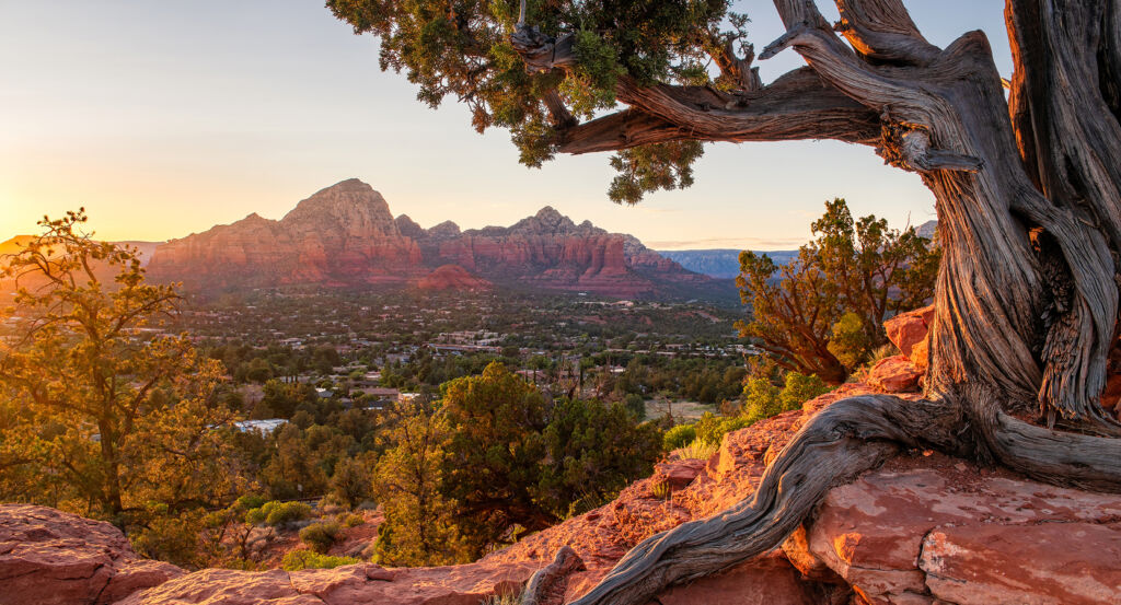
Extending into the Coconino National Forest northwest of Central Sedona, the trail follows the sandstone foothills beyond Dry Creek Road, ascending through the broken terrain of the Red Rock-Secret Mountain Wilderness toward an elevated natural arch overlooking the surrounding mesas and forested valleys. Its lower sections cross exposed sandstone, compacted earth and scattered juniper woodland. Higher elevations introduce steep rock steps, narrow ledges and increasingly expansive views across the surrounding formations. The final approach reaches a broad sandstone platform overlooking the arch and its steep-sided surroundings. The result is a demanding but accessible introduction to Sedona's erosional geology, combining a distinctive natural formation with the physical challenge of ascending the region's rugged sandstone terrain.
What defines Devil's Bridge Trail.
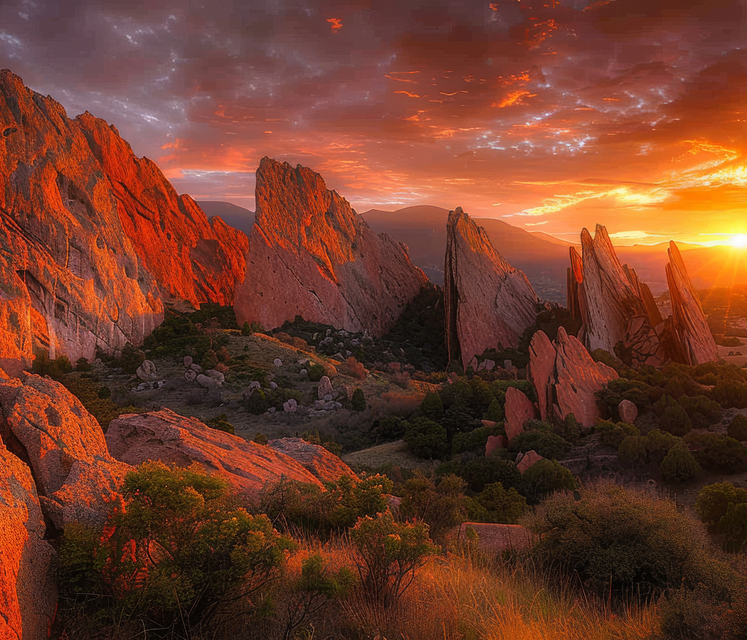
Devil's Bridge Trail is best known for leading to one of the largest natural sandstone arches in the Sedona region, a striking geological formation created through prolonged weathering and erosion of the Colorado Plateau's sedimentary rocks. The arch developed within the Schnebly Hill Formation, a sequence of Permian-age deposits responsible for much of Sedona's distinctive red-rock scenery. During the Permian Period, the region occupied a landscape shaped by shifting dunes, coastal plains and intermittent watercourses. Wind and water transported extensive quantities of sand and sediment across the ancient terrain, gradually accumulating deposits that later hardened into sandstone. Iron-bearing minerals oxidized within portions of these sediments, producing the reddish coloration characteristic of the exposed rock. Continued burial compacted the deposits and cemented their grains, establishing layers with differing resistance to weathering. Regional uplift subsequently raised these sedimentary formations above their original depositional environments. Streams and surface runoff removed overlying material, exposing the sandstone to erosion across the surrounding uplands. Fractures within the rock concentrated water penetration and encouraged the gradual separation of individual sandstone masses. Differential erosion removed less resistant material, creating recesses and openings beneath more durable sections of the formation. The surviving arch developed through this process, retaining a substantial span of sandstone above an eroded opening. Its geological structure belongs to the wider system of mesas, cliffs and isolated rock formations that characterize Sedona's landscape. Human occupation of the greater Verde Valley extends back thousands of years, with Indigenous communities maintaining extensive relationships with its water sources, mountains and seasonal environments. The Southern Sinagua established settlements and agricultural systems across the region during the late prehistoric period. Yavapai and Apache communities subsequently preserved important cultural connections with the surrounding terrain. Anglo-American settlement expanded during the nineteenth century, introducing ranching, agriculture and new transportation routes. Sedona developed as a small agricultural community before the growth of tourism and outdoor recreation during the twentieth century. The establishment and management of surrounding national forest lands helped preserve extensive areas of sandstone wilderness. Devil's Bridge Trail subsequently became a prominent recreational route as hiking and landscape photography attracted increasing attention to Sedona's natural formations.
Schnebly Hill sandstone displays the sedimentary structures responsible for the arch's layered appearance, including cross-bedding produced by ancient wind-driven dunes. These inclined internal layers preserve changes in sediment transport and deposition during the Permian Period. Variations in mineral composition and cementation influence the resistance of individual rock surfaces to erosion. The arch's principal span extends across a steep-sided opening, with substantial sandstone masses supporting its ends. Vertical fractures and horizontal bedding planes influence the distribution of stress within the formation. Rainfall moves rapidly across exposed rock surfaces, concentrating runoff along joints and accelerating the removal of loosened material. Freeze-thaw activity contributes to the gradual breakdown of sandstone during periods of seasonal temperature change. The surrounding slopes support pinyon pine, juniper and drought-tolerant shrubs adapted to the region's relatively dry climate. The trail begins near the Dry Creek Road corridor, with access varying according to vehicle capability and the condition of the unpaved approach roads. Standard passenger vehicles generally require a longer hiking approach from designated parking areas, particularly when the final road section is unsuitable for low-clearance vehicles. The principal trail ascends through forested sandstone terrain before reaching increasingly steep rock steps. Its final section requires careful footing across exposed stone surfaces and uneven natural stairways. The route reaches an elevated viewpoint overlooking the arch, revealing the formation's narrow profile and substantial drop beneath its span. The sandstone surface provides an unobstructed view across the surrounding red-rock landscape, including distant mesas and forested ridges. The exposed setting requires particular attention to footing, especially near the edges of the arch and adjoining cliffs. Morning and afternoon light produce pronounced contrasts between illuminated sandstone and the shadows within the surrounding canyon. The formation's distinctive geometry and elevated position have made it a major subject of Sedona landscape photography. Its preservation within the national forest maintains public access to a significant example of natural arch formation through sedimentary erosion.
How Devil's Bridge Trail fits.
Devil's Bridge Trail works as the geological anchor for a Sedona outing connecting the region's protected sandstone wilderness, its historical agricultural settlement and the riparian ecosystems that distinguish the Verde Valley.
Begin at Fay Canyon Trail, the relatively gentle hiking route situated within the Coconino National Forest west of Central Sedona. The trail follows a sheltered canyon enclosed by towering sandstone walls, passing juniper woodland, desert shrubs and seasonal vegetation adapted to the canyon's variable moisture conditions. Its route provides views of layered rock formations and a natural arch situated above the canyon floor. The surrounding cliffs preserve the geological effects of erosion along fractures and sedimentary bedding planes. The canyon's protected environment supports a different vegetation pattern from the more exposed sandstone uplands, establishing a detailed perspective on Sedona's ecological diversity. Continue to Sedona Heritage Museum, housed within the historic Jordan family homestead in the Uptown district. The museum preserves the agricultural and domestic history of Sedona's early Anglo-American settlement, particularly the development of orchards and farming along Oak Creek. Walter and Ruth Jordan established their homestead during the twentieth century, cultivating fruit trees and contributing to the area's agricultural economy. The surviving buildings contain household objects, farming equipment and historical exhibits associated with ranching, agriculture and community development. Collections also examine Sedona's history as a location for Western film production, connecting the town's dramatic scenery with the growth of the American motion-picture industry. Conclude at Red Rock State Park, the protected natural area situated southwest of Sedona along Oak Creek. Established in 1991, the park preserves riparian woodland, sandstone hills and high-desert habitats across a substantial conservation landscape. Its trail system crosses the creek and ascends toward elevated viewpoints overlooking the surrounding red-rock formations. Interpretive programs examine regional ecology, wildlife and the environmental importance of perennial watercourses in the desert Southwest. The park's protected landscape supports native birds, mammals and plant communities associated with the Verde Valley's varied habitats. The progression moves from Fay Canyon Trail's sheltered sandstone environment through Sedona Heritage Museum's settlement history and culminates at Red Rock State Park's protected ecosystems, connecting Devil's Bridge Trail with the geological and cultural development of Sedona.
Where your story begins.
Foresyte Travel reveals places that feel extraordinary long before you arrive.
Enjoy editorial crafted for luxury travelers.
Foresyte may earn a commission when you book.