Why Independence Pass matters.
Independence Pass is a high-altitude Continental Divide crossing where the Sawatch Range's glacially sculpted alpine terrain meets Colorado's silver-mining history, the engineering of mountain transportation routes and the preservation of one of the Rocky Mountains' most dramatic seasonal highways.
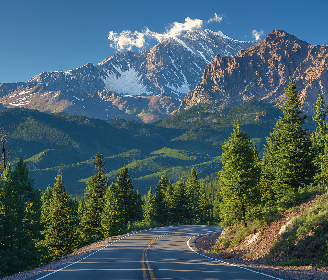
Set along Colorado State Highway 82 between Aspen and Twin Lakes, the mountain pass occupies a 12,095-foot saddle on the Continental Divide, between the headwaters of the Roaring Fork River to the west and the Upper Arkansas River watershed to the east. Broad alpine tundra extends across the summit beneath surrounding ridgelines, with scattered rock outcrops and low vegetation exposed to severe mountain weather. The highway approaches through narrow valleys, steep switchbacks and forested slopes before crossing the open crest. A paved summit overlook and short walking paths provide access to views across the surrounding peaks and glacial basins. The result is a mountain crossing whose elevation, watershed position and seasonal highway preserve the relationship between Colorado's mining-era transportation ambitions and the physical constraints of the Central Rocky Mountains.
What defines Independence Pass.
Independence Pass is best known for carrying Colorado State Highway 82 across the Continental Divide at 12,095 feet, connecting the Roaring Fork Valley with the Upper Arkansas River basin through a route developed during the state's nineteenth-century silver-mining expansion. The crossing lies within the Sawatch Range, whose high summits and deeply incised valleys developed through successive episodes of tectonic uplift, erosion and Pleistocene glaciation. Before permanent wagon roads reached the mountains, Indigenous peoples traveled through the region using established routes between seasonal hunting grounds and neighboring valleys. Prospectors entered the Upper Roaring Fork drainage during the Colorado silver rush of the late 1870s, searching for mineral deposits in the mountains east of the future Aspen settlement. In 1879, miners established a settlement named Independence near the western approach to the pass after discovering silver-bearing ore in the surrounding mountains. The town grew rapidly during the following year, supporting mining claims, cabins, commercial establishments and a substantial seasonal population. Its position near the divide provided access to mineral prospects but imposed severe winter conditions and difficult transportation arrangements. The pass acquired its name through its association with the mining settlement, linking the geographic crossing with the earliest period of organized prospecting in the Upper Roaring Fork Valley. A wagon road over the divide developed during the early 1880s, connecting Aspen's expanding mining economy with Leadville and transportation routes farther east. The road required extensive grading across steep slopes, with narrow sections and difficult grades limiting the movement of freight and passengers. Railroad construction into Aspen during the late 1880s reduced the economic importance of the mountain crossing, redirecting substantial commercial traffic toward more reliable transportation corridors. The original Independence settlement declined as mining activity shifted toward richer deposits and lower-elevation communities. Automobile travel renewed interest in the route during the twentieth century, and improvements eventually established the crossing as part of Colorado's state highway network. The highway became an important seasonal connection between Aspen and the Arkansas Valley, with winter snow accumulation requiring annual closures across the highest elevations. Its development preserves a transportation corridor whose origins lie in mining, whose engineering follows demanding mountain terrain and whose seasonal operation remains governed by alpine weather.
Colorado State Highway 82 approaches the summit through a sequence of distinct mountain environments, beginning in forested valleys and climbing toward exposed alpine tundra above the tree line. On the western approach, the road follows the Upper Roaring Fork River through steep terrain characterized by narrow pavement, rock walls and substantial elevation changes. Several sections restrict vehicles longer than 35 feet, reflecting the limited width and sharp curves of the historical mountain alignment. The eastern approach rises through the Lake Creek drainage, with broad valley sections gradually narrowing toward the higher slopes of the Sawatch Range. The summit occupies a shallow saddle where the Continental Divide separates waters flowing toward the Colorado River system from those entering the Arkansas River and ultimately the Mississippi River drainage. Short walking paths extend from the highway toward nearby viewpoints, crossing tundra vegetation adapted to a brief growing season and prolonged winter snow cover. Alpine grasses, sedges and low flowering plants occupy sheltered areas between exposed rocks, with seasonal wildflowers appearing during the summer months. The surrounding mountains contain glacial cirques, steep headwalls and broad valleys shaped by the movement of ancient ice. Snowfields persist on shaded slopes into summer, feeding streams that descend toward the lower river valleys. Mountain goats, marmots and American pikas inhabit the high-elevation environment, occupying rocky slopes and alpine meadows. The summit's open terrain provides views toward the surrounding Sawatch peaks, including the ridgelines extending toward Mount Elbert and La Plata Peak. Weather conditions change rapidly at this elevation, with afternoon thunderstorms, strong winds and early-season snowfall influencing recreational access. The Colorado Department of Transportation closes the pass during winter, generally reopening the highway in late spring after substantial snow removal and roadway inspection. Seasonal access creates a concentrated period for sightseeing, cycling, hiking and travel between Aspen and Twin Lakes. The route's combination of steep grades, exposed summit terrain and extensive mountain views preserves the physical demands of crossing the Continental Divide through Colorado's central high country.
How Independence Pass fits.
Independence Pass works as the geographical centerpiece for a high-country itinerary connecting the earliest silver-mining settlements of the Upper Roaring Fork Valley, the preservation of nineteenth-century mountain communities and the historical transportation routes that shaped Colorado's interior mountain development.
Begin at Independence Ghost Town, the preserved mining settlement situated along the western approach to the pass. Founded in 1879 following the discovery of silver deposits, the town developed rapidly as prospectors established cabins, mining claims and commercial establishments near the Upper Roaring Fork River. Its elevation above 10,000 feet exposed residents to severe winter conditions, complicating the transport of food, fuel and mining equipment. The settlement declined during the 1880s as economic activity shifted toward Aspen and more productive mining districts. Aspen Historical Society maintains the surviving structures, including cabin remains and mining-era buildings, preserving the physical setting of the area's earliest organized silver prospecting. Continue to Twin Lakes, the mountain community and adjoining glacial lakes situated east of the Continental Divide. The settlement developed during Colorado's nineteenth-century mining expansion, serving travelers and commercial traffic moving between Leadville, Aspen and surrounding mountain districts. The two lakes occupy a broad glacial basin beneath the eastern slopes of the Sawatch Range, with Mount Elbert rising above their northern shoreline. Historic buildings preserve elements of the settlement's early commercial and residential development. The lakes subsequently became important recreational destinations, supporting boating, fishing and access to nearby mountain trails. Conclude at Leadville National Historic Landmark District, the preserved mining-era urban center situated farther northeast in the Upper Arkansas Valley. Leadville's silver boom accelerated during the late 1870s, attracting entrepreneurs, laborers and investors to one of Colorado's richest mining districts. Its commercial streets developed substantial masonry buildings, theaters, hotels and civic institutions financed by mineral wealth. The Tabor Opera House, completed in 1879, became a prominent venue for theatrical performances and public gatherings. The district preserves an extensive concentration of nineteenth-century commercial architecture, connecting the town's mining prosperity with the development of transportation, banking and cultural institutions in the Central Rockies. The progression moves from a remote prospecting settlement through a mountain transportation community and culminates in Leadville's substantial mining-era urban center, placing Independence Pass within the economic geography of Colorado's nineteenth-century silver boom.
Where your story begins.
Foresyte Travel reveals places that feel extraordinary long before you arrive.
Enjoy editorial crafted for luxury travelers.
Foresyte may earn a commission when you book.