Why Kasha-Katuwe Tent Rocks National Monument matters.
Kasha-Katuwe Tent Rocks National Monument is a striking volcanic preserve where the Pajarito Plateau's ancient eruptive history meets the cultural heritage of Cochiti Pueblo and the sculptural forces that created northern New Mexico's distinctive cone-shaped rock formations.
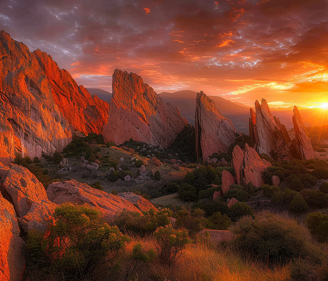
Situated southwest of Santa Fe on the eastern flanks of the Jemez Mountains, the monument occupies a rugged landscape within the traditional lands of Cochiti Pueblo, where narrow drainage channels cut through pale volcanic deposits above the Rio Grande Valley and the surrounding piñon-juniper foothills. Tapered rock spires rise from eroded slopes, their pale surfaces interrupted by darker volcanic capstones. Narrow passages wind between towering walls of compacted ash, exposing intricate layers of ancient eruptive material. Elevated ridges overlook the surrounding mesas, forested mountains and distant valleys. The result is a protected geological landscape whose unusual formations, Indigenous significance and concentrated volcanic history distinguish it within the American Southwest.
What defines Kasha-Katuwe Tent Rocks National Monument.
Kasha-Katuwe Tent Rocks National Monument is best known for its cone-shaped volcanic formations, narrow slot canyons and geological connection to the explosive eruptions that shaped the Jemez Mountains. The name Kasha-Katuwe derives from the Keresan language of Cochiti Pueblo and means “white cliffs,” describing the pale volcanic formations that distinguish the landscape. The monument's geological history began millions of years ago during periods of intense volcanic activity associated with the Jemez volcanic field. Explosive eruptions deposited extensive quantities of ash, pumice and fragmented volcanic rock across the surrounding region. These deposits accumulated in thick layers that gradually consolidated into volcanic tuff and related sedimentary materials. Subsequent eruptions introduced additional deposits with differing mineral compositions, grain sizes and resistance to weathering. Regional uplift and prolonged erosion exposed these formations to the effects of rainfall, runoff and seasonal temperature changes. Water concentrated along fractures and drainage channels, progressively removing softer material from the volcanic slopes. More resistant rock fragments protected portions of the underlying deposits, contributing to the development of the monument's distinctive tent-shaped cones. The resulting formations preserve a visible relationship between ancient volcanic activity and the erosional processes that continue to shape the landscape. Cochiti Pueblo maintains longstanding cultural and ancestral connections with the surrounding territory, including its mountains, waterways and geological features. The region's Indigenous history extends through centuries of settlement, agricultural activity and ceremonial relationships with the land. Spanish colonial expansion introduced new political and religious pressures during the seventeenth century, altering the broader historical circumstances of Pueblo communities. Federal protection of the area followed growing recognition of its geological significance and cultural importance. President Bill Clinton established Kasha-Katuwe Tent Rocks National Monument on January 17, 2001, under the Antiquities Act. The designation protected 4,645 acres of volcanic formations, canyons and surrounding natural habitat. The Bureau of Land Management assumed responsibility for administering the monument in cooperation with Cochiti Pueblo. Recreational access subsequently centered on designated hiking routes through the volcanic terrain. The monument closed to public visitation in March 2020, initiating an extended period of restricted access and discussions concerning visitor management. A reservation-based reopening in November 2024 introduced new arrangements developed with Cochiti Pueblo to protect cultural resources and manage recreational pressure. Its conservation history demonstrates the importance of Indigenous participation in the stewardship of culturally significant federal lands.
Cochiti Pueblo's relationship with the monument provides an essential cultural context for understanding its protected landscape and contemporary management. The pueblo's traditional territory encompasses extensive areas of the surrounding Rio Grande Valley and the eastern Jemez foothills. Its continuing cultural practices maintain connections with ancestral places and the natural features of the region. Within the monument, volcanic deposits display alternating bands of pale gray, beige and pinkish material produced by variations in eruptive composition and subsequent weathering. The tent-shaped formations rise from steep slopes, with individual cones displaying narrow summits and broad bases. Darker capstones protect selected formations from direct erosion, producing distinctive profiles above the surrounding terrain. The Canyon Trail follows a drainage corridor through increasingly confined volcanic walls, entering passages where erosion has created narrow openings between substantial rock masses. Its upper sections ascend toward elevated viewpoints overlooking the formations and surrounding mountain landscape. The Cave Loop Trail traverses a gentler section of the monument, passing exposed volcanic deposits and a small cave excavated into the rock. The cave preserves evidence of human modification within the volcanic landscape, connecting the monument's geology with its history of occupation and use. Piñon pine, juniper and drought-tolerant shrubs occupy the surrounding slopes, illustrating the adaptation of woodland vegetation to the region's relatively dry climate. Seasonal runoff moves through the narrow canyons, contributing to continued erosion and creating potential hazards during periods of heavy rainfall. The monument's fragile rock surfaces are particularly vulnerable to damage from off-trail activity and concentrated visitation. Designated trails and managed access help protect the formations and surrounding cultural resources. The landscape's striking appearance results from the interaction of resistant volcanic fragments, compacted ash deposits and the persistent removal of softer material by water and wind. Its geological formations preserve an unusually accessible example of the processes that transform volcanic deposits into complex erosional landscapes.
How Kasha-Katuwe Tent Rocks National Monument fits.
Kasha-Katuwe Tent Rocks National Monument works as the geological anchor for a northern New Mexico outing connecting the volcanic origins of the Jemez Mountains, the continuing cultural traditions of Pueblo communities and the archaeological history of the Rio Grande Valley.
Begin at Valles Caldera National Preserve, the expansive volcanic basin situated within the Jemez Mountains northwest of Santa Fe. The preserve encompasses the collapsed caldera created by enormous prehistoric eruptions, establishing the geological foundation for extensive portions of the surrounding plateau. Broad grassland valleys occupy the basin floor, enclosed by forested volcanic peaks and high-elevation ecosystems. The protected landscape supports substantial elk populations, mountain streams and extensive meadow habitats. Interpretive programs examine the region's volcanic development and its longstanding cultural significance to Indigenous communities. Continue to Coronado Historic Site, the archaeological and historical preserve situated near Bernalillo along the Rio Grande. The site contains the remains of Kuaua Pueblo, a substantial Indigenous settlement occupied during the period of early Spanish exploration. Its preserved archaeological features include masonry foundations and a reconstructed ceremonial kiva containing reproductions of historic wall paintings. The site's interpretation examines Pueblo architecture, agricultural life and the arrival of Francisco Vázquez de Coronado's expedition in 1540. Its position overlooking the Rio Grande provides a direct geographical connection with the river systems that supported regional settlement. Conclude at Indian Pueblo Cultural Center, the cultural institution situated in Albuquerque and dedicated to the histories and continuing traditions of New Mexico's Pueblo communities. Established in 1976, the center presents exhibitions examining Pueblo history, pottery, weaving, architecture and contemporary cultural practices. Its programs include traditional dance performances, educational activities and exhibitions developed through relationships with Pueblo artists and communities. The institution provides a broader perspective on the nineteen Pueblo nations of New Mexico and their distinct cultural traditions. The progression moves from Valles Caldera National Preserve's volcanic landscape through Coronado Historic Site's archaeological remains and culminates at Indian Pueblo Cultural Center's continuing Indigenous traditions, connecting Kasha-Katuwe Tent Rocks National Monument with the geological and cultural history of northern New Mexico.
Where your story begins.
Foresyte Travel reveals places that feel extraordinary long before you arrive.
Enjoy editorial crafted for luxury travelers.
Foresyte may earn a commission when you book.