Why Slide Rock State Park matters.
Slide Rock State Park is a distinctive creekside preserve where Oak Creek Canyon's towering sandstone cliffs meet the agricultural heritage of Sedona's early settlers and the natural water chutes that transformed a historic apple orchard into one of Arizona's most recognizable swimming destinations.
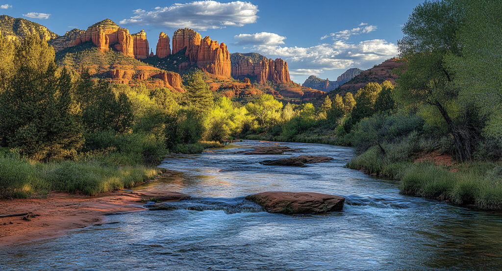
Situated along State Route 89A north of Central Sedona, the park occupies a narrow stretch of Oak Creek Canyon between steep forested slopes and the creek's winding sandstone channel, with its historic orchard terraces extending above the water beneath the canyon's towering red-rock walls. Smooth rock shelves descend into shallow pools, forming a succession of natural slides shaped by flowing water. Historic agricultural buildings stand among mature apple trees, preserving the property's former use as a working farm. Creekside paths connect the orchard with swimming areas, where exposed sandstone creates a striking contrast with riparian vegetation. The result is a protected recreational landscape whose natural swimming formations and surviving agricultural structures preserve two consequential chapters of Sedona's history.
What defines Slide Rock State Park.
Slide Rock State Park is best known for its natural sandstone water slide and the historic Pendley Homestead, which preserves an important chapter in the agricultural settlement of Oak Creek Canyon. The canyon developed through prolonged erosion by Oak Creek, which cut into sedimentary formations along the southern margin of the Colorado Plateau. Its steep walls expose geological deposits accumulated across ancient desert, coastal and shallow-water environments. Perennial water created a comparatively fertile corridor through the surrounding high-desert landscape, supporting riparian vegetation and agricultural settlement. Indigenous communities maintained longstanding relationships with Oak Creek and the greater Verde Valley, drawing upon its water, plants and seasonal resources. During the late nineteenth century, settlers began establishing farms and orchards along accessible stretches of the canyon. Frank L. Pendley acquired land along Oak Creek in 1907 and began developing an agricultural property that eventually became the park. His farming operation depended upon diverting creek water onto terraces above the channel, where the canyon's sheltered conditions supported fruit cultivation. Pendley constructed an irrigation system that carried water across difficult terrain and sustained an expanding orchard. Apple production became the property's principal agricultural activity, connecting the homestead with Sedona's early commercial farming economy. The orchard operated during a period when improved transportation gradually expanded access to the region's agricultural products. Pendley's family also developed facilities associated with visitors drawn to the canyon's scenery and recreational opportunities. The property's natural swimming areas attracted increasing attention as automobile travel made Oak Creek Canyon more accessible. The distinctive sandstone chute became widely associated with the name Slide Rock, eventually giving the recreational site its familiar designation. Arizona acquired the property in 1985 to preserve its historic structures, agricultural landscape and natural recreational features. Slide Rock State Park opened to the public in 1987 under the administration of Arizona State Parks. The surviving orchard and homestead structures became central elements of the park's historical interpretation. Its development as a state park established a permanent relationship between recreational access, cultural preservation and the protection of Oak Creek's sensitive environment.
Frank Pendley's irrigation works provide an unusually direct connection between the canyon's natural geography and the agricultural engineering required to cultivate its narrow terraces. Water diverted from Oak Creek supplied the orchard through channels designed to distribute moisture across the cultivated slopes. The system supported apple trees in a region where rainfall alone provided an unreliable foundation for commercial fruit production. Historic structures associated with the homestead include the Pendley residence and agricultural buildings that preserve the physical organization of the former farm. The orchard's surviving trees connect the property with a period when fruit growing formed an important part of Sedona's economy. Beneath the cultivated terraces, the creek passes across exposed sandstone belonging to the region's extensive sedimentary formations. Flowing water has polished sections of the channel into smooth, sloping surfaces that function as natural water slides. The principal sliding area extends through a narrow chute where the current carries swimmers toward deeper pools. Seasonal changes in streamflow alter the speed, depth and character of the water. Algae growing on submerged rock contributes to the slippery surfaces associated with the site's recreational appeal. The surrounding riparian corridor supports Arizona sycamore, cottonwood and other vegetation dependent upon the creek's perennial moisture. Canyon walls create areas of shade that moderate temperatures along portions of the stream. Swimming access requires careful attention to water conditions, slippery rock and the possibility of sudden changes in flow. Water quality also influences recreational management, particularly following storms that introduce sediment and runoff into the creek. The park's walking routes connect historic agricultural features with the creek's natural swimming areas. Interpretive displays explain the Pendley family's farming activities and the property's transition into public ownership. The combination of a functioning riparian environment, preserved orchard and natural sandstone chute distinguishes the park within northern Arizona's recreational landscape.
How Slide Rock State Park fits.
Slide Rock State Park works as the creekside anchor for a Sedona outing connecting Oak Creek Canyon's dramatic geological formations, the region's forested highlands and the historic infrastructure that supported travel through northern Arizona.
Begin at Midgley Bridge, the substantial highway crossing situated near the southern entrance to Oak Creek Canyon. Completed in 1939, the steel arch bridge carries State Route 89A across Wilson Canyon, establishing an important transportation connection between Sedona and the canyon's northern reaches. Its elevated position provides views of sandstone cliffs, forested slopes and the deeply incised drainage below. The bridge's engineering responded to the difficult terrain encountered during the development of modern road access through the region. Nearby viewpoints reveal the relationship between the roadway and the canyon's steep geological formations. Continue to West Fork Trail, a forested hiking route following one of Oak Creek Canyon's principal tributary valleys. The trail passes the historic Mayhew Lodge site, associated with early twentieth-century accommodations that attracted travelers seeking the canyon's secluded scenery. Its route crosses the stream repeatedly beneath towering sandstone walls, moving through stands of maple, oak and conifer. The narrow canyon creates a cooler environment than the surrounding exposed uplands, supporting vegetation associated with higher moisture levels. Seasonal autumn color makes the valley particularly distinctive within Arizona's predominantly evergreen and desert landscapes. Conclude at Oak Creek Vista, the elevated overlook near the northern rim of Oak Creek Canyon. The viewpoint occupies a prominent position along the highway above the winding descent toward Sedona, providing extensive views across the canyon's forested slopes and layered rock walls. Its elevation reveals the transition between the Colorado Plateau's upland forests and the lower sandstone country surrounding Sedona. Interpretive displays explain the canyon's geological development and the engineering challenges of the highway. The overlook also accommodates Native American artisans who sell handmade jewelry and crafts, maintaining a connection between the region's cultural traditions and its principal scenic corridor. The progression moves from Midgley Bridge's transportation engineering through West Fork Trail's forested canyon environment and culminates at Oak Creek Vista's elevated geological panorama, connecting Slide Rock State Park with the landscapes and infrastructure of Oak Creek Canyon.
Where your story begins.
Foresyte Travel reveals places that feel extraordinary long before you arrive.
Enjoy editorial crafted for luxury travelers.
Foresyte may earn a commission when you book.