Why Uetliberg matters.
Uetliberg is a forested mountain summit where Friesenberg's hillside meets the geological history of the Swiss Plateau, the medieval fortifications of the city's western heights and a panoramic landscape extending from Lake Zürich to the Alps.
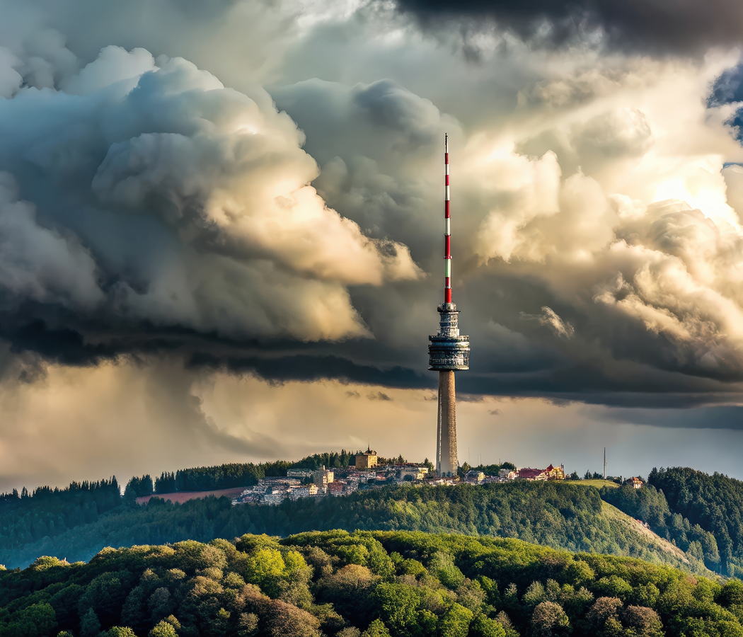
Set atop the Albis ridge near Uetliberg railway station and just steps from the Uetliberg observation tower, the summit rises southwest of Central Zürich above the Sihl valley, the wooded slopes of Triemli and the residential districts extending toward Wiedikon. Dense beech and fir forests cover the ascending hillsides, opening around the summit into clearings that overlook the city's rooftops, lake basin and surrounding mountain ranges. Gravel footpaths, stepped woodland trails and broad viewing terraces connect the railway approach with the mountain's highest public spaces. The summit's telecommunications tower rises above the forest canopy, forming a distinctive vertical marker visible across much of the metropolitan area. The result is a mountain whose accessible summit, layered geological terrain and commanding views connect Zürich's urban geography with the wider landscape of northeastern Switzerland.
What defines Uetliberg.
Uetliberg is best known as Zürich's local mountain, rising to 870 meters above sea level and occupying a prominent position within the Albis ridge overlooking the city. Its geological origins belong to the formation of the Swiss Molasse Basin, where sediments accumulated during the uplift and erosion of the Alps. Rivers transported gravel, sand and finer materials northward from the developing mountain chain, depositing successive layers across the Alpine foreland. These deposits consolidated into conglomerate, sandstone and marl, forming the geological foundation of the hills surrounding Zürich. Subsequent erosion shaped the Albis ridge and the valleys separating it from neighboring uplands, establishing the steep wooded slopes characteristic of Uetliberg. The mountain's elevated position attracted human settlement and defensive activity during prehistoric periods, including occupation associated with the Late Bronze Age and Iron Age. Archaeological remains on the summit and adjoining slopes include evidence of fortifications associated with the strategic control of routes through the surrounding valleys. The Uetliberg oppidum became an important fortified settlement during the Celtic La Tène period, reflecting the political and commercial organization of communities occupying the northern Alpine foreland. Its defensive earthworks exploited the mountain's naturally steep terrain, concentrating access through more manageable approaches along the ridge. The site subsequently acquired medieval significance through the construction of Uetliburg, a fortified complex associated with the regional nobility. The castle's history belongs to the development of territorial authority around Zürich during the High Middle Ages, when elevated strongholds controlled important routes and surrounding agricultural lands. The fortress eventually disappeared as a functioning defensive center, leaving archaeological traces within the wooded summit landscape. Uetliberg's recreational importance increased during the nineteenth century as Zürich expanded and excursions into the surrounding hills became an established part of urban leisure. The development of mountain hospitality and improved access transformed the summit into a destination for walking, dining and panoramic observation. The Uetliberg railway opened in 1875, creating a direct connection between Zürich and the mountain's upper slopes. Its construction represented an important achievement in Swiss suburban railway development, allowing residents and visitors to reach the ridge through a regular rail service. The railway's steep gradients required specialized engineering and careful route planning across the ascending terrain. Electrification during the twentieth century further integrated the line into Zürich's expanding transportation system. The mountain's historical significance rests on its prehistoric fortifications, medieval strategic importance and transformation into a major recreational destination through the development of modern railway infrastructure.
The Uetliberg railway provides the principal public transportation approach to the summit, ascending from Zürich's urban districts through wooded slopes and hillside residential areas. Its route incorporates substantial gradients and curving sections adapted to the terrain, establishing a distinctive example of mountain-oriented suburban rail engineering. The final approach leads to a station below the summit, where pedestrian paths continue through the forest toward the principal viewing areas. The Uetliberg observation tower provides an elevated vantage point above the surrounding trees, extending the visible landscape across Zürich, Lake Zürich and the northern Alpine ranges. On clear days, the panorama includes distant peaks associated with the Glarus and Bernese Alps, connecting the city's immediate geography with the wider mountain system. The summit's telecommunications tower forms another important structural feature, supporting broadcasting infrastructure within a prominent elevated position. Its steel structure rises above the forest, creating a recognizable element of the skyline visible from the lakefront and surrounding districts. Hotel Uto Kulm occupies a substantial portion of the summit precinct, continuing the mountain's established hospitality tradition through dining facilities and panoramic terraces. The surrounding woodland contains extensive networks of recreational paths, including routes that follow the Albis ridge toward Felsenegg. The Planetenweg, a scale-model planetary trail, introduces an educational dimension to the ridge walk through installations representing the Sun and planets at proportional distances. Its route connects astronomical concepts with the physical distances encountered along the mountain path, extending the summit's recreational character into outdoor scientific education. The ridge's forest environment supports a variety of Central European woodland species, including roe deer, foxes and numerous resident birds. Beech trees define substantial portions of the slopes, accompanied by conifers and other species adapted to the region's temperate climate. Seasonal changes produce marked differences in the forest landscape, with spring foliage, summer canopy cover and autumn coloration altering the character of the walking routes. Winter conditions occasionally place the summit above low cloud covering the Zürich basin, creating expansive views across a layer of valley fog toward the surrounding Alpine peaks. The mountain's recreational infrastructure accommodates walking, running and cycling on designated routes, supporting extensive outdoor activity within close reach of the metropolitan center. Its position along the Albis ridge also connects the city with a larger network of protected woodland and regional hiking trails. Uetliberg's distinctive character emerges from the combination of accessible mountain transportation, extensive forest ecology and a summit landscape offering direct geographical perspective on Zürich and the Swiss Plateau.
How Uetliberg fits.
Uetliberg works as the elevated centerpiece for a Zürich itinerary connecting the city's historic mountain railway, the recreational landscapes of the Albis ridge and the river valleys that shaped the development of its surrounding settlements.
Begin at Uetliberg Railway Station, the mountain terminus reached by the S10 service from Zürich Hauptbahnhof. The railway's historical development established one of the city's earliest direct connections between the metropolitan center and the surrounding recreational uplands. Its route ascends through residential districts and wooded terrain, demonstrating the engineering adaptations required for railway operation across substantial elevation changes. The station occupies a sheltered position below the summit, with pedestrian routes leading toward panoramic viewpoints and ridge trails. Its continued transportation function preserves the relationship between nineteenth-century railway investment and Zürich's established tradition of accessible outdoor recreation. Continue to Felsenegg, the elevated viewpoint occupying the Albis ridge south of Uetliberg. The location overlooks Lake Zürich, the Sihl valley and the surrounding mountain ranges, establishing a broad perspective on the geographical structure of the region. The ridge walk connecting the two summits passes through mature woodland and open sections of hillside, with changing views across the lake basin and neighboring valleys. Felsenegg is also connected to Adliswil by an aerial cableway, introducing another form of mountain transportation within the regional recreational network. The destination's combination of hiking access, panoramic terraces and cableway infrastructure establishes an important counterpart to Uetliberg's railway-oriented summit. Conclude at Sihlwald, the extensive protected forest occupying the Sihl valley south of Zürich. The woodland forms part of the Wildnispark Zürich conservation area, preserving a substantial example of the natural forest ecosystems historically associated with the Swiss Plateau. Its protected status supports ecological processes involving mature trees, deadwood and the regeneration of indigenous vegetation. Educational trails introduce the forest's ecological characteristics and the importance of allowing natural woodland development. The surrounding valley contains the Sihl River, whose course contributed to the historical geography and industrial development of communities approaching Zürich. The progression moves from the railway infrastructure that opened Uetliberg to metropolitan recreation through the panoramic landscapes of the Albis ridge and culminates in a protected forest preserving the region's woodland ecology.
Where your story begins.
Foresyte Travel reveals places that feel extraordinary long before you arrive.
Enjoy editorial crafted for luxury travelers.
Foresyte may earn a commission when you book.