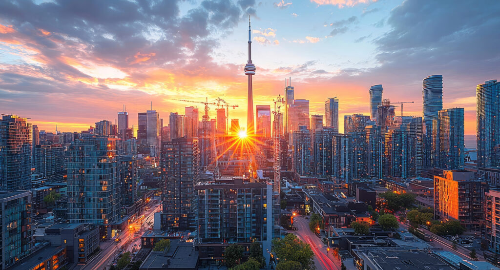
Why you should experience Cherry Street in Toronto, Ontario.
Cherry Street is a storied corridor where West Don Lands' industrial heritage, waterfront renewal, engineering ambition, and cultural reinvention reveal one of Toronto's most transformative urban landscapes.
Running through West Don Lands between Distillery District and Port Lands, the corridor connects former harbour industries, restored heritage infrastructure, river engineering projects, and contemporary public spaces that collectively demonstrate Toronto's continual relationship with Lake Ontario and the Don River. Successive blocks reveal how shipping, manufacturing, flood protection, transportation investment, and adaptive urban planning reshaped an industrial waterfront into one of the city's most compelling destinations. Throughout the corridor, preserved industrial structures, modern civic investments, and expansive public realm improvements express more than a century of urban evolution. The result is an experience defined by resilience, reinvention, and one of Toronto's most distinctive waterfront corridors.
What you should know about Cherry Street.
Cherry Street is best known for serving Toronto's eastern waterfront after large-scale harbour improvements undertaken by the Toronto Harbour Commission, established in 1911, transformed marshland and industrial shoreline into an organized network of shipping facilities, rail infrastructure, and port industries. Construction of the Cherry Street Strauss Trunnion Bascule Bridge in 1930, engineered by the Toronto Harbour Commission, created one of Canada's few surviving Strauss trunnion bascule bridges, employing riveted structural steel, massive concrete counterweights, and electrically powered lifting machinery to accommodate both roadway traffic and marine navigation. The corridor became a vital industrial artery serving manufacturers, petroleum storage facilities, port warehouses, grain handling operations, and extensive rail sidings operated by the Canadian National Railway and Canadian Pacific Railway, reinforcing Toronto's position as one of Canada's principal Great Lakes ports. Subsequent public investment introduced modern flood protection infrastructure, reconstructed utilities, complete streets improvements, and new municipal services supporting long-term redevelopment across the eastern waterfront. Together, these harbour works, engineering achievements, transportation systems, industrial enterprises, and public infrastructure established Cherry Street as one of Toronto's defining waterfront corridors.
Realignment of the Don River through the Don Mouth Naturalization and Port Lands Flood Protection Project represents one of Canada's largest urban river restoration initiatives, creating new river valleys, wetlands, bridges, and engineered flood protection designed to unlock extensive redevelopment opportunities across the eastern waterfront. Implementation of the West Don Lands Precinct Plan established coordinated standards for parks, streets, utilities, sustainable infrastructure, and mixed-density urban development while guiding long-term neighbourhood growth. Oversight by Waterfront Toronto, working alongside the City of Toronto, Province of Ontario, and Government of Canada, has coordinated environmental remediation, infrastructure renewal, public investment, and phased redevelopment throughout the surrounding district. Collectively, these river engineering projects, planning initiatives, intergovernmental partnerships, environmental restoration programs, and infrastructure investments demonstrate how Cherry Street continues evolving through some of Toronto's most ambitious city-building efforts.
How to fold Cherry Street into your trip.
Cherry Street works as an exploration of Toronto's industrial waterfront, evolving public realm, and harbour history.
Begin at Corktown Common, where expansive native landscapes, wetlands, and elevated landforms introduce the flood-resilient design principles that now define the West Don Lands while establishing the environmental story behind the surrounding waterfront transformation. Continue to Distillery District, where meticulously preserved Victorian industrial buildings, artisan workshops, galleries, and public plazas reveal how nineteenth-century manufacturing spaces have been reimagined into one of Toronto's most celebrated cultural destinations before leading naturally toward the harbour. Conclude at Polson Pier, where sweeping skyline views across the Inner Harbour provide the resonant payoff, bringing Toronto's maritime landscape, working port, and evolving waterfront into a single unforgettable panorama. Together, the sequence moves from ecological renewal to industrial heritage before culminating at the harbour itself, revealing how Cherry Street connects the city's past, present, and future along the waterfront.
Where your story begins.
Foresyte Travel reveals places that feel extraordinary long before you arrive.
Experience premium editorial crafted for luxury travelers.