Why Old Port of Montréal matters.
Old Port of Montréal is a historic waterfront corridor where Old Montréal's mercantile heritage meets the maritime infrastructure of the St. Lawrence River, the industrial ambitions of nineteenth-century Canada and the transformation of a working harbor into one of the city's principal public spaces.
Extending along the St. Lawrence River between the western harbor basins and the eastern approaches to the historic city, the waterfront occupies former commercial quays below Rue de la Commune, where broad promenades, preserved port structures and open riverfront spaces connect Montréal's oldest streets with its maritime surroundings. Substantial stone buildings rise behind the waterfront, preserving the relationship between former warehouses and the harbor. Long piers project into the river, creating distinct public spaces around former shipping facilities. Landscaped paths and open plazas accommodate walking, cycling and seasonal activities beside the water. The result is an extensive waterfront landscape whose industrial infrastructure, river views and adapted public spaces preserve Montréal's longstanding relationship with maritime commerce.
What defines Old Port of Montréal.
Old Port of Montréal is best known for its transformation from a major commercial harbor into an extensive public waterfront while preserving the maritime infrastructure that supported Montréal's development as a continental trading center. The harbor's origins extend to the establishment of Ville-Marie in 1642, when French settlers developed a community beside the St. Lawrence River. The waterfront provided access to trading routes connecting the colony with Indigenous communities, the Great Lakes and Atlantic shipping networks. Montréal subsequently became a major center of the North American fur trade, with merchants using the river to transport goods between inland territories and European markets. The British conquest of New France in 1760 initiated a period of expanding commercial activity under merchants connected with British Atlantic trade. During the early nineteenth century, the growth of steam navigation increased demand for improved harbor facilities capable of accommodating larger vessels. The opening of the Lachine Canal in 1825 strengthened Montréal's transportation network by providing a navigable route around the rapids upstream from the city. Harbor improvements followed through the construction of substantial quays, dredging operations and facilities designed to handle growing cargo volumes. The establishment of the Montréal Harbour Commission in 1830 provided an institutional structure for the management and development of the port. Railway expansion during the middle decades of the century connected the waterfront with inland industrial districts and agricultural markets. Grain exports became particularly important, encouraging the construction of large elevators and mechanized handling facilities. The completion of the Victoria Bridge in 1859 strengthened railway connections across the St. Lawrence, reinforcing Montréal's position within continental transportation networks. Twentieth-century shipping increasingly required deeper channels, larger terminals and more extensive cargo-handling areas. Commercial port operations gradually shifted eastward, leaving portions of the historic waterfront available for redevelopment. The Old Port of Montréal Corporation was established in 1981 to oversee the transformation of the former harbor into a public destination. The waterfront reopened in 1992 following a major redevelopment program associated with Montréal's 350th anniversary, establishing the promenade and recreational spaces that characterize the district.
The Jacques-Cartier Pier demonstrates how the waterfront's former shipping infrastructure has been adapted to accommodate large public gatherings while retaining its direct relationship with the river. Its broad paved surface extends outward from the historic street grid, creating an open setting framed by water and the surrounding harbor basin. The Montréal Observation Wheel rises beside the pier, introducing an elevated perspective over the waterfront and the adjoining historic district. Its enclosed cabins provide views across the St. Lawrence, the river islands and the central city's architectural profile. The neighboring Clock Tower Quay preserves a different aspect of the harbor's development through its substantial waterfront structures and formal pedestrian approaches. The Clock Tower, completed in 1922, commemorates Canadian merchant sailors who died during the First World War. Its white masonry shaft provides a vertical reference along the eastern waterfront, contrasting with the lower forms of the surrounding piers. The adjacent Clock Tower Beach introduces a seasonal recreational area beside the river, extending the range of activities supported by the former commercial shoreline. Farther west, the Science Centre occupies adapted waterfront facilities, connecting the district's industrial heritage with exhibitions devoted to science and technology. Its interactive displays introduce scientific principles through hands-on installations, making the former port buildings part of a wider educational setting. The promenade links these distinct areas through continuous pedestrian circulation, allowing movement between open quays, cultural facilities and landscaped public spaces. Seasonal festivals and temporary installations occupy portions of the waterfront, taking advantage of the substantial paved areas inherited from commercial port operations. The river remains the principal geographical reference throughout the district, with changing views of vessels, bridges and distant shorelines reinforcing the harbor's maritime origins. Old Port of Montréal develops its distinctive public character through the adaptation of industrial infrastructure into a connected sequence of waterfront recreation, cultural activity and expansive river views.
How Old Port of Montréal fits.
Old Port of Montréal works as the maritime centerpiece for a Montréal outing connecting the city's colonial foundations, its nineteenth-century commercial institutions and the preserved architecture of the historic waterfront district.
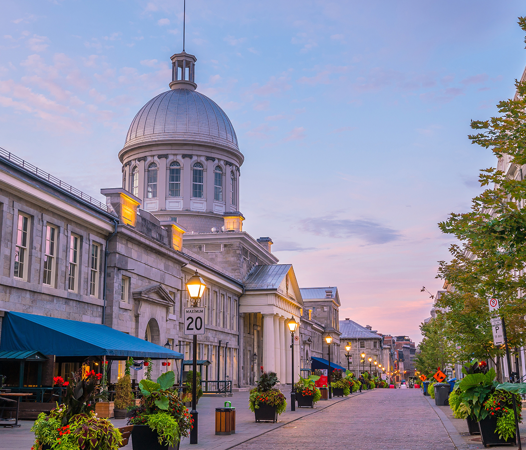
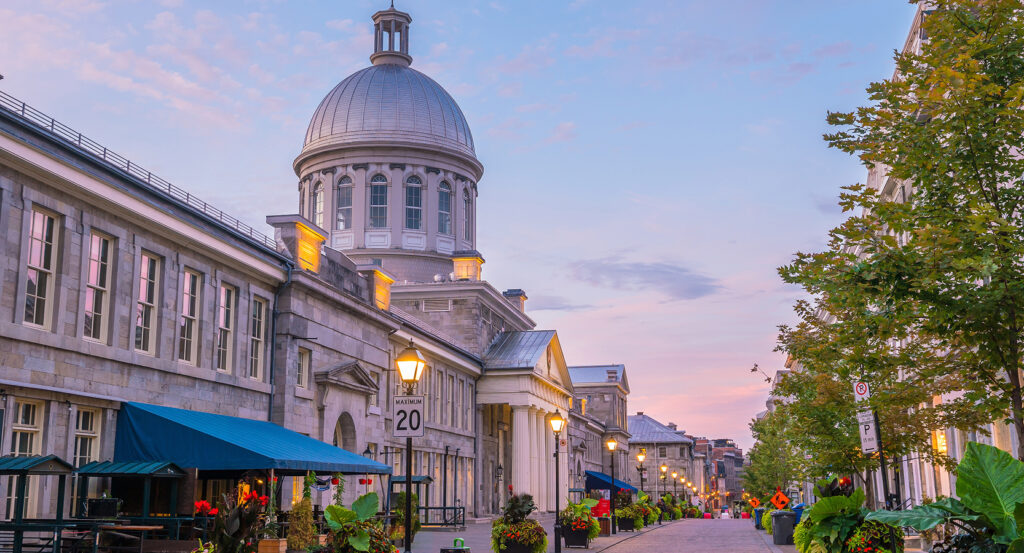
Begin at Pointe-à-Callière, Montréal's museum of archaeology and history, established in 1992 on the site associated with the city's original colonial settlement. Its exhibitions incorporate archaeological remains beneath the museum buildings, revealing traces of early structures, defensive works and former public spaces. The institution occupies an area near the former meeting of the St. Lawrence and Petite Rivière, where the geography of the waterfront influenced the organization of Ville-Marie. Excavated foundations and preserved infrastructure connect the surviving historic district with earlier phases of settlement and commercial development. Continue to Bonsecours Market, the substantial neoclassical building completed in 1847 along Rue Saint-Paul near the waterfront. Designed by architect William Footner, the building originally accommodated a public market and subsequently served important municipal functions. Its prominent silver-colored dome became a recognizable feature of Montréal's nineteenth-century harbor district. The building's broad façade and formal architectural composition express the ambitions of a growing commercial city. Its later adaptation for exhibitions, shops and cultural activities preserved the historic structure within the changing waterfront economy. Conclude at Notre-Dame-de-Bon-Secours Chapel, the historic Catholic sanctuary associated with Marguerite Bourgeoys and the religious life of Montréal's early settlement. The original chapel was established in the seventeenth century, and the present building dates principally to the eighteenth century. Its longstanding association with sailors contributed to its designation as the Sailors' Church, reflecting the importance of maritime travel to the surrounding community. Ship models suspended within the interior preserve devotional traditions connected with voyages and safe passage. The adjoining museum interprets the history of Marguerite Bourgeoys and the chapel's relationship with the city's colonial development. The progression moves from Pointe-à-Callière's archaeological foundations through Bonsecours Market's mercantile architecture and culminates at Notre-Dame-de-Bon-Secours Chapel's maritime religious heritage, connecting Old Port of Montréal with the institutions that shaped the historic waterfront.
Where your story begins.
Foresyte Travel reveals places that feel extraordinary long before you arrive.
Enjoy editorial crafted for luxury travelers.
Foresyte may earn a commission when you book.