Why Rideau Canal matters.
Rideau Canal is a historic Canadian waterway where Downtown Ottawa's expansive parliamentary landscape meets nineteenth-century military engineering, UNESCO World Heritage significance, and one of the world's most celebrated urban skating traditions.
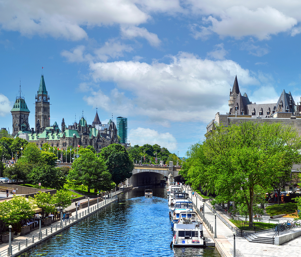
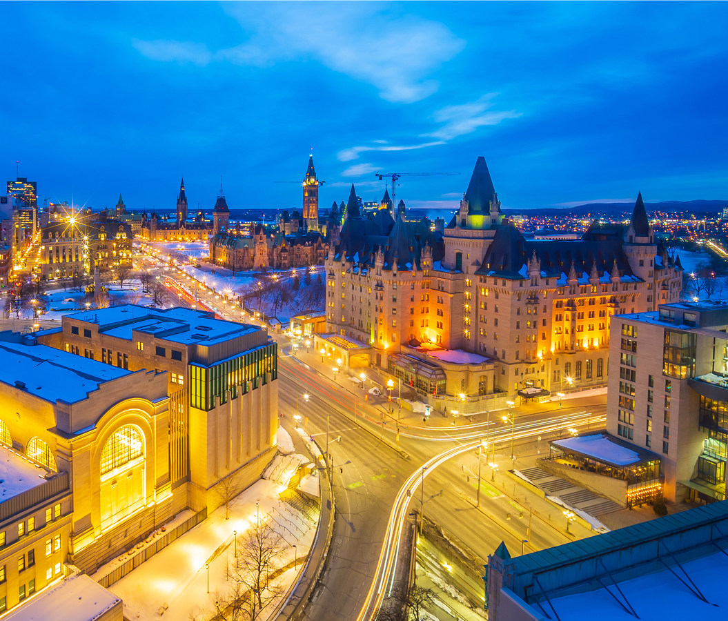
Beginning at the Ottawa River beneath Parliament Hill, Rideau Canal passes between Château Laurier and the National Arts Centre before extending south through Central Ottawa toward the Glebe, Dow's Lake, and the wooded waterways beyond the capital. Its northern entrance occupies a dramatic limestone ravine beneath Wellington Street, where eight consecutive locks connect the upper canal with the river below. Massive stone retaining walls frame the waterway between the Château Laurier's château-style towers and Parliament Hill's Gothic Revival architecture. The Plaza Bridge crosses the canal near Confederation Square, introducing a sequence of historic bridges that continues through the downtown core. Farther south, landscaped pathways follow both banks past the University of Ottawa, residential neighborhoods, and the established parkland surrounding the Glebe. The Pretoria Bridge introduces a distinctive steel crossing near the canal's transition into a quieter residential landscape. Mature trees, stone embankments, pedestrian promenades, and carefully maintained gardens establish an uninterrupted recreational corridor through the city. The waterway widens into Dow's Lake before continuing toward Carleton University and the southern reaches of Ottawa, connecting the capital's ceremonial center with an extensive system of natural lakes and rivers. The result is an expansive urban waterway whose historic engineering, preserved architectural surroundings, and extensive waterfront landscape connect Canada's national capital with the broader geography of eastern Ontario.
What defines Rideau Canal.
Rideau Canal is best known for Lieutenant-Colonel John By's transformation of an ambitious British military defense project into a 202-kilometre inland waterway connecting the Ottawa River with Lake Ontario. The War of 1812 had exposed the vulnerability of British transportation along the St. Lawrence River, whose proximity to the American border threatened military communications between Montréal and the naval installations at Kingston. An inland route through the Rideau and Cataraqui river systems offered a protected alternative, allowing troops, provisions, and military equipment to move between Upper and Lower Canada. Surveyor Samuel Clowes investigated the proposed route during the early 1820s, examining the difficult terrain and substantial changes in elevation separating the two watersheds. Arthur Wellesley, Duke of Wellington, subsequently became an influential advocate for the project, recognizing its importance within Britain's strategy for defending its North American possessions. Lieutenant-Colonel John By of the Royal Engineers arrived in Canada in 1826 to supervise construction, establishing his headquarters near the northern entrance of the proposed waterway. The settlement that developed around his engineering works became Bytown, establishing the geographical foundation for the future city of Ottawa. By rejected the limitations of conventional excavation through the region's extensive wetlands and rocky terrain, adopting an innovative slackwater system that raised existing lakes and rivers through dams and interconnected locks. The approach transformed natural waterways into navigable channels, substantially reducing the excavation required across the 202-kilometre route. He also persuaded British military authorities to authorize larger lock chambers capable of accommodating the steam-powered vessels beginning to transform inland transportation. Construction commenced in 1826, bringing thousands of Irish immigrants, French Canadian laborers, Scottish stonemasons, civilian contractors, and Royal Engineers into the forests and marshlands of eastern Ontario. As many as 5,000 to 6,000 workers assembled across the construction sites during individual years, confronting difficult terrain, dangerous excavation, and severe outbreaks of malaria. The disease devastated labor camps, contributing to substantial mortality among the workers and their families. At Jones Falls, engineers confronted an exceptional elevation change through the construction of a massive stone arch dam and interconnected locks, creating one of the most ambitious engineering works in British North America. The 107-metre-long dam rose eighteen metres above the original streambed, establishing a substantial artificial reservoir behind its masonry structure. At Hog's Back, powerful spring floods repeatedly destroyed temporary works before the engineers completed the structures required to separate the navigation channel from the Rideau River. The Ottawa entrance presented another formidable challenge, requiring a continuous staircase of eight locks to overcome the substantial elevation difference between the river and the upper canal. Contractor Thomas McKay supervised major stonework at the northern entrance, contributing expertise acquired through earlier canal construction in Montréal. The completed waterway opened in 1832 with forty-seven locks, twenty-three original lockstations, and an extensive system of dams, bridges, and associated defensive structures. Its construction cost reached £800,000, provoking intense criticism in the British Parliament and an investigation into By's administration. The inquiry cleared him of financial misconduct, but the controversy overshadowed his achievement, and he died in England in 1836. The canal subsequently became an important commercial transportation route, carrying agricultural products, timber, passengers, and manufactured goods between communities throughout eastern Ontario. Improvements to the St. Lawrence navigation system during the 1840s gradually redirected major commercial shipping toward the shorter river corridor, changing the Rideau's economic role. Regional trade nevertheless sustained the waterway through successive decades, and the completion of the Tay Canal extension in 1887 established an additional navigation connection with Perth. The decline of commercial shipping during the twentieth century accompanied the growing importance of recreational boating and historical preservation. Rideau Canal became a National Historic Site of Canada in 1925, acknowledging its exceptional engineering and military significance. Parks Canada assumed responsibility for the waterway in 1972, preserving its historic structures through a period of expanding recreational use. The Rideau Waterway received Canadian Heritage River designation in 2000, followed by inscription on the UNESCO World Heritage List in 2007. The international designation recognized the canal as North America's best-preserved example of nineteenth-century slackwater engineering and the only major canal from the continent's early canal-building era operating along its original route with most of its original structures intact.
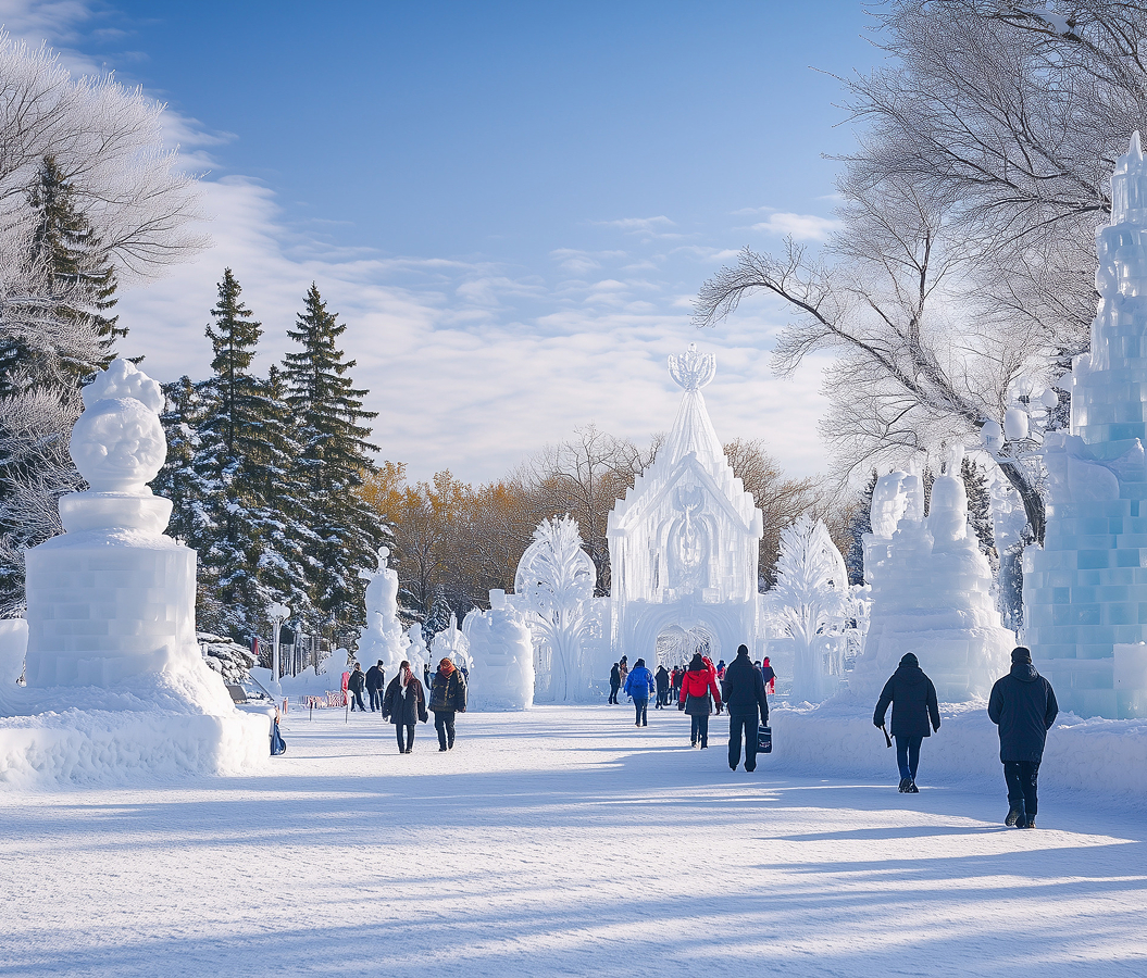
Douglas Fullerton's appointment as chairman of the National Capital Commission introduced a second defining chapter in the canal's history when he proposed transforming Ottawa's frozen waterway into a public skating route during the winter of 1970-1971. On January 18, 1971, a small crew began clearing snow with shovels and brooms between the Mackenzie King and Laurier bridges near the National Arts Centre. The initial experiment expanded into a six-metre-wide skating track extending five kilometres toward Dow's Lake, with lighting and music introduced along the downtown section. Hundreds of thousands of people visited during the first season, establishing an Ottawa winter tradition that subsequently expanded into a 7.8-kilometre skating corridor. The National Capital Commission developed specialized ice preparation techniques to support the growing attraction, including controlled flooding that builds the frozen surface into a maintained recreational route. The skating season of 1971-1972 lasted ninety days, establishing a duration record that demonstrates the importance of sustained winter temperatures to the waterway's transformation. Winterlude began in 1979, placing the frozen canal at the center of an annual celebration of Canadian winter culture. The festival introduced a broader program of outdoor activities, performances, and ice sculpture that connected the skating route with public spaces across Ottawa and Gatineau. An international outdoor curling competition arrived at Dow's Lake in 1980, extending the frozen waterway's sporting character beyond recreational skating. BeaverTails became part of the skateway in 1981, bringing the Ottawa-born fried pastry business into a tradition closely associated with the capital's winter celebrations. The pastry's flattened shape and sweet toppings established a distinctive culinary accompaniment to skating, eventually becoming one of the attraction's most recognizable traditions. Horse racing also occupied the ice during the early years, with the final quarter-mile event taking place in 1985. Hockey subsequently became another major component of the winter program, culminating in more than one hundred simultaneous shinny games during Hockey Day in the Capital in 2004. Guinness World Records recognized the Rideau Canal Skateway as the world's largest naturally frozen ice rink in 2005, acknowledging the exceptional scale of its maintained skating surface. The introduction of specialized resurfacing equipment continued the development of ice preparation, including the Froster machine in 2011. Canada's sesquicentennial celebrations brought 150 hockey games onto the skateway in 2017, extending the tradition of organized winter sport along the canal. The 2018-2019 season attracted 1,493,524 visits, establishing a major attendance milestone for the attraction. Rising winter temperatures subsequently introduced substantial variability into the skating calendar, culminating in the complete cancellation of the 2022-2023 season. The following winter brought a shortened reopening, demonstrating the direct relationship between Ottawa's climate and the viability of its most distinctive seasonal attraction. During warmer months, the waterway undergoes an equally consequential transformation as pleasure boats, sightseeing vessels, canoes, and kayaks return to its navigable channels. The historic lock system operates through manually controlled gates and original mechanical principles, preserving a direct connection with nineteenth-century engineering as vessels travel between successive water levels. Rideau Canal occupies an exceptional position in Canadian recreational culture, functioning as a historic navigation system during the warmer months and an expansive skating corridor whenever winter conditions permit.
How Rideau Canal fits.
Rideau Canal works as the historical centerpiece of a Central Ottawa exploration connecting the city's earliest surviving stone building, its principal national war memorial, and the landscaped parliamentary escarpment overlooking the Ottawa River.
Begin at Bytown Museum, the historic institution occupying the former Commissariat Building beside the canal's northern lock staircase. Constructed in 1827 under contractor Thomas McKay, the limestone building served as a military supply depot during the formative years of the settlement. Its substantial masonry walls and utilitarian architecture reflect the practical requirements of storing provisions and equipment for an ambitious nineteenth-century engineering project. The structure survives as Ottawa's oldest stone building, preserving an architectural connection with the earliest development of Bytown. The museum originated in 1917 through the Women's Canadian Historical Society of Ottawa, whose members sought to preserve the capital's local history through collections of photographs, artifacts, and historical objects. Its exhibitions trace the settlement's transformation from a lumbering and transportation community into the national capital, incorporating the lives of workers, merchants, political figures, and residents who shaped the city's development. Continue east toward the National War Memorial, the expansive granite arch occupying Confederation Square near the intersection of Elgin and Wellington streets. British sculptor Vernon March won the international competition for the monument's design in 1926, developing a composition of bronze figures passing beneath an immense stone arch. His death in 1930 left the sculptural work unfinished, and members of the March family completed the bronze ensemble according to his original conception. The memorial's twenty-two figures represent military personnel and supporting services associated with Canada's participation in the First World War, including infantry, cavalry, artillery, naval personnel, nurses, and other wartime contributors. King George VI unveiled the monument on May 21, 1939, establishing a principal national site of military remembrance. The Tomb of the Unknown Soldier was added in 2000, containing the remains of an unidentified Canadian serviceman recovered from a First World War cemetery near Vimy Ridge in France. The memorial serves as the focal point of Ottawa's national Remembrance Day ceremony, bringing military personnel, veterans, dignitaries, and members of the public together each November. Conclude at Major's Hill Park, the landscaped grounds overlooking the Ottawa River between Parliament Hill and the ByWard Market district. The park occupies land associated with the earliest British military presence in the settlement, including the former residence of Colonel By. The property later became associated with Major Daniel Bolton, whose occupation of the residence contributed to the park's enduring name. Following Ottawa's selection as Canada's capital, the grounds developed into an important public landscape adjoining the expanding parliamentary precinct. The park's elevated lawns, mature trees, and winding pathways provide substantial views toward the Parliament Buildings, the Ottawa River, and the historic institutions of Gatineau across the water. Seasonal flowerbeds and open green spaces preserve a landscaped setting within the capital's expansive center, connecting the parliamentary escarpment with the historic streets surrounding Sussex Drive. The progression moves from Bytown Museum's early military supply depot through the National War Memorial's expansive commemoration of Canadian service and culminates at Major's Hill Park, where the capital's nineteenth-century settlement history opens onto the Ottawa River and Parliament Hill.
Where your story begins.
Foresyte Travel reveals places that feel extraordinary long before you arrive.
Enjoy editorial crafted for luxury travelers.
Foresyte may earn a commission when you book.